6 Highlights of the UNESCO Biosphere Entlebuch
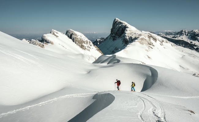
- The viewpoints Schrattenfluh (2,093 m above sea level), Beichlen (1,770 m above sea level), and Farneren (1,452 m above sea level) offer great panoramas of the biosphere area.
- Covering an area of 400 km2, a quarter of it consists of nationally significant moorlands.
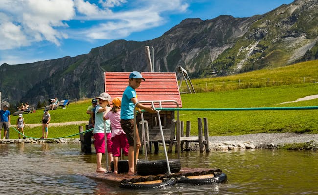
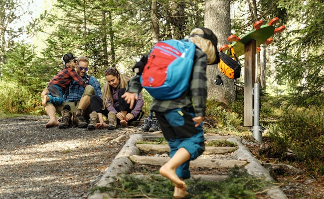
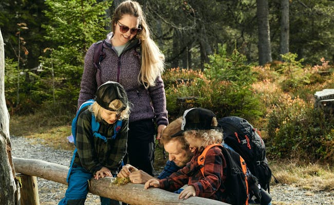
- You'll find locations for experiences and adventures throughout the nature park that are tailored for families.
- The longest hanging bridge in Entlebuch, measuring 65 m, can be found in Flühli. It hangs about 45 m above the Seebebach and leads you to the stunning Chessiloch waterfall.
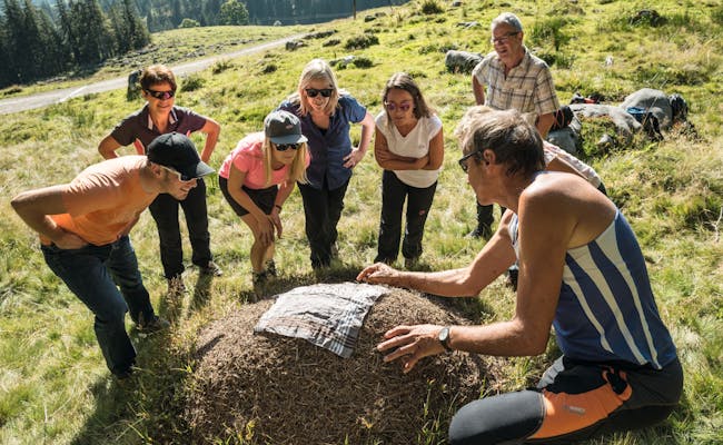
- You can try your hand at gold washing at the Great Fontannen between Doppleschwand and Romoos.
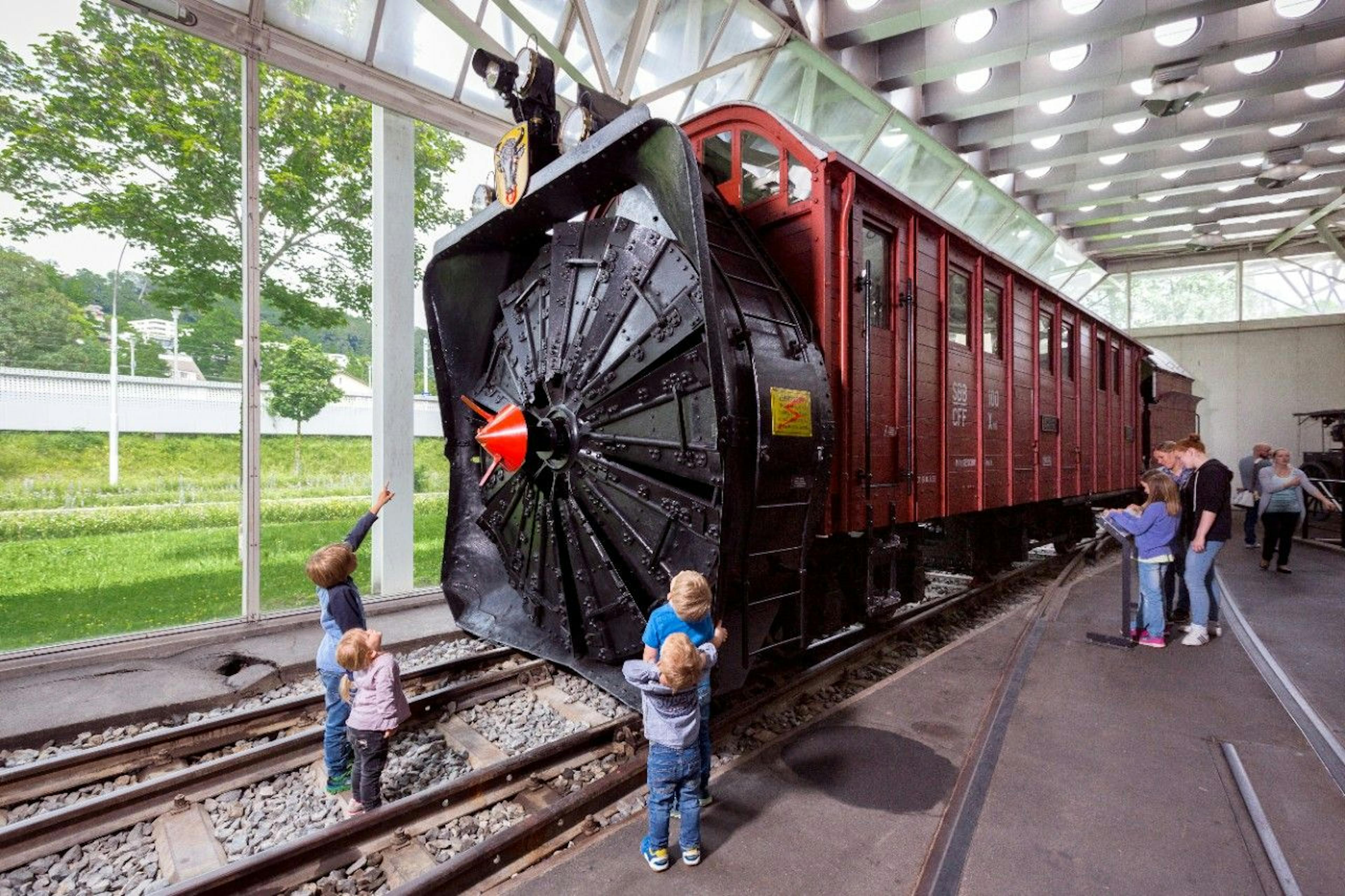
- The experiential park Mooraculum playfully conveys scientific knowledge about moorland landscapes.
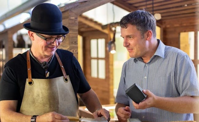
- The Marbach mountain cheese dairy can be visited at any time for free. The show dairy also has a restaurant for a following aperitif.
You can find an overview of all the nature parks in Switzerland in our article about the 20 most beautiful Swiss nature parks.
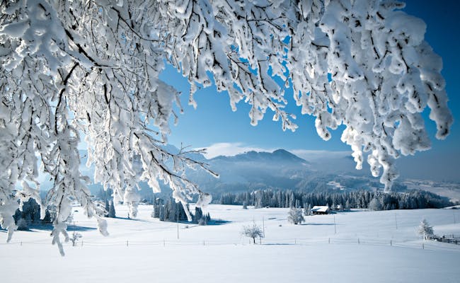
There are about 750 biosphere reserves worldwide and one of them is located in the canton of Lucerne. The Entlebuch has been a UNESCO biosphere since 2001 and since 2008, when the federal program began, it has been one of Switzerland's regional nature parks.
What awaits you in the UNESCO Biosphere Entlebuch
The Entlebuch Biosphere is a UNESCO World Heritage Site and covers an area of 400 km². It extends over seven municipalities and is home to around 17,000 inhabitants.
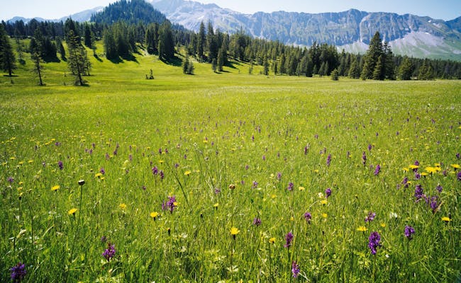
It is characterized in particular by the many moor landscapes. The "wild west of Lucerne", as the area is also called, consists of a quarter of moors of national importance. Nowhere in Switzerland can you find more moors than here.
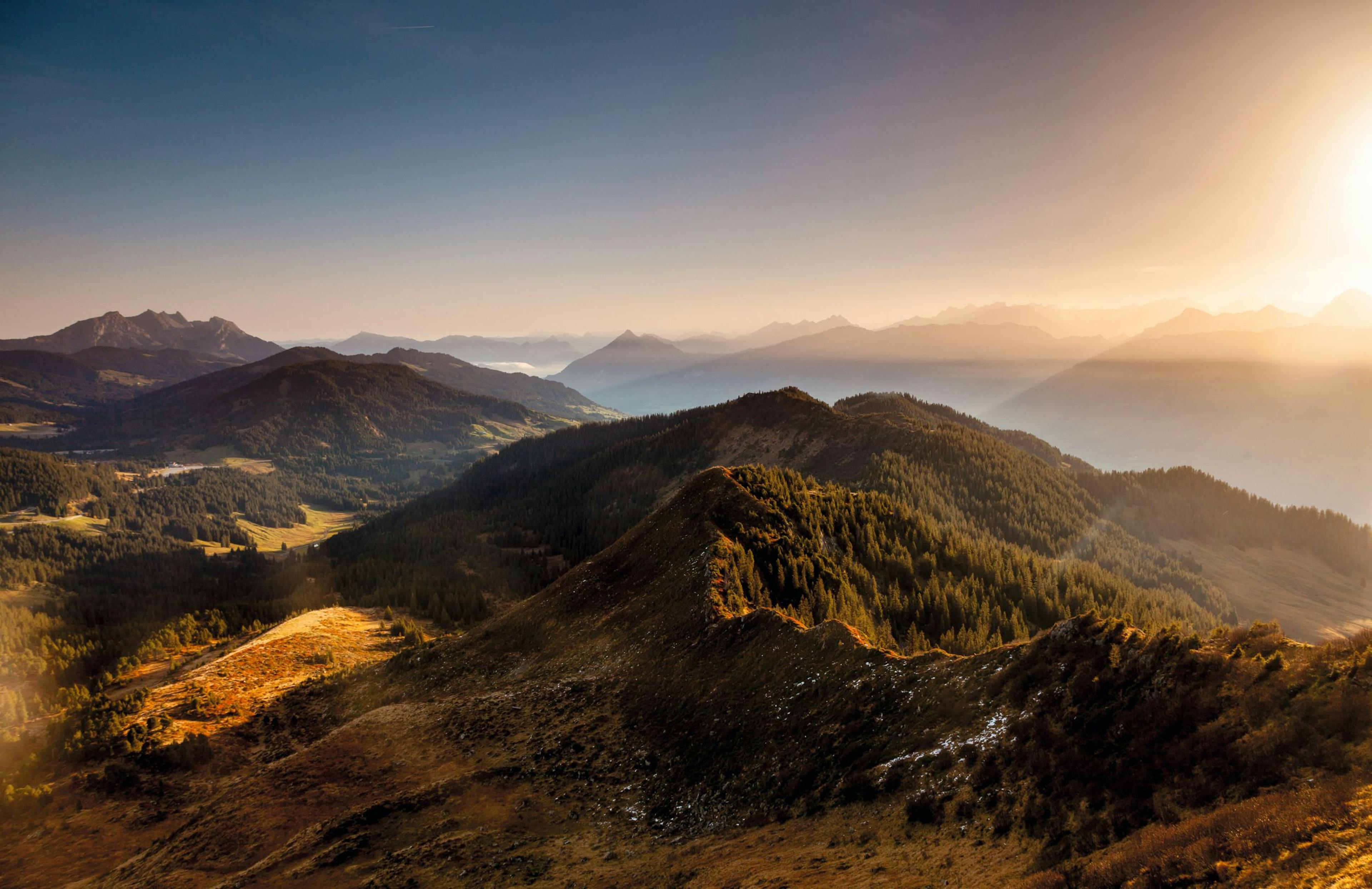
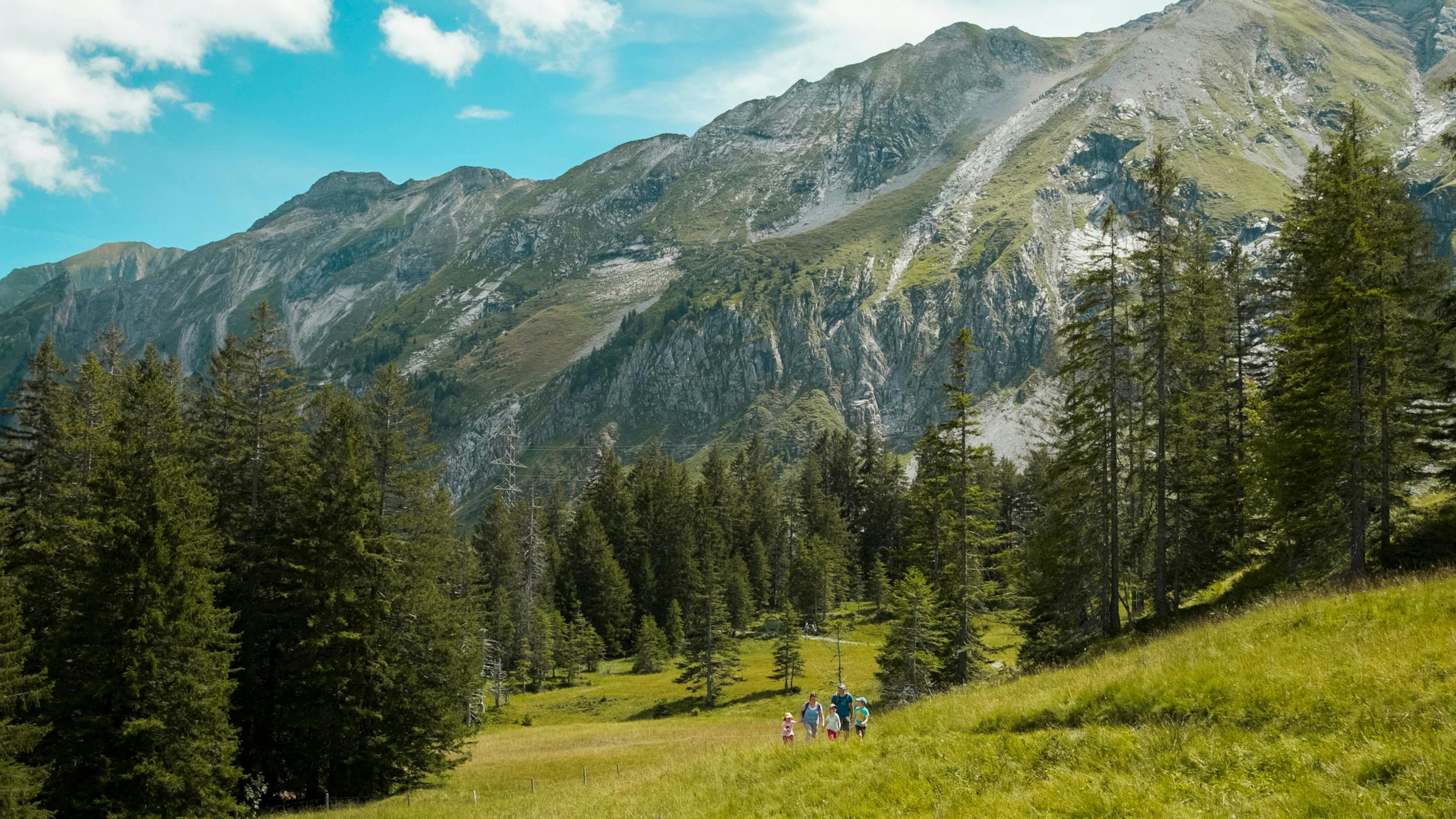
But also alpine meadows, wild mountain streams and the imposing Schrattenfluh are part of this nature park. It is not for nothing that the Entlebuch is considered a model and showcase region by UNESCO.
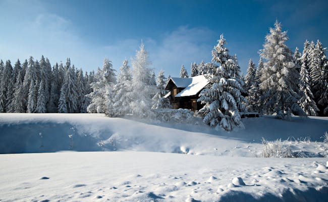
Due to the wide range of leisure activities, the Entlebuch is a popular vacation region that offers something for almost every taste. If you are looking for a relaxing beach vacation, you will unfortunately be disappointed here. But otherwise you are sure to find something that suits your preferences.
Villages in the Nature Park UNESCO Biosphere Entlebuch
| place | special |
|---|---|
| Entlebuch | The village lies in a valley hollow of the Kleine Emme. Here the Entlen flows into the Kleine Emme. The tourism project "Experience Energy Entlebuch" comprises six experience platforms that can be reached via a well-developed network of hiking trails |
| Romoos | The municipality lies in the foothills of the Alps and is very hilly to mountainous and forested. Romoos is bordered to the east and south by the Grosse Fontanne. |
| Hasle | The community includes numerous individual farmsteads, hamlets and alpine huts. A fresco in the ossuary from 1687 shows a death dance cycle with eight larger-than-life figure pairs |
| Doppleschwand | The village lies at the foot of the Napf Mountains, between the Kleine Emme and the Grosse Fontanne |
| Schüpfheim | The village is situated on the river Kleine Emme. The Entlebucherhaus in Schüpfheim is a local history museum. |
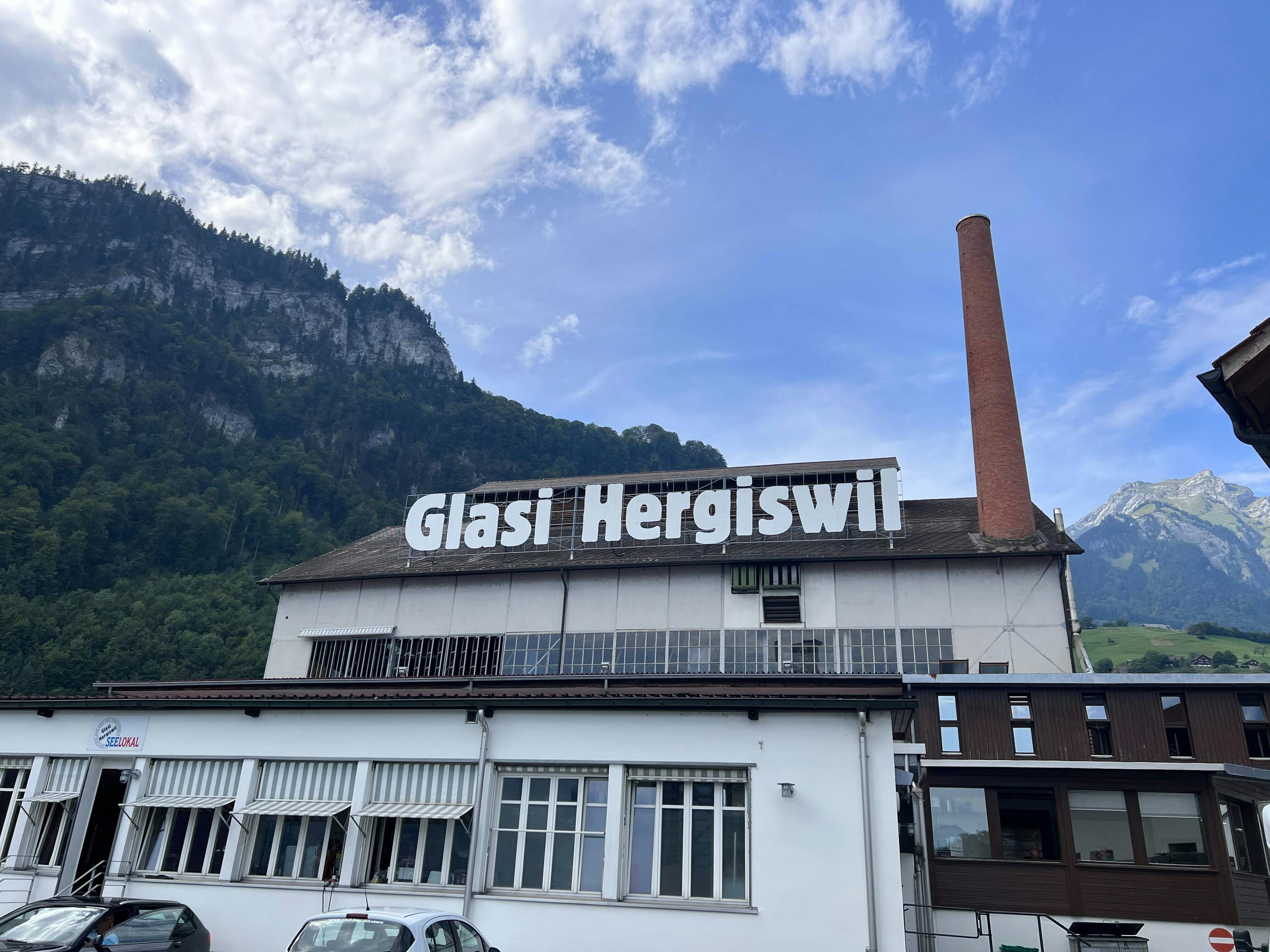
| Flühli | The municipality of Flühli is located in the foothills of the Alps in Central Switzerland and includes the village of Sörenberg. Four modern glassworks are located in the municipality. |
| Escholzmatt | In the village center the Schybi stone commemorates the peasant leader executed in the Peasants' War of 1653 |
| Marbach | In Marbach you will find a show dairy. The parish church St. Nikolaus is a worth seeing baroque church from the 18th century |
Escholzmatt and Marbach have merged into one municipality.
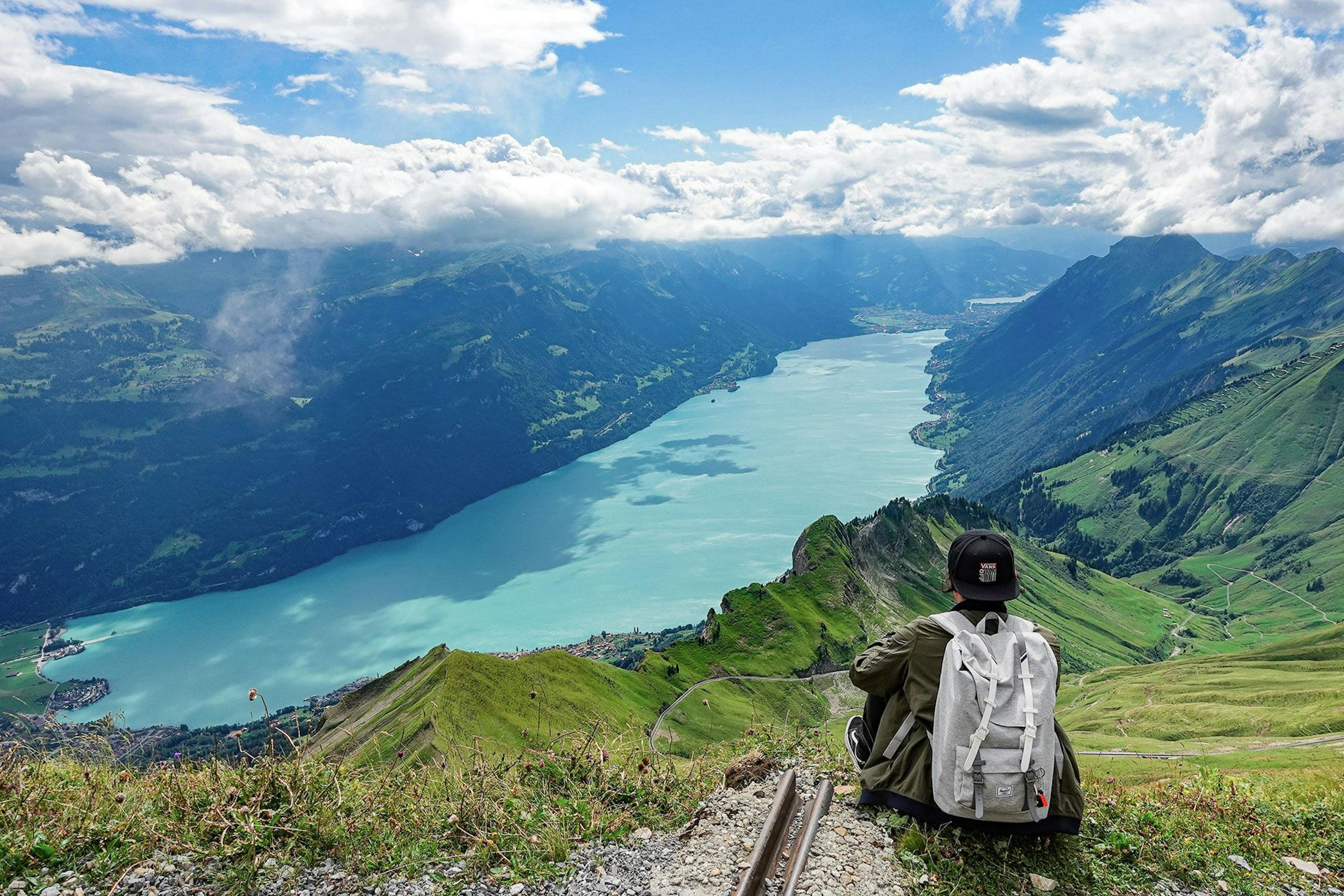
Viewpoints in the UNESCO Biosphere Entlebuch
In the UNESCO Biosphere Entlebuch you will discover several viewpoints that offer a beautiful view of the landscape. Here are some of the most famous ones:
| Viewpoint | Special |
|---|---|
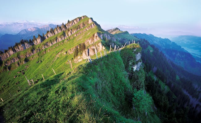
| Schrattenfluh | This karstified mountain range has four prominent peaks. It reaches up to 2093 m above sea level and clearly stands out in the Entlebuch from the pre-Alpine hilly country. |
| Farneren | The Farneren reach about 1452 m a.s.l. and are located in the municipality of Hasle. |
| Schimbrig | At 1815 m above sea level, the long ridge of Schimbrig in Hasle towers above the landscape. It is known for its sulfur springs. |
| Beichlen | The Beichlen are a long mountain ridge in the center of the Entlebuch. They belong to the Emmental Alps and at 1770 m above sea level offer a beautiful view of the Entlebuch. |
These vantage points offer very different perspectives on the beauty of the UNESCO Biosphere Entlebuch from different directions. They are ideal to really enjoy the nature and the landscape of the region.

Mooraculum Adventure Park in the UNESCO Biosphere Entlebuch
The Mooraculum adventure park starts directly at the mountain station of the Rossweid Sörenberg cable car. It consists of a children's playground and two themed trails that lead directly through fens and raised bogs.
With playful experiments and puzzles, scientific topics are conveyed in a child-friendly way at the Mooraculum. At the same time, benches and fireplaces invite families to linger longer.
Admission to the adventure park is free and it is open from the end of May to the end of October.
Adventure Playground Mooraculum Adventure Park
The large playground is located directly next to the Rossweid adventure restaurant. It consists of several playgrounds:
- Ponds with water play equipment
- Hanging chair forest
- climbing adventure
- raft to cross the big pond
At the edge of the forest you will find four barbecue sites, which can accommodate a total of 40 people. They are partly sunny, partly in the shady forest. You can get firewood bundles for a few francs at the mountain station.
Sundew trail in the Mooraculum adventure park
The circular trail is 1.5 km long and is suitable for baby carriages. It leads through colorful fens with pretty flowers, including many orchids. The blueberry high moor forest with gnarled mountain pines lets visitors experience another world.
A total of 17 diversely designed experience stations have been set up. You have the opportunity to experience a lot of exciting things about the moor. The beauty of it is that you experience it with all your senses. The mosaic maiden Mira from the high moor accompanies you.
You explore animal tracks, walk barefoot over moss and sand and compare flower scents. Hanging chairs on the trees invite you to linger.
Large moorland circular trail Sörenberg in the UNESCO Biosphere Entlebuch
This theme trail is about 4.5 km long. The Great Moor Circuit Sörenberg is easy to walk. You should plan 1.5 hours for it.
Did you know that the peat soil grows by only one millimeter per year? For one meter of peat soil it takes 1000 years of growth.
The typical peat soil is formed by carnivorous plants like sundew and mosses. The adventure stops you find along the way are interactive. You build bog art, solve riddles and combine to bring the bog balance into balance.
At the bottom and top stations of the Rossweid cable car, you can pick up an explorer kit with expedition gear for you or your family. Magnifying glass, compass and acid test strips will help you to collect real research results. In the Moor Whisperer Pass you enter the results and may even get a reward at the end.
Trotti experience in the Mooraculum
At the top station of the Rossweid cable car you can rent fat scooters for the descent and return them at the bottom station.
Attention: They are racy and not suitable for smaller children.
Fat-Trottis not only look cool, they also guarantee driving fun with their oversized tires. The fast-paced descent leads from the top station 4 km along mountain meadows, an alpine cheese dairy and the sparkling reservoir.
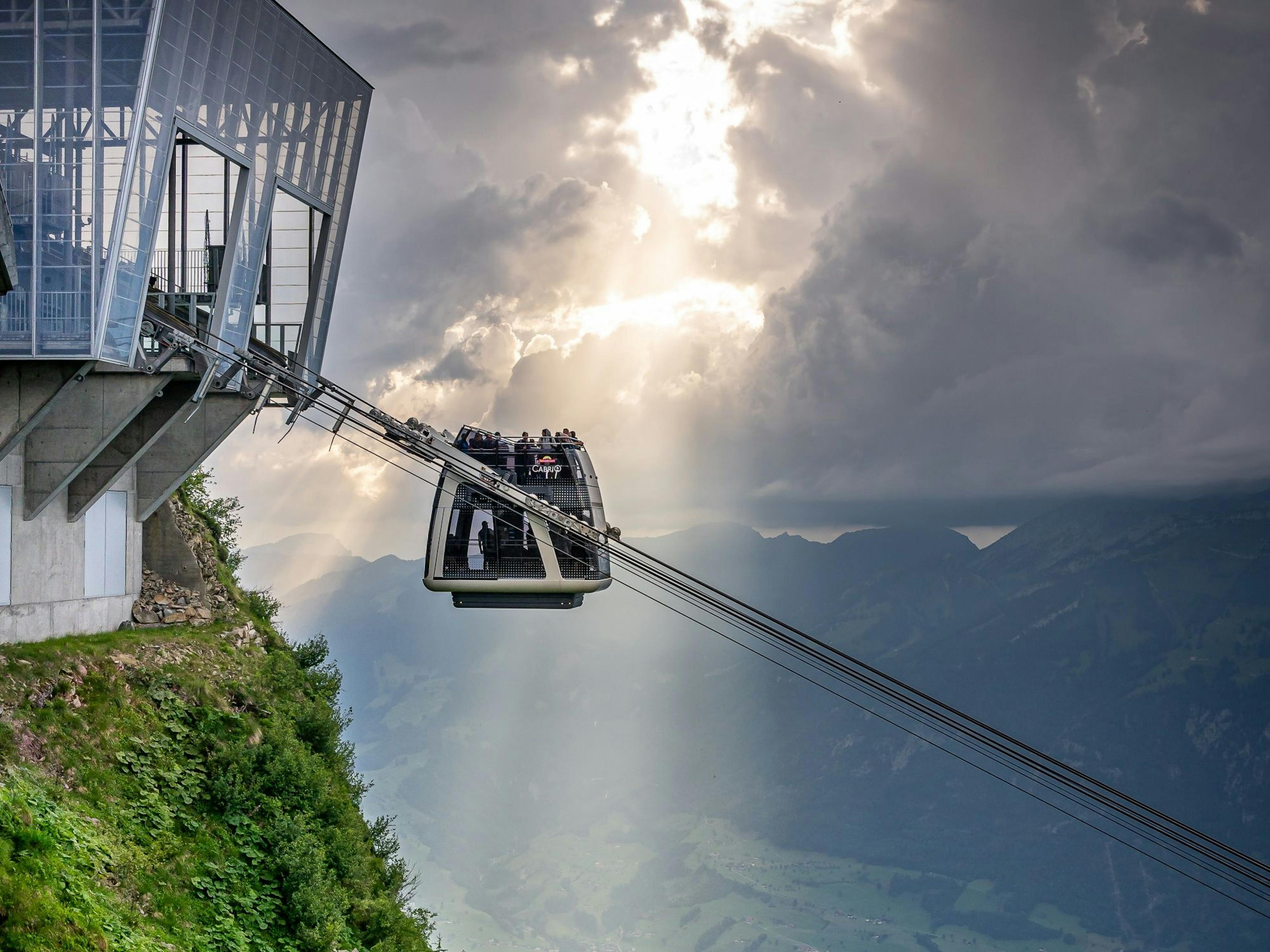
Cable car Sörenberg - Rossweid
The cable car takes 6:40 min and is in operation both in summer and winter.
| Tal station | m above sea level | Mountain station | m above sea level |
|---|---|---|---|
| Sörenberg | 1166 | Rossweid | 1470 |
Parking spaces are available at the valley station, in the middle of Sörenberg village.
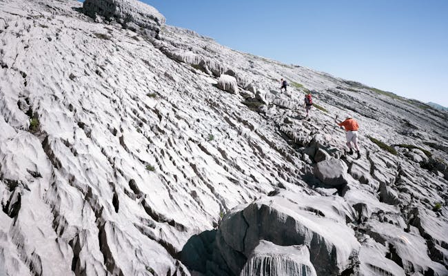
Schrattenfluh karst landscape
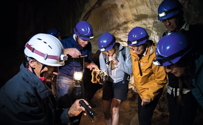
The karst landscape of the Schrattenfluh (also called Schratteflue), which reaches 2093 m above sea level, is so unique that it too - along with the moor landscape - has been awarded a UNESCO prize. It is one of the most natural karst landscapes in Switzerland. Above ground it impresses with very bizarre patterns in the karst rock and underground with a widely branched cave system. The permeable surface lets the water pass directly into the depth. There it flows off through a strongly branched, huge underground water network.
The mountain range has a length of about six kilometers and stands out clearly in the landscape. The almost vegetationless cart fields are located on the flat sloping southeastern flanks. There are also numerous caves to be found here. With the biosphere guide you can take part in organized tours that will also take you into the caves.

More Excursion Destinations in the Entlebuch Biosphere, Perfect for Families
The Entlebuch is particularly well-suited for a family outing. Besides the already mentioned Mooraculum adventure park, there are more exciting places to explore in the UNESCO Entlebuch Biosphere.
For instance, you can spend a whole day gold panning with a guide at the Great Fountains between Doppleschwand and Romoos.
In Marbach, there's an experience cheese dairy that you can visit spontaneously with your family. While you learn exciting facts about cheese-making, you'll also get to try some delicious samples. They also have a restaurant for a follow-up apéro.
Zyberliland Romoos in the UNESCO Biosphere Entlebuch
Families are on the trail of the mysterious Bärgmandli in the adventure world of Zyberliland in the wild Napf region. You can recognize the bear mandli by their little red feet. Six different play worlds are hidden in the picturesque landscape.
Play worlds in Zyberliland Romoos
- Talherrenburg for climbing and balancing with 2 barbecue areas, WC
- Nüütelimine, a water playground with gold panning and barbecue area
- Bärgmandli village with playground and barbecue area, WC
- Zyberli run, today used as a 30 m long marble run
- Ash house- tree labyrinth to hear Bärgmandli chatting and laughing
- Forest arena for playing, KUBB games (old Wickinger wooden throwing game) and barbecue area, WC
Zyberliland Romoos can be reached from the village of Romoos via a circular path called Bärgmandlitritt. It is suitable for children.
Rischli summer toboggan run in the Entlebuch UNESCO Biosphere Reserve
At the northern entrance to Sörenberg, a toboggan run is operated in summer. You'll find it near the Hotel Rischli. The fast ride goes over alpine meadows and passes 12 curves. the track is 900 m long and at the end you can be comfortably pulled back up by the lift. A photo trap with snapshot is permanently installed. You can purchase the photo at the photo booth at the finish for 5.00 CHF.
Marbachegg Carts in the UNESCO Biosphere Entlebuch
The Marbachegg Carts are available with three or four wheels. On a wooden track you drive over the alpine pastures of Marbachegg. With the drag lift you go back to the starting point.
Arrival: Via the cable car from Marbach (valley station) to Marbachegg. The cable car runs 10 min.
Open: May to October on weekends, during the summer and autumn vacations daily.
Water playground Flühli in the UNESCO Biosphere Entlebuch
On the Dammweg behind the Raiffeisenbank in Flühli, children can dam up, pump or splash water. Even sand castles are possible here. The playground at the Sonnenmatte is a little paradise for children.

How to Best Explore the UNESCO Biosphere Entlebuch
The UNESCO Biosphere Entlebuch has an extensive and well-maintained network of paths. Whether you're walking or biking, you'll find plenty of options here.
If you're on foot, there are various hikes and themed paths you can explore on your own. You can also choose to see Entlebuch by mountain bike or bicycle, either solo or on guided tours.
Tours and Excursions in the UNESCO Biosphere Entlebuch
- Chessiloch Waterfall: About a 1-hour walk from Flühli. After crossing the 65-meter long and 45-meter high suspension bridge, it’s about another 15 minutes. There are no less than 14 hiking paths crossing the waterfall.
- Schrattenfluh Hiking Tour: Hirsegg - Schrattenfluh - Rossweid - Sörenberg. You'll need 7 hours for 18 km (difficult hike) with an elevation gain of 1195 m and a descent of 1112 m.
- Schrattenfluh Bike Tour: Loop around Schrattenfluh starting from Sörenberg, featuring steep climbs and interesting single trails. It follows the bikeroute 817. For 52 km, you need 5 hours.
- Schrattenfluh Snowshoe Tour: Hirsegg - Chlus. You’ll cover 10.6 km in about 5 hours.
- Clientis Flowtrail Marbachegg: Take the cable car from Marbach to Marbachegg. The descent is almost 4 km and takes about half an hour. Along the way, there are playful elements like waves, turns, and jumps.
- Hike from Brienzer Rothorn over Eisee to Schönebode: 6.1 km will take approximately 3 hours, with a descent of 1104 m, making this hike difficult.
- Bramboden-Napf: The hike from Bramboden leads through the hilly landscape of Entlebuch and Emmental. You’ll cover 7 km in 2.5 hours. With an elevation gain of 382 m and a descent of 33 m, this hike is moderate.
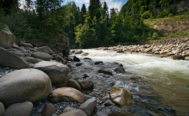
Canoeing on the Klein Emme
The Klein Emme flows between Schüpfheim and Entlebuch. This beautiful river landscape is a popular hiking destination, but it also offers excellent opportunities for white water paddling. However, the ‘wild’ Klein Emme isn't suitable for beginners. Newcomers can book a trial day with the local canoe club in Entlebuch.
Climbing in the Biosphere Entlebuch
You can climb in the Biosphere Entlebuch both in the climbing gym in Wolhusen and in the limestone cliffs of the Pre-Alps.
There are various climbing routes available in all difficulty levels:
- Brienzer Rothorn
- Tannhorn
- Aarnihagen
- Schrattenfluh
- Hagleren
- Fürstein
- Grönflue
- Schafmatt
- Farnern
- Beichlen
Getting to the UNESCO Biosphere Entlebuch
The nature park is easily accessible by public transport from various directions, whether by bus or train. Regular trains run from Lucerne and Bern to Entlebuch, and several postbus routes lead to the more remote villages. From Schüpfheim, you take the postbus to Flühli "Post". By the way, Entlebuch is included in the Tellpass validity area.
You can easily reach the biosphere by car as well. It's located in the heart of Switzerland, right between Bern and Lucerne. To get to Sörenberg, take the main road 10 to Schüpfheim and from there head to Flühli Sörenberg until you reach the parking lot at Dorf Flühli. In summer, it's a good idea to drive via Sarnen - Giswil over the Glaubenbielen Pass to Sörenberg.
Public parking is available for a fee at the parking lot in Dorf Flühli.
Further information on topics such as accommodation, gastronomy, package deals, events and much more can be found on the website of the UNESCO Biosphere Entlebuch.