
The 20 most beautiful nature parks in Switzerland
There are 20 nature parks in Switzerland that you can visit for free. These parks include the Swiss National Park, the only national park in the country. Most of the parks are very well accessible by public transport and are suitable for outdoor activities. The majority of the nature parks are located in the settlement area and are inhabited.
Nature is a precious asset. Aside from the world-famous Swiss chocolate and the versatile Swiss army knife, it’s a key trademark of Switzerland.
Who doesn’t picture snow-covered mountains, green meadows with grazing cows, or sparkling alpine lakes when dreaming about the little confederation in the Alps?
Some of these typical Swiss landscapes are part of a support program initiated by the federal government in 2007. Currently, a total of 20 parks of national significance receive financial assistance under this program. There are three categories: national parks, regional nature parks, and nature experience parks.
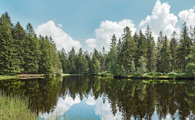
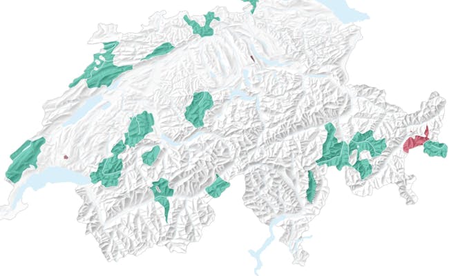 Map of Swiss Nature Parks (Photo: Parks Swiss)
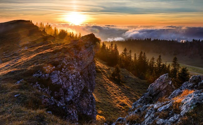
 Binntal (Photo: Parks Swiss Brigitte Wolf)
Thus, parks are supported throughout Switzerland that are characterized by "beautiful landscapes, rich biodiversity and high-quality cultural assets". Regions, cantons and municipalities can apply to the federal government for this label and, if the required criteria are met, may benefit from financial support for their nature park.
If you are interested in starting your own nature park in Switzerland, you can find the requirements here.
However, if you are more interested in an overview of the already existing parks, you can find it here.
All Nature Parks in Switzerland
We’ve gathered here all 20 nationally significant nature parks in Switzerland. They are listed by location, size, and population.
| Name of Nature Park | Location | Canton | Area (km²) | Population | Municipalities |
|---|---|---|---|---|---|
| Regional Nature Park Schaffhausen | North of the Rhine and west of Lake Constance | Schaffhausen | 213 | 28,600 | 15 |
| Wildnispark Zürich | In the northwest part of Lake Zurich, S-Bahn connection | Zürich | 11 | 80 | 5 |
| Jurapark Aargau | Rural Jura landscape between Basel and Zurich | Aargau, Solothurn | 241 | 42,000 | 28 |
| Naturpark Thal | South of Basel and north of the Aare | Solothurn | 139 | 15,000 | 8 |
| Parc du Doubs | Jura Mountains, along the Doubs River | Jura, Neuchâtel, Bern | 11 | 80 | 5 |
| Parc Regional Chasseral | Jura Mountains, northwest of Lake Biel | Bern, Neuchâtel | 474 | 51,000 | 23 |
| Naturpark Jura Vaudois | North of Lake Geneva | Vaud | 568 | 39,700 | 34 |
| UNESCO Biosphere Entlebuch | West of Lucerne and Mount Pilatus | Lucerne | 395 | 17,700 | 7 |
| Naturpark Gantrisch | South of Bern and northwest of Thun | Bern, Fribourg | 404 | 37,400 | 19 |
| Regional Park Gruyere | Lake Geneva (Montreux) to Greyerzerland and Saanenland (Gstaad) | Fribourg, Vaud | 503 | 14,700 | 13 |
| Naturpark Jorat | Contiguous forest area of central Switzerland | Vaud | 9 | 20 | 1 |
| Naturpark Diemtigtal | Southwest of Lake Thun up to Mount Gsür | Bern | 136 | 2,400 | 2 |
| Naturpark Pfyn-Finges | Central Valais, south of Leukerbad, between Gampel and Sierre | Valais | 277 | 11,000 | 12 |
| Landscape Park Binntal | East of the Breithorn up to the Italian border | Valais | 181 | 1,200 | 5 |
| Parco Val Calanca | In the Italian-speaking part | Graubünden | 120 | 400 | 4 |
| Naturpark Beverin | Four valleys (including the Rhine Gorge) around Piz Beverin | Graubünden | 515 | 3,700 | 9 |
| Park Ela | Between Albula, Bergün, and the Surses | Graubünden | 548 | 5,200 | 6 |
| Swiss National Park | Engadin | Graubünden | 170 | - | - |
| Biosphere Val Müstair | Beyond the Ofen Pass | Graubünden | 199 | 1,400 | 1 |
| Naturpark Trient-Tal | Between the peaks of Arpille and Cime del’Est | Valais | 222 | - | 7 |
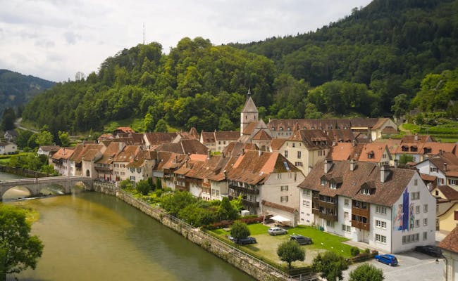
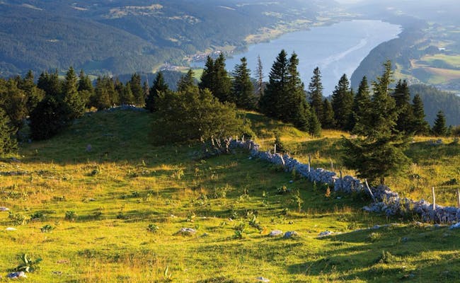
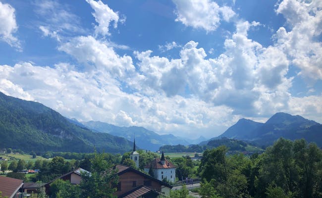
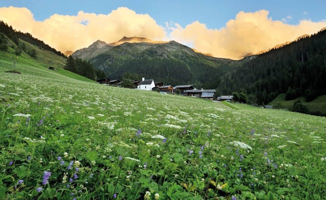
Schaffhausen Regional Nature Park
The Schaffhausen Regional Nature Park joined the federal support program in 2018. Two of its municipalities are located beyond the German-Swiss border.
How to get to the Schaffhausen Regional Nature Park
All the municipalities in the Schaffhausen Regional Nature Park can be reached by public transport, whether it's by bus, train, or boat. If you're driving, the best route is via Schaffhausen, and then make your way to your destination.
 (Photo: Switzerland Tourism Renato Bagattini)
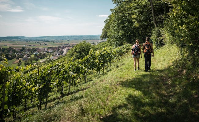 (Photo: Switzerland Tourism Peer Füglistaller)
Wildlife Park Zurich with Sihlwald and Langenberg
The Wildlife Park Zurich is the smallest nature park in Switzerland. It includes both the Sihlwald and Langenberg. This was the first nationally recognized nature experience park. Since 2010, it has been part of the federal funding program.
How to reach the Zurich Wilderness Park
Both parks are easily accessible by public transport from Zurich, Thalwil and Horgen. It is also possible to get there by car, although the parking fees are a flat rate of CHF 10 per day for the zoo and CHF 5 for the wilderness park.
 (Photo: Switzerland Tourism Metzger Rottmann Bürge AG)
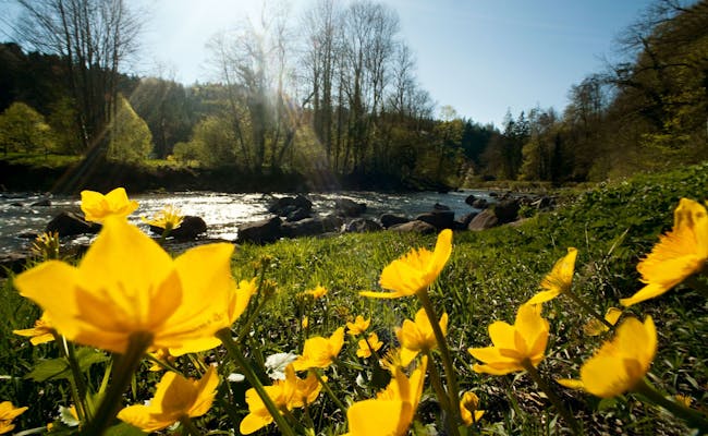 Sunshine in the Sihlwald Nature Park (Photo: Switzerland Tourism Marcus Gyger)
Jurapark Aargau
The Jurapark Aargau has held the title of nature park since 2012. It stretches to the north up to the German border, which is formed by the Rhine. The eastern and southern edges of the park are bordered by the Aare river.
How to get to Jurapark Aargau
All the communities of Jurapark Aargau can be reached either by car, by bicycle - for example on the Route Verte - or by public transport from Aarau, Brugg, Zurich or Basel.
Jurapark Aargau is also ideally located for travel by car and can be easily reached via the freeway from Aarau, Brugg, Zurich, Basel and Bern.
 (Photo: Switzerland Tourism Renato Bagattini)
 (Photo: Switzerland Tourism Renato Bagattini)
Naturpark Thal
Another seasoned player in the game is the Naturpark Thal, which has been part of the Swiss natural parks since 2010. It's located in the canton of Solothurn, and with its spot in the triangle between Bern, Zurich, and Basel, it’s super easy to get to.
The Nature Park website offers a wealth of further information on experiences, accommodation, mountain restaurants, hikes, sports activities and events.
How to get to the Thal Nature Park
You can easily reach the Thal Nature Park by public transport from several directions. This can be by train via Oensingen and Balsthal, by cable car from Solothurn to Weissenstein, or by post bus from the Basel-Landschaft region.
The park is also well accessible by car, as there is direct access to the A1 motorway via Oensingen, and it is not far from the Egerkingen motorway junction.
 (Photo: Switzerland Tourism Roland Gerth)
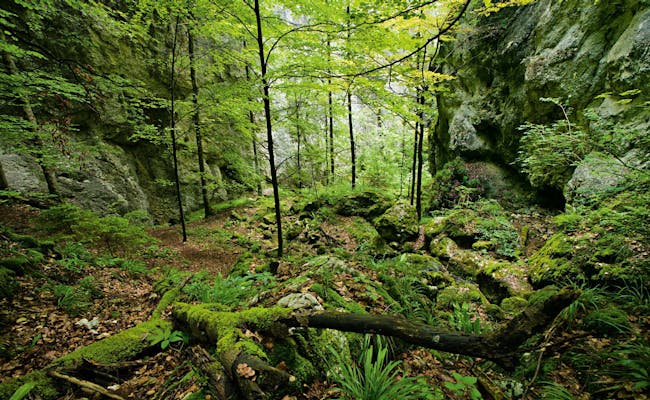 (Photo: Switzerland Tourism Renato Bagattini)
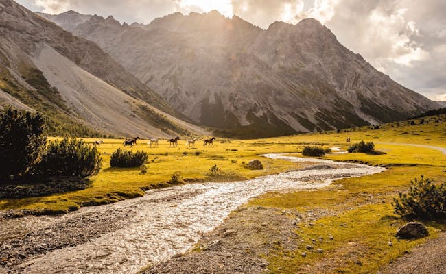
Parc du Doubs
Even though the Doubs didn’t make it onto the list of waterways in Switzerland, it does get a well-deserved mention here. This river shapes the northern part of the nature park and gives it its name. At the same time, it serves as the border with France north of the Jura Mountains.
The Parc du Doubs is filled with a lot of nature and has no densely populated towns.
But it does have plenty of horses.
Swiss Activities Tip: Be prepared for cooler temperatures in the Freibergen compared to the shores of the Doubs. Even on sunny days, the situation can be misleading, so having an extra layer of clothing on hand is definitely a good idea.
 (Photo: Switzerland Tourism Gerry Nitsch)
For more information, discoveries and suggestions for this area, visit the website of the Parc du Doubs.
How to reach the Parc du Doubs
You can reach the Parc du Doubs by public transport, but not as easily as, for example, the Jurapark Aargau. However, if you have a little more time, this is not a serious problem
The cities of La Chaux-de-Fonds, Le Locle and St-Ursanne are on the SBB network and various villages in the Franches-Montagnes can be reached by train. Buses and cable cars also provide access to the park
With your own car you are of course also in good hands here. In this case, it is best to travel via Biel or Neuchâtel via La Chaux-de-Fonds.
 (Photo: Switzerland Tourism Raffael Waldner)
 (Photo: Switzerland Tourism Giglio Pasqua)
Chasseral Regional Park
For the Chasseral Nature Park, we're staying in the Jura Mountains for now. It’s named after Chasseral, the highest point in the Bernese Jura, which is also considered a viewpoint of the Swiss Jura. It has held the title of regional nature park since 2012.
For more information on discovering the Chasseral Nature Park, with up-to-date details and offers, visit this website
How to reach the Parc régional Chasseral
If you are not on your way from Schaffhausen to Geneva by bike, you can also reach the Chasseral Nature Park by public transport. From Biel, La Chaux-de-Fonds and Neuchâtel you can reach the park in less than 20 minutes. You can either take the train, the bus or your own car.
 (Photo: Switzerland Tourism Martin Maegli)
 (Photo: Switzerland Tourism Daniel Abort)
Jura Vaudois Nature Park
The Jura Vaudois Nature Park has been part of the Swiss Nature Parks since 2013. It is the westernmost park in Switzerland and thus the last in our list to be located in the Jura mountains. Thanks to its proximity to the densely populated coast of Lake Geneva, it is a popular destination for the people of western Switzerland.
More suggestions and inspirations can be found on the website of the Jura Vaudois Nature Park. However, the site exists exclusively in French, although the many pictures fortunately speak a globally understandable language
How to reach the Jura Vaudois Nature Park
The park is very easy to reach from different starting points. Whether you start in Geneva, Nyon, Morges or Lausanne, public transport gives you easy access
Within the park there are several train and post bus lines, which makes a car practically unnecessary. Although you can of course also reach the park by choosing any access road from the direction of Lake Geneva.
 (Photo: Switzerland Tourism Roland Gerth)
 (Photo: Switzerland Tourism Roland Gerth)
UNESCO Biosphere Entlebuch
Facts and figures about the Entlebuch Biosphere Reserve
There are around 700 biosphere reserves worldwide, with one of them located in the canton of Lucerne. The Entlebuch Biosphere is a UNESCO World Heritage Site and covers an area of 395 km². It extends over seven municipalities and is home to around 17,700 inhabitants
The Entlebuch has been a UNESCO Biosphere since 2001 and since 2008, when the federal program was launched, it has been one of Switzerland's regional nature parks.
What awaits you in the Entlebuch Biosphere
The Entlebuch Biosphere is characterized in particular by its many moorland landscapes. The "wild west of Lucerne", as the area is also called, consists of a quarter of moors of national importance. Nowhere in Switzerland will you find more moors than here
But also alpine meadows, wild mountain streams and the imposing Schrattenfluh are part of this nature park. It is not for nothing that the Entlebuch is considered a model and showcase region by UNESCO
Due to the wide range of leisure activities, the Entlebuch is a popular vacation region that offers something for almost every taste. If you are looking for a relaxing beach vacation, you will unfortunately be disappointed here. But otherwise you are sure to find something that suits your preferences.
 (Photo: Switzerland Tourism Martin Mägli)
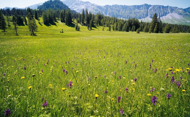 (Photo: Switzerland Tourism Gerry Nitsch)
The assortment of ways to pass the time in Entlebuch is immense and you will not find it difficult to occupy yourself here for a few days. Especially for families, the nature park offers a lot of options, which makes it a suitable destination for active family vacations.
You can find more information on topics such as accommodation, gastronomy, packages, events and much more on the website of the UNESCO Biosphere Entlebuch
How to reach the Entlebuch Biosphere
The nature park is easily accessible by public transport from various directions, whether by bus or train. Regular trains run from Lucerne and Bern to Entlebuch, and several postbus routes lead to the more remote villages. By the way, Entlebuch is included in the validity area of the Tellpass.
You can also reach the Biosphere by car, whether from Lucerne or Bern, quite easily.
 (Switzerland Tourism Jan Geerk)
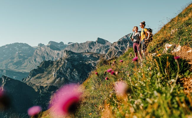 (Photo: Switzerland Tourism Silvano Zeiter)
Gantrisch Nature Park
Facts and figures about the Gantrisch Nature Park
Things get much more mountainous in the Gantrisch Nature Park, which has been one of Switzerland's nature parks since 2012. Covering an area of 404 km², it extends over the territory of 19 municipalities and is home to around 37,400 inhabitants
The park was named after the Gantrisch chain, a mountain range in the Bernese Alps southwest of Thun. Unlike the parks in the Jura Mountains, the peaks here are considerably higher, at more than 2,000 meters above sea level
What awaits you in the Gantrisch Nature Park
The Gantrisch Nature Park advertises many features, one of which immediately catches the eye. Due to the low light pollution, you can experience clear starry nights in the park and hunt for shooting stars. So make a note of your most urgent wishes and go on a shooting star hunt.
Also during the day there is a lot to see and discover in the Gantrisch Nature Park. On the one hand, there are deep canyons and gorges through which the river "Schwarzwasser" meanders. On the other hand, you encounter vast moorlands, the striking Gantrisch chain and endless forests. The importance of the forest must be especially emphasized here
The Gantrisch Nature Park is home to one of the largest contiguous forest areas in Switzerland. In addition, four times more people work here in the agricultural and forestry sector than the Swiss average.
From a cultural-historical point of view there are some treasures to be found here. Spread over the park you will find castles, various baths in the Gurnigel area - which bear witness to the old bathing culture - but also the Schwarzenburg chapel, a part of the Jakobsweg with the Rüeggisberg monastery and various farmhouses built in the style typical of the region. In addition, the Gantrisch Nature Park has eight museums and three observatories
You remember the clear nights? That was no joke.😉
 (Photo: Switzerland Tourism Ivo Scholz)
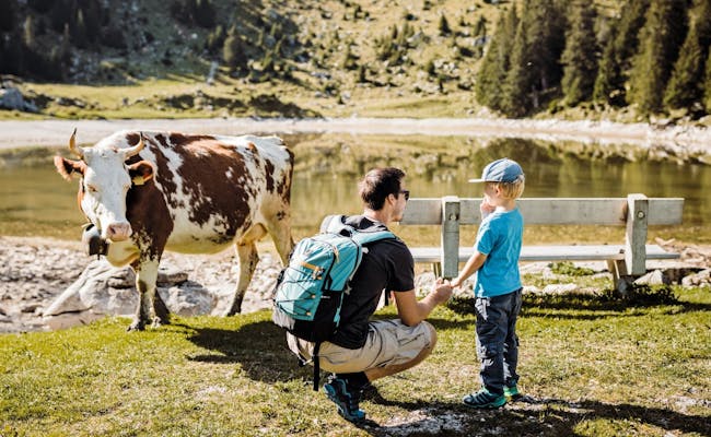 (Photo: Switzerland Tourism Ivo Scholz)
How to reach the Gantrisch Nature Park
The Gantrisch Nature Park is well served by public transport. On the one hand with the train from Bern or within the park with various post bus lines. In winter there is even a snow bus
If you arrive with your own car - no matter if you come from Bern, Thun or Fribourg - there are several parking lots available
 (Photo: Switzerland Tourism Alain Rumpf)
 (Photo: Switzerland Tourism Ivo Scholz)
Regional Park Gruyère
Facts and Figures about the Regional Park Gruyère
We're bending the rules a bit with this park. Its full name is “Parc naturel régional Gruyère Pays-d’Enhaut”. A real mouthful that I'd rather spare you (and myself) from tackling. So for now, let's just call it the “Regional Park Gruyère”.
Since 2012, it has been part of Switzerland's network of nature parks and covers an area of 503 km². It includes 13 municipalities and around 14,700 residents. The park stretches from the shores of Lake Geneva in Montreux up to Greyerzerland and Saanenland near Gstaad.
What to Expect in the Regional Park Gruyère
You might recognize famous cheese varieties like Gruyère, l’Etivaz, and Fribourg Vacherin that come from this region, so it's no surprise that there are several ways to explore one of Switzerland's most important trademarks.
Other features of the Regional Park Gruyère include deep valleys, lush alpine and mountain meadows, numerous forests, as well as cliffs and steep scree slopes.
The medieval town of Gruyères and the Cailler chocolate factory in Broc are actually right outside the park. Just in case you find yourself craving chocolate after a long hike, followed by a photo stop in Gruyères.
How best to explore the Gruyère Regional Park
The park is a true hiker's paradise. By bike you are less well off here than in most other parks, although there are nevertheless isolated bike routes. So we suggest you put on your walking shoes and choose one of the many hikes.
- On the route Les Granges - Gérignoz - l'Etivaz you will find yourself in the largest nature reserve in western Switzerland. This five-hour hike will challenge your legs as you climb over 1,000 meters in altitude
- The cheese trail from Allières to Montbovon is a bit more leisurely. Yes, there are indeed cheese trails in the Gruyère Regional Park. Here you'll find more candidates
- This hike through the moorland at Col des Mosses leads past alpine huts, cow pastures and last but not least the enchanting mountain lake Lac Lioson
- For an excursion on a bike, there are two signposted routes from Schweizmobil. On the one hand there is the Alpine Panorama Route for cyclists and on the other hand the Panorama Bike Route for mountain bikers

You can find more route suggestions and details about the Parc naturel régional Gruyère Pays-d’Enhaut – seriously, who came up with that name? – on this website.
By the way, the Golden Pass Line, one of the five major panoramic trains, takes you right through the Gruyère Regional Park on its journey from Montreux to Lucerne. If you’re not really into hiking and prefer to enjoy the scenery, this would be a time-saving option for exploring the park.
How to reach the Gruyère Regional Park
The Gruyère Regional Park is well connected by train and several post bus lines. Be it from Fribourg, Gstaad, Montreux or Bulle. If you like winding roads, you will also be happy here with your own car
However, there is no direct road from the heart of the park down to the southern part on Lake Geneva. For that you would have to take the highway from Bulle via Vevey to Montreux or the train through the mountains
 (Photo: Switzerland Tourism Marcus Gyger)
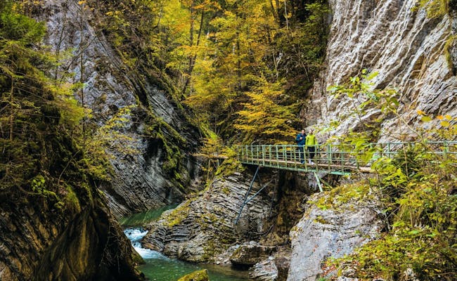 Gorge in the Gruyere Nature Park (Photo: Switzerland Tourism Tina Sturzenegger)
Jorat Nature Park
Facts and figures about the Jorat Nature Park
Small but mighty takes on a whole new meaning in connection with the Jorat Nature Park. Strictly speaking, it is not a nature park, but only a nature park candidate. It has been on the list since 2016 because it would like to be a nature discovery park
Registered or not, no one is left out here. With a manageable 9 km², it is located in a single municipality and only 20 people live on its territory
What awaits you in the Jorat Nature Park
One thing above all awaits you in the Jorat Nature Park.
Forest.
At 40 km², the Jorat forests are the largest contiguous forest area in the Swiss midlands. Since it rains a lot here, the forest is considered a water reservoir that could temporarily guarantee the region's water supply in case of pollution of Lake Geneva.
In addition, the Jorat landscape provides a home for a variety of insects, amphibians, birds and mammals. Since the park is not far from the last metro station of the Lausanne Métro, it registers about one million walkers per year
So you see. Small, fine but very busy.
The best way to discover the Jorat Nature Park
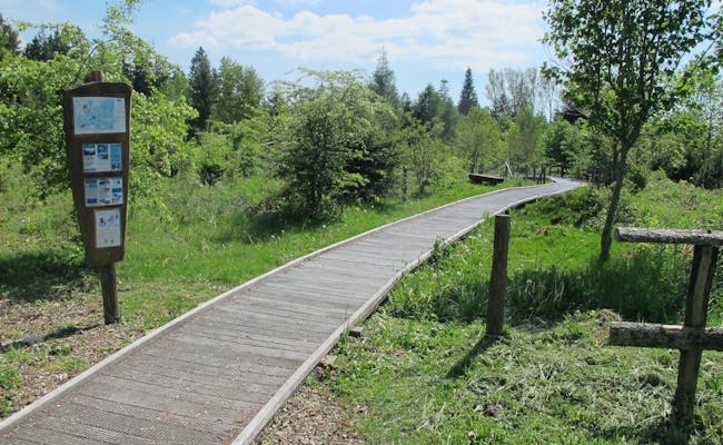
The best way to discover the Jorat Nature Park is on foot along one of the numerous walking trails, paths and boardwalks. Cyclists pass the southern edge of the park on the Swiss mobile route from Lausanne to Payerne.
For more information on the project around the Jorat Nature Park and its goal of earning a place in the federal program, visit this French-language website
How to reach the Jorat Nature Park
With the Métro to Epalinges and a subsequent bus ride, the Jorat Nature Park is easily accessible from Lausanne.
 (Photo: Switzerland Tourism Maxime Rebord)
 (Photo: Switzerland Tourism)
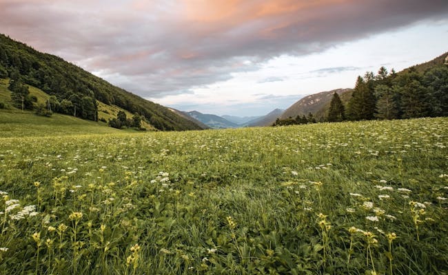
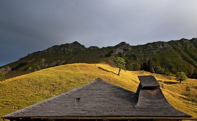
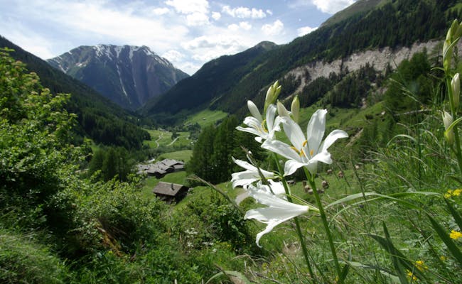
Diemtigtal Nature Park
Facts and Figures about Diemtigtal Nature Park
On the other side of Gstaad, nestled between the Regional Park Gruyère and Lake Thun, lies the remote Diemtigtal. Covering 136 km², this nature park is one of the smaller ones in Switzerland. Since 2012, it has been part of the Swiss network of nature parks, spanning across two municipalities and home to around 2,400 residents.
Somehow small and charming—though not in the same way as Jorat Nature Park. The 19 km long valley stretches from Oey-Diemtigen—by the way, it's also on the route of the Golden Pass Line—all the way to the Landvogtehore, a mountain peak reaching 2,616 meters at the valley's end.
What to Expect in Diemtigtal Nature Park
With around 140 alpine farms leading over 10,000 cows, cattle, sheep, and goats into the Diemtiger Alps during summer, Diemtigtal is one of the most significant communities for Swiss alpine farming. So get ready for a symphony of cowbells during your hikes and mountain bike rides.
You'll also look forward to stunning flower meadows, a wild mountain landscape, breathtaking views in every direction, icy mountain streams, sparkling mountain lakes, and a diverse wildlife. Keep your eyes peeled for ibex, chamois, marmots, and other mountain inhabitants while you hike.
Especially impressive are the many beautiful Diemtigtal houses, adorned with intricate carvings and paintings. These are connected by various themed trails that can be explored with the help of an app. But we'll get to that shortly.
 (Photo: MySwitzerland)
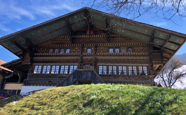 House in the Diemtigtal Nature Park
How to best explore the Diemtigtal Nature Park
The range of activities in the Diemtigtal Nature Park is very comprehensive. You can explore it on foot, by bike, on a mountain bike, on horseback or along one of the many themed trails
- Everything about hiking, including suggested routes to mountain lakes, peaks and the Alps, can be found on the hiking page of the Diemtigtal Nature Park.
- The three Diemtigtaler Hauswege lead you past the most beautiful houses and let you marvel again and again. Don't forget to install the app for it
- Thanks to various other theme trails you will never get bored here. Whether you are interested in birds, cultural history, churches or wild roses
- Bikers get their money's worth in the Bike Park Wierihorn and on the numerous biking routes. Put on your helmet and get into the fun.
- The scooter fun on the Wierihorn is something for small and adult children
- You can also enjoy the Diemtigtal Nature Park in the air or on horseback.
As you can see, the Diemtigtal offers something for everyone. No matter whether you are looking for peace and quiet and a few beautiful photos or for a proper adrenaline rush. You can find more information about the nature park on this website
How to reach the Diemtigtal Nature Park
The Diemtigtal is only accessible from one side. Unless you are on a hiking tour and arrive via one of the many mountains standing around. Otherwise you can travel by train to Oey-Diemtigen and change there to the post bus
If you are traveling by car, drive via Spiez in the direction of Zweisimmen and take the turnoff to Diemtigtal in Oey.
 (Photo: Switzerland Tourism Roland Gerth)
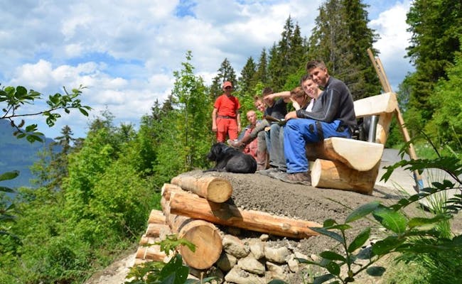 Hiking with family in the Diemtigtal Nature Park (Photo: MySwitzerland)
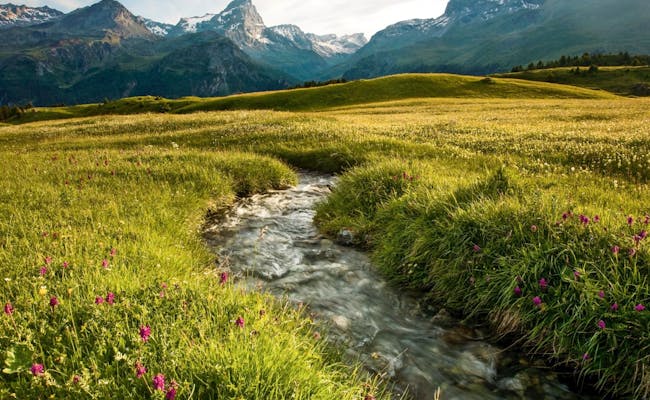
Pfyn-Finges Nature Park
Facts and figures about the Pfyn-Finges Nature Park
In the canton of Valais - which, along with Ticino, is one of the two southernmost cantons in Switzerland - there are two nature parks. One of them is the Pfyn-Finges Nature Park, which covers an area of 277 km² and 12 communes. It has been part of the inventory of Swiss nature parks since 2013 and is inhabited by around 11,000 people
The special feature of this park is that it is located on the language border between the German and French speaking parts of Switzerland. In addition, the differences in altitude within its territory are considerable, as the lowest point is at 500 and the highest at 4153 m.a.s.l. As you can see, this is a very contrasting area.
What awaits you in the Pfyn-Finges Nature Park
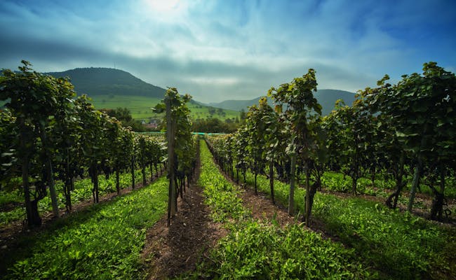
The variety of landscapes and habitats in the Pfyn-Finges Nature Park is impressive. On the one hand, glaciers, rocky steppes, some of the highest mountains in Switzerland and several alpine huts can be found in the park, while not far away are endless pine forests, stately castles, various floodplain areas and the fertile Rohnetal valley with its numerous vineyards.
The core of the Pfyn-Finges Nature Park consists of the Pfynwald protected area. This forest is one of the largest pine forests the Alps have to offer and is one of the most important biodiversity hotspots in Switzerland on 17 km². The park is also a paradise for ornithologists, as it is home to a large number of different bird species. Even eagles can be observed in the Pfyn-Finges Nature Park.
If you have a little sommelier slumbering inside you and would like to give it some exercise, you will get your money's worth here. Over 80 wine shops offer their regional products and wine tastings, most of which can be found in the wine village of Salgesch and on the wine island of Varen
How you can best explore the Pfyn-Finges Nature Park
With over 450 km of signposted hiking trails, there are more than enough options for exploring Pfyn-Finges Nature Park on foot. You can also make good progress by bike or mountain bike. If you don't have your own bike, you can rent one in Leuk or in Sierre.
The nature park website has numerous route suggestions, excursion ideas and themed trails posted. These include the following:
- The Wine Trail from Sierre to Salgesch takes 2-4 hours and leads through the heart of the Valais wine industry.
- On the Birdwatching Tour, which is about 15 km long, rare bird species such as the kingfisher can be observed with a bit of luck.
- A completely different landscape is revealed on the Lämmeren Glacier Trail, which leads through a floodplain landscape of national importance.
- Various biking routes meander through the park. Be it leisurely along the water or on hair-raising trails at higher elevations.
- The Soundwalk focuses on the fact that you can perceive the area not only with your eyes, but also with your ears.
For more information, inspiration, interesting facts and descriptions about the nature and landscape center in Sangelsch, visit the website of the nature park Pfyn-Finges.
How to reach the Pfyn-Finges Nature Park
Along the Rhone Valley, the nature park is accessible by fast and regional trains. Since the park is somewhat remote - of course, this is always a question of perspective - you have to allow about two hours for the journey from the larger Swiss cities such as Geneva, Zurich, Lucerne or Basel. From Bern, you can reach the park in a little more than an hour.
Within the park you will find various post bus lines and cable cars that will take you to your destination. By car, you can either reach the park via the Lake Geneva region via Montreux or by car transport through the Lötschberg tunnel, if you don't want to take the detour through western Switzerland.
 (Photo: Switzerland Tourism Roland Gerth)
 (Photo: Switzerland Tourism Marco Schnyder)
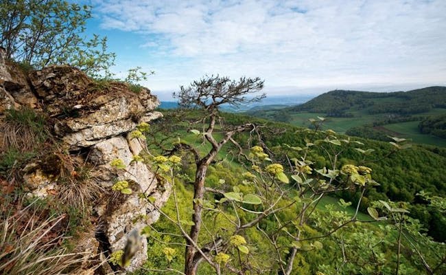
Binntal Landscape Park
Facts and figures about the Binntal Landscape Park
The second nature park in the Valais is the Binntal Landscape Park. This comparatively small park is located on the border with Italy and covers an area of 181 km². Its territory extends over five municipalities and about 1200 inhabitants call it home.
This side valley of the Valais, which used to be used by smugglers as a route on their way to Italy, has held the title of a nature park since 2012.
What awaits you in the Binntal Landscape Park
No other Alpine region is as rich in minerals as Binntal and it is not for nothing that Binn is known as the "Mineraliendorf". So far, more than 300 different types of minerals have been found in this area, far beyond the well-known rock crystals. If you are interested in these fascinating gems, you can find more information here.
Otherwise, the Binntal Landscape Park presents itself at its best with its enchanting views, authentic villages, extensive wildlife, the unique Grengj wild tulip, sparkling mountain lakes and breathtaking mountain landscapes.
How to best explore the Binntal Landscape Park
The best way to get around the Binntal Landscape Park is on foot or by mountain bike. In addition, the Alpin bus runs during the summer months, transporting excursionists from Binn to Fäld and back to Binn after the hike
On one of the numerous signposted hiking trails you can reach every corner of the landscape park, whereby you also have the option for a guided tour or a theme trail. Here's a small selection of possible pastimes:
- On the Hike to Schaplersee you'll see the Swiss mountain landscape from its chocolate side.
- If you are interested in the history of the world-famous hotelier Caesar Ritz (Ritz-Carlton, ring a bell?), the theme trail "The Life of Caesar Ritz" offers a cultural excursion
- For those with a head for heights, the 92-meter suspension bridge Goms Bridge is an impressive experience
- Choose one of the more than 30 further hiking suggestions to discover the Binntal Landscape Park on foot.
- On one of the guided tours you will be shown the park by a professional. Most tours take place in winter as part of a ski tour
- Bicyclists and mountain bikers will find a selection of tours and routes here
- Of course, there are also several offers dealing with the Binntal minerals. These include guided hikes on the topic, grinding courses and mineral hunts or a visit to one of the two museums.
 (Photo: Parks Swiss Brigitte Wolf)
 (Photo: Switzerland Tourism Giglio Pasqua)
This list is by no means exhaustive, and you can find more ideas for all kinds of experiences in the Binntal Landscape Park on the park website
How to reach the Landscape Park Binntal
Getting to the Binntal Landscape Park is a bit of a hassle, but it's still easy to get there by public transport. From Brig or Göschenen, the Matterhorn Gotthard Bahn takes you directly to the park. The suspension bridge is also accessible by train. In addition, there are regular buses and in summer the Bus Alpin within the Binntal.
By car you arrive in the same way as to the nature park Pfyn-Finges. Either via the Lake Geneva region via Montreux or by car transport through the Lötschberg tunnel
 (Photo: Switzerland Tourism Lorenz A. Fischer)
 (Photo: Switzerland Tourism Lorenz A. Fischer)
Parco Val Calanca
Facts and figures about Parco Val Calanca
Another nature park, which for the time being is only a candidate for the title and is waiting to be included in the federal inventory, is the Parco Val Calanca in the canton of Graubünden. It covers an area of 120 km² and extends over the territory of four municipalities. With only about 400 inhabitants, it is very sparsely populated.
The sunny valley is open towards the south and is protected in the north by mountains up to 3000 meters high. In addition, the park is home to a small mountain lake in the shape of a heart, which the organizers immediately incorporated into their logo
What to expect at Parco Val Calanca
Some of the features of the idyllic Parco Val Calanca are the traditional stone and wooden settlements, well-preserved mule tracks, a wild and unspoiled nature with a diverse wildlife, two very remote villages that can be reached only by cable car and a crystal clear river landscape in the bottom of the valley.
Parco Val Calanca is far from the transit traffic between the northern and southern Alps, which makes it a very quiet destination. For wildlife, the park offers an ideal habitat and if you keep your eyes open a bit, you may be lucky enough to see ibexes, deer, chamois and even golden eagles or black grouse
Water-wise, the park has a lot to offer. On the one hand there is the Calancasca River, but also several waterfalls and mountain lakes can be found in this small area.
The best way to explore Parco Val Calanca
In Parco Val Calanca you are ideally on foot. Bicycle and mountain bike routes are not really found here, but there are several beautiful hikes that will lead you into the hidden valley:
- The Via Calanca is a hike that can be done in three stages.
- The Panoramic Calanca Valley Trail is a leisurely hike that is also suitable for families.
- In the Lower Calanca Valley there is a circular hike that is perfect for nature lovers who are in good shape.
- Other trails start in Rossa, a village at the end - or beginning? - of the Via Calanca
Additional information about this park candidate can be found on the website of Parco Val Calanca.
How to reach the Parco Val Calanca
With public transport it is a bit of a cramp to reach the Parco Val Calanca. With the post bus from Chur or Bellinzona you can get to Rossa, a good starting point for various hikes, with one or two changes
The Calanca Valley is easily accessible all year round via the A2 and A13 freeways. Here you will find a more detailed description of your journey to the Parco Val Calanca
 (Photo: Switzerland Tourism Andreas Gerth)
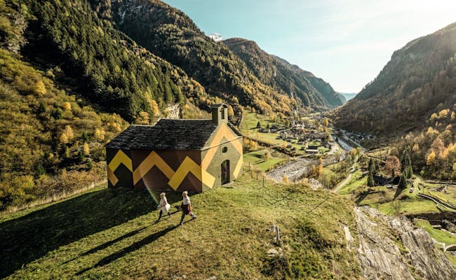 (Photo: Switzerland Tourism Daniel Loosli)
Beverin Nature Park
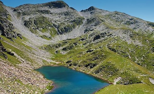
Facts and figures about the Beverin Nature Park
Let's move on to a somewhat larger park for a change. The Beverin Nature Park covers an area of 515 km² and extends over nine municipalities. It has been a regional nature park since 2013 and has about 3700 inhabitants
Ibexes excluded.
The park is named after the Piz Beverin, a 2998 meter high mountain that characterizes the image of this nature park in the canton of Graubünden. The area includes four valleys and two linguistically distinct settlement areas
What awaits you in the Beverin Nature Park
In the Beverin Nature Park, incomparable landscapes of the Grisons mountains await you
Deep gorges such as the Rhine Gorge - also known as the "Swiss Grand Canyon" - imposing mountain landscapes around the Piz Beverin, a hunting reserve that is home to over 350 ibexes, and regionally important mining areas are among the features of the nature park.
One of the three gorges that make their way through the valleys is the famous Viamala Gorge. The name means something like "bad way". And it is not by chance. If you find yourself on the well-prepared hiking trail with bridges and wooden footbridges in this unpleasant gorge and imagine how dangerous this obstacle on the way south used to be, the pessimistic naming will hardly surprise you.
How you can best explore the Beverin Nature Park
The Beverin Nature Park can be explored on foot, by bicycle or mountain bike. But certain gorges are also available for a trip in a canoe or a canyoning tour. It all depends on how much adrenaline you want to release during your stay in the park. Among the options you can choose from are:
- The Via Capricorn is entirely dedicated to the ibex and takes you on a 51 km hike, covered in three stages, across the ibex territory at Schamserberg. The overcoming of 3,400 meters of altitude should not stop you if you want to enjoy this hike.
- Information and suggestions about the Rhine Gorge, which touches the northern edge of the Beverin Nature Park, can be found on the Ruinaulta website
- On the Heinzenberger Gratweg you will be accompanied by wonderful views of the Grisons Alps
- By bike, the Graubünden Route leads you in several stages through various parts of the canton. The fifth stage from Thusis to Splügen runs, among other things, through the Viamala Gorge and along the Hinterrhein.
- Several mountain bike routes, such as the Alpine Bike Route, can be found on the interactive map from Schweizmobil.
- Offers for rafting excursions or guided mountain tours are listed on the website of the Beverin Nature Park.
Hiking trails and other activities are rather sparse on the park website. Nevertheless, you will find helpful information and details about current offers
How to reach the Beverin Nature Park
The Beverin Nature Park can be reached by car on the A13 via Chur, or by train on the Rhaetian Railway, also via Chur or Thusis. Within the park there are various post bus lines and regional trains
 (Photo: Switzerland Tourism Marcus Gyger)
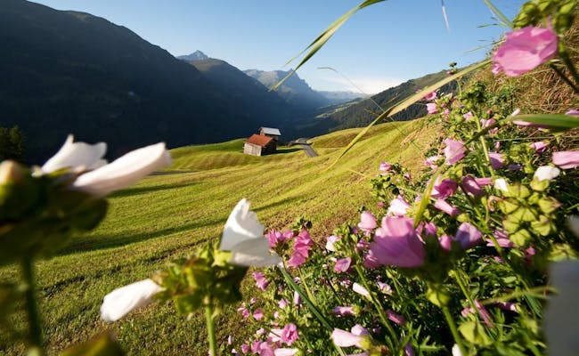 (Photo: Switzerland Tourism Marcus Gyger)
Parc Ela
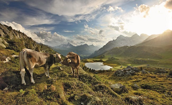
Facts and figures about Parc Ela
Parc Ela is also located in the canton of Graubünden and, with an area of 548 km, is the largest nature park in Switzerland. It covers the territory of six municipalities and unites a whole three language cultures - German, Romansh and Italian. In total, only about 5200 inhabitants live within its borders.
Parc Ela has been part of the Swiss nature parks since 2012 and directly borders the Beverin Nature Park to the west. The lowest point is in the Schin Gorge at 745 meters and the highest point is on Piz Kesch at 3418 meters above sea level.
What awaits you in Parc Ela
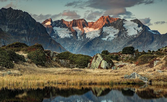
In Parc Ela you will encounter a wild landscape, steep mountain peaks, moorlands of national importance, beautiful Graubünden villages - such as Bergün - and vast landscapes surrounded by glaciers and mountain lakes. In addition, the Albula mountain line, a UNESCO World Heritage Site of the Rhaetian Railway, runs over the Albula Pass. With all its helical tunnels and loops that the train passes through to overcome the altitude, you can quickly lose your bearings.
With over 70 species of mammals, Parc Ela provides habitat for a rich diversity of animals. Starting with the dwarf shrew weighing 3 grams and ending with the red deer weighing over 200 kg. By the way, since 2009 wolves can be detected in the park again. Bears have also found their way in sporadically, although this has not happened since 2008.
In the nature park there are also numerous medieval castles and churches, which can be visited on various excursions
How to Best Explore Parc Ela
This large park, by Swiss standards, offers various ways to get around. There are endless hiking trails and mountain biking routes, roads for cyclists and motorcyclists, and several train lines operated by the Rhaetian Railway.
One particularly impressive train journey leads along the Albula line, part of the Bernina Express route. This panoramic train travels from Chur, past the Rhine Gorge, and along the winding Albula line to St. Moritz in the Engadin. Here are some other ideas for outings and activities:
- A hike in Parc Ela is almost a must. Various long-distance hikes, spanning multiple stages through the canton of Graubünden, pass through the nature park. But there are also shorter hikes available along the over 100 km of hiking trails.
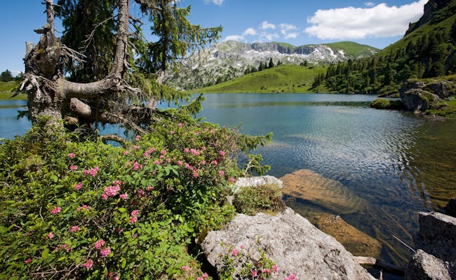
- The charming little Palpuognasee, which we describe in detail in this article, is right by the Albulapass road and definitely worth a visit.
- On a total of 26 themed trails, you can discover the unique features of Parc Ela.
- With a bike or mountain bike, you have access to a seemingly endless selection of routes.
A variety of excursion destinations in Parc Ela - 523 to be exact - are listed at this link. Further information about the park is compiled on the nature park website
How to reach Parc Ela
Parc Ela is easily accessible by public transport as well as by car from Davos, St. Moritz or Chur. Various post bus lines take you to the places that do not have a railroad line
The park is also popular with cyclists and motorcyclists who take a tour over the passes of the canton of Graubünden
 (Photo: Switzerland Tourism Roland Gerth)
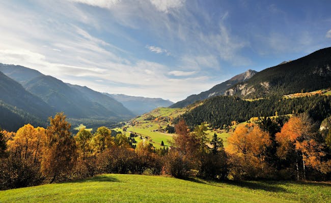 (Photo: Switzerland Tourism Lorenz A Fischer)
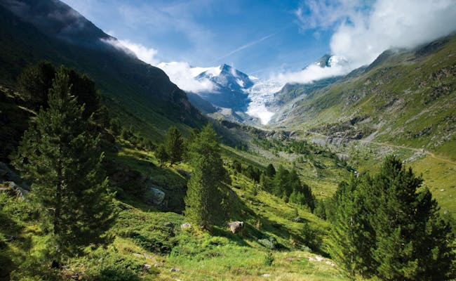
Swiss National Park
Facts and figures about the Swiss National Park
There is only one national park in Switzerland. But this one has it all... Nowhere else in Switzerland will you encounter so many marmots, ibexes and other wild animals in the wild
The Swiss National Park has existed since 1914 and is located in the Engadine in the canton of Graubünden. It covers an area of 170 km²] and apart from a very rich wildlife, there is no permanent resident population in the park.
Since 2010, together with the municipalities of Val Müstair and Scuol, it forms the UNESCO Biosphere Val Müstair, which you will learn more about later. With over 100 years under its belt, it is not only the oldest national park in the Alps, but also the best protected.
What to expect in the Swiss National Park
As you can guess, it's all about one thing
Nature.
The national park is open to visitors on around 100 km of signposted hiking trails and a total of 21 routes. You can expect a variety of animals such as ibex, marmots, chamois, red deer, foxes, squirrels, bearded vultures and many more. In addition, the park has a rich flora, breathtaking views and unspoiled landscapes.
However, in order to make all the beautiful aspects possible, there are a whole set of rules that every visitor has to follow. For example, due to the high protection of the national park, it is not allowed to leave the trails, make an open fire, spend the night freely in the park or take any plants with you
A detailed list of what is forbidden in order to preserve nature in all its beauty can be found here
The only possibility for an overnight stay in the Swiss National Park are on the one hand the Chamanna Cluozza - a simple hut in the middle of the Val Cluozza - and on the other hand the Hotel Parc Naziunal il Fuorn.
How you can best explore the Swiss National Park
Apart from hiking, all sports are prohibited in the National Park. That means: put on your hiking boots, put on your backpack and off you go.
The 21 hiking routes, which are, however, closed in winter, can be filtered on the Swiss National Park website according to marching time, altitude gain and difficulty
The main entrance to the park, through which virtually all hiking trails can be reached, is Zernez. Here is also the Visitor Center, where all conceivable information is served to you on a silver platter
Speaking of information: The Swiss National Park website is your best source to prepare for your trip. Whether it's finding out more about the app created for the park, browsing special tourist offers, or securing a place at the accommodation
How to reach the Swiss National Park
Due to its peripheral location, the National Park can only be reached with a certain amount of time. However, the access with the trains of the SBB and the Rhaetian Railway to Zernez is very good. Detailed information on how to get there can be found here
Arrival by car is also possible, although the number of parking spaces directly at the park is rather limited.
 Swiss National Park
 (Photo: Switzerland Tourism David Merkhofer)
Biosphere Val Müstair
Facts and figures about the Val Müstair Biosphere
This idyllic spot on earth has been part of the Swiss nature parks since 2011 and covers an area of 199 km². The park is located in a single municipality and is home to around 1,400 inhabitants.
Like the Entlebuch, the Val Müstair Biosphere also bears a UNESCO World Heritage designation. Or rather two of them. The two awards went on the one hand to the monastery of St. Johann in Müstair and on the other to the high alpine biosphere reserve that Müstair shares with the national park and the municipality of Scuol
What awaits you in the Biosphere Val Müstair
The Val Müstair Biosphere is a small world in itself on the other side of the Ofen Pass. Biodiversity is a priority here and several projects are dedicated to endangered animal species and the preservation of existing landscapes, among other things.
Typical Graubünden villages, spectacular mountain landscapes, several museums, a traditional hand weaving mill, the great variety of wildlife, the famous monastery of St. Johann, crystal clear mountain streams and rivers make up the beauty and uniqueness of the Biosphere Val Müstair.
How you can best explore the Biosphere Val Müstair
The Biosphere is best discovered on foot or by mountain bike. A visit is also possible by car or post bus, although you will definitely see more of the park at a slower pace. Here for the last time a selection of possible hikes, mountain bike tours and other specialties:
- Just before the border with Italy in Müstair, as mentioned above, is the Benedictine monastery of St. Johann. Information about this UNESCO awarded building can be found here
- On the theme trail A la riva dal Rom you follow the course of the wild river Rom for 18 km. You will see flowering meadows, dense alder forests and impressive landscapes
- Various guided tours deal with topics such as wildlife, the stories of the local villages or the return of the wolf.
- The second stage of the Alpine Bike Route leads through the Val Müstair Biosphere
- Several hikes, such as a stage of the Way of St. James, can be found on the interactive map of Switzerland Mobile
What else is waiting for you in the Biosphere Val Müstair, such as tips on local products or current attractions, you can find on this website
How to reach the Biosphere Val Müstair
Whether you travel by public transport or individually with your own car, the Biosphere Val Müstair is not easy to reach. Nestled in the very tip of Switzerland, the journey to the Engadin and via Zernez is a time-consuming undertaking, but one that is clearly worthwhile.
By train, the journey takes place from almost all corners of Switzerland via Landquart with a subsequent trip through the Vereina tunnel to Zernez. By car, you either drive over one of the mountain passes or you send your car through the Vereina tunnel by car transport.
 (Photo: Switzerland Tourism Andre Meier)
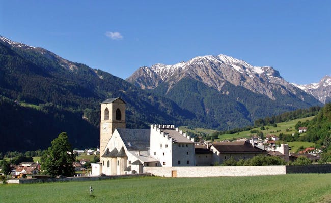 Monastery in Val Müstair (Photo: MySwitzerland)
Further practical information
Finally, we share a few more tips with you about Swiss nature parks:
- There are various helpful apps that will accompany you on your visit and keep you on the right path.
- On this interactive map you can get a good overview where to find which nature park.
- For the journey by public transport we recommend you to use the timetable on the SBB website.
Discover leisure activities
Book NowTop Destinations
Top Activities
