
Ticket
High demandFunicular Monte Brè Ticket from Lugano Cassarate
4.8 (17)
booked 481 times
FromCHF 17

4 Activities
Filter
Better than 4.5 stars
Better than 4 stars
Better than 3.5 stars
Better than 3 stars
No Rating
Ticket
High demandbooked 481 times

Ticket
booked 18 times
Why book with Swiss Activities?

Ticket
booked 279 times

Ticket
booked 35 times
Ticket
High demandbooked 481 times
Ticket
booked 18 times
Why book with Swiss Activities?
Ticket
booked 279 times
Ticket
booked 35 times
You can find more information about Ticino in our article Sights and Activities in Ticino as well as on our pages about activities in Ticino.
 Monte San Salvatore Funicular (Photo: Ticino Tourism Agency ATT SA)
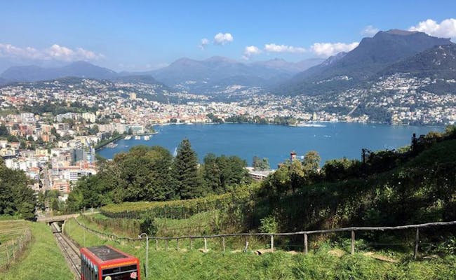
 Funicular Monte Brè (Photo: Ticino Tourism Agency ATT SA)
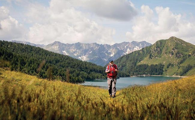
Hiking is possible in Ticino all year round because of the mild temperatures. Whether mountain hikes in the northern Alps or more leisurely walks along Lake Maggiore: there is something for everyone. Along the way, you can experience historical villages, vineyards or waterfalls and caves in the wild and romantic valleys of Ticino. About 2000 km of hiking trails are officially marked.
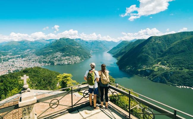
At the summit (912 m above sea level), Monte San Salvatore has, in addition to the observation tower, a panoramic path with seven panoramic views. Each of these views is provided with informative panels and comfortable benches. Several hiking trails lead up or down the mountain.
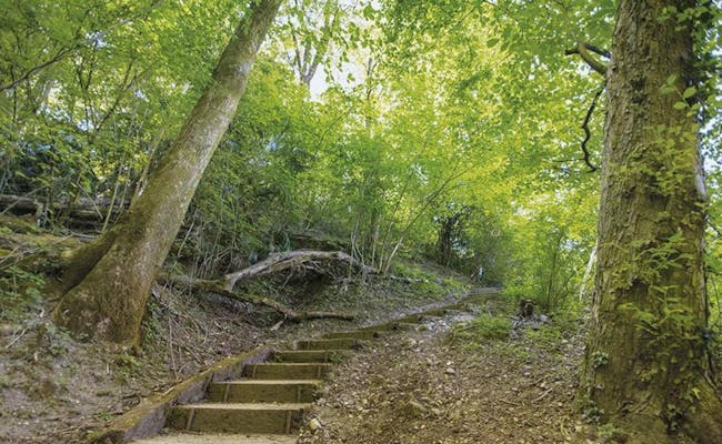
A popular path to the summit village of San Salvatore starts in Paradiso (282 m a.s.l.) behind the station of the funicular railroad that goes to the top of Monte Salvatore. The path first leads through the woods, from Morchino it goes right next to the tracks of the funicular over a staircase to the middle station of Pazzallo (448 m a.s.l.). Up to the top of the mountain 630 meters of altitude are overcome. This hike takes about two hours.
From Monte San Salvatore down there are two possibilities. Either you take the path to Ciona or the one to Carona. In Carona there is a botanical garden (San Grato) to visit. The village itself is an old and picturesque place with pretty stucco work on the facades. The interior of the three-nave parish church, dating from the 16th century, is also particularly splendid.
Some interesting hiking trails:
The return to Paradiso can be done by post bus, train or boat.
This hike is really popular. From Rivera, you take the cable car to Alpe Foppa on Monte Tamaro. The first stop is Capanna Tamaro. The trail leads over the saddle and is well signposted. The hike is not difficult for people with a normal fitness level. At the end of the tour, you can take the cable car down to Miglieglia from Monte Lema. A shuttle service connects the two valley stations, Miglieglia and Rivera, in the late afternoon. This way, you can easily return to the starting point of the hike.
Facts:
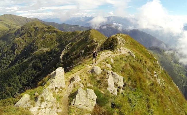
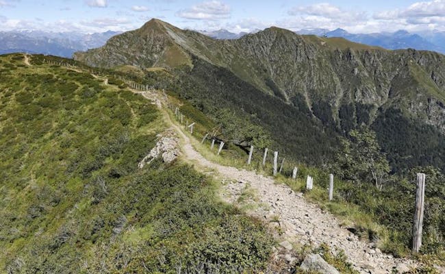
One of the most beautiful mountain hikes in Switzerland starts at Monte Lema. The so-called Traversata runs almost entirely along the mountain ridge near the border with Italy. There are two major ascents to tackle: to Monte Gradiccioli and to Monte Tamaro.
In a little over five hours, you'll reach Alpe Foppa (1530 m above sea level) from Monte Lema. From Alpe Foppa, you take the cable car to Rivera and then the bus back to Miglieglia.
Facts:
There is no cable car at Monte San Giorgio. All destinations can be reached exclusively on foot.
The geological-paleontological trail is a circular route with information panels on the UNESCO World Heritage Site. With about 600 meters of altitude, it is moderately demanding, but can also be walked by children.
The trail starts in Meride (575 m above sea level) at the baroque church of San Silvestro. It leads through small hamlets to Serpiano (659 m a.s.l.). Here ends the cableway (Funvia) Brusino-Serpiano, through which you can shorten the way if necessary.
The circular path has been awarded by Unesco for its didactic value and presents the complex paleontological history of the mountain. The rest of the path goes up to Alpe di Brusino (673 m a.s.l.) In a historical grotto under chestnut trees there is some refreshment. In Pozzo the climb ends and the descent to Meride is via Riva San Vitale.
Facts:
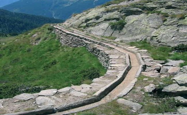
700 kilometers of hiking trails make up the hiking network in the most important valley in Ticino. Here, 40 clear mountain lakes can be visited. A beautiful hike leads from Fusio to the Acquedotto di Canáa, an ancient irrigation system of the farmers in Ticino
In Fusio the path begins to climb through larch woods, along the mountain stream Ri di Mognòla. In a rocky hollow the Lago di Mognòla becomes visible. The path leads over stone slabs and round rocky humps to Córt da Canáa. From here you can see the reservoir Lago del Sambuco in the upper Val Lavizzara. The area is rich in springs. Therefore, the farmers directed the water through stone irrigation channels to the alpine pastures further down.
Facts:
An easy hike takes you from Locarno to the Gordola Adventure Park. It's suitable for the whole family to enjoy together. The path nicely follows the lake and goes through Tenero, with practically no elevation gain to tackle.
Facts:
The Breggiatal has some beautiful hiking trails. The route described here leads into an interesting nature park featuring the Breggia Gorges. Located near Morbio Inferiore, it runs along the deeply carved riverbed of the Breggia River. There are two ways to explore the Breggia Gorges: a geological route and a historical one.
The trail into the Breggia Gorges begins at the Ghitello Mill, built in 1606, next to the old cement plant. Initially, the path passes by a small lake and then follows the Breggia River. Later, the river is crossed, and the route ascends into the Magna Valley up to Colle San Pietro, where the ruins of a medieval castle can be found. In the nearby Red Church, beautiful frescoes from the 14th century can be admired.
You'll then continue following the marked path downwards and cross the river via the canal bridge. The visible limestone pebbles here are about 190 million years old. Another bridge spans a narrow and deep gorge. Walking further along the right bank, you can clearly observe the rock layers. In the summer, local tourism offices also offer guided tours.
The so-called Cement Path should not be walked without a knowledgeable guide and a helmet. This 2-kilometer trail leads from the open-pit mine to the old tunnel shafts, along with visits to the stone crushers and oven towers.
The valley can be accessed by public transport to the Balerna train station. If driving, you can use parking spaces at the Ghitello Mill, which also has an information point.
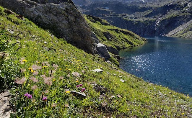
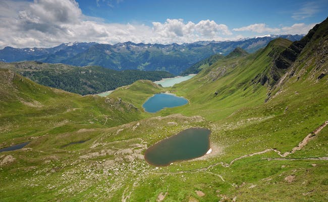
A very beautiful hike is the trail around the lakes of the Pioratal. The loop starts and ends in Piotta at the base station of the funicular railway.
After a twelve-minute ride, you'll arrive in an almost untouched Alpine landscape. The trail begins with a climb up to Pizzo Föisc, which stands at 2,208 m above sea level. There's also a mountain hut here. The path continues over the Föisc Pass to the Ritom Lake, the largest mountain lake in Ticino. From the left shore of the lake, you can head towards a junction that leads to the Tom Lake.
Next, you reach the Cadagno Lake. This lake is quite unique; it consists of two overlapping lakes, one of which is salty. They never mix and even attract researchers from all over the world. After that, you cross the Alpe di Piora, which is one of the largest pastures in Ticino and a protected landscape area. There's also a mountain hut, the Cadagno hut, where you can take a break.
The way back to Piora is along the trail on the left shore of the lake. At the fork to Fontanella, the trail goes down to the Ritom Lake and along the nature trail to the dam. The water of the Ritom Lake is used for power generation.
Facts:
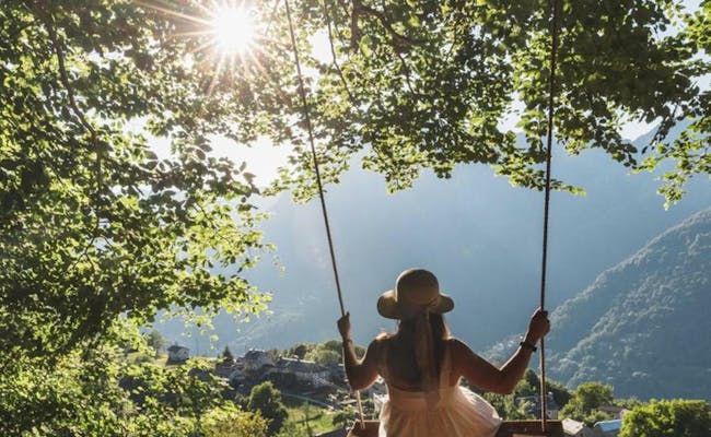
Swing the World is more than just swings. It represents a carefree feeling of life that can be experienced by the lake or in the mountains on a panoramic swing. And more and more new swings are being added.
Elisa Cappelletti and Fabio Balassi, young people from Ticino, had the idea during the lockdown to manufacture wooden swings and install them in impressive locations in Ticino. This idea is now being enthusiastically received everywhere.
The Monte Generoso received the first “Swing the World” swing in the Mendrisiotto area. The giant panorama swing offers a 360-degree view of Lake Lugano, Lake Maggiore, the Alps, the Muggio Valley, and even the Po plain. It takes 14 minutes to reach Monte Generoso by cogwheel train.
One of the two swings in the Nara region is located in the Belni Valley. It can be quickly reached from the Cancori chairlift. It stands in a clearing in the Bosco Nero near Bar Pela at an altitude of 1760 m above sea level. From here, you can see the highest peak in Ticino.
The swing is located at the summit of Pizzo Zucchero and takes about 30 minutes to hike to. The Funivia Alpe Salei cable car brings visitors in seven minutes to an altitude of 1783 m above sea level at Alpe Salei.
Right next to the mountain station of the Orselina-Cardada cable car is a large wooden swing on Locarno's home mountain. From here, you can see the Dufourspitze (4634 m above sea level), the highest mountain in Switzerland.
The Cascata di Foroglio is located off the tourist paths. It cascades down from rocks 110 meters high near the village of Foroglio. The water flows into the Calnègia river. The swing has been installed between two trees on the other side of the river, providing a direct view of the waterfall. The swing can be reached from Foroglio via a short walk. Foroglio is located about 35 kilometers north of Locarno in the Bavona Valley. The traditional stone houses of the village are built around a church from the 15th century and are also worth seeing.
This swing is located in Vira (Gambarogno) on the northern shore of Lake Maggiore at a bar in Shaka Beach.
The village is situated at an altitude of 898 m above sea level in the Centovalli mountains. It can be reached by the Centovallibahn from Locarno and a cable car from Verdasio.
can be found in:

Ticino has a cogwheel train and 6 public funiculars. They operate on tracks. In addition, there are gondola lifts, aerial tramways, and chairlifts.
The funicular Monte Brè runs in two sections up to Monte Brè.
The funicular has been in operation since 1908. The total length of the route is 1599 m. Cassarate is a district of Lugano at about 330 m above sea level. The short section to Ruvigliana climbs 107 meters over a distance of 196 m.
To reach the summit of Monte Brè (933 m above sea level), you climb around 600 meters in less than 10 minutes.
You can take bus number 2 from Lugano station to Lanchetta. From the city center, bus line 1 runs every 10 minutes. This bus will take you to the valley station at the Cassarate/Monte Brè stop. If you're driving, take the Lugano Nord exit and go straight through the city. However, parking at the valley station is quite limited.
The 1st section operates daily from 7:00 AM to 9:00 PM every 15 minutes in both directions. In July and August, the train runs until 11:00 PM on Fridays and Saturdays, and on August 1st.
The 2nd section operates daily in both directions every 30 minutes from 9:00 AM to 5:00 PM. In April and May, the train operates until 6:00 PM. On Easter and from June to October, it runs until 7:00 PM. In July and August, you can use the service on Fridays and Saturdays, and on August 1st until 11:00 PM.
This funicular consists of two sections leading to the summit:
The comfortable funicular operates from mid-March to the end of October in the summer season, and from early December to early March in the winter season. Starting from the valley station Paradiso (282 m above sea level), the ride goes via Pazzallo to the summit, which is at 883 m above sea level. The more than 600 meters of elevation is covered in twelve minutes. It has been running since 1890.
Only 500 meters from the Lugano Süd motorway exit and five minutes from Paradiso-Lugano station, the valley station in Paradiso is easily accessible.
The funicular runs every 30 minutes. In the winter season, it operates between 10:00 AM and 5:00 PM (except at 1:00 PM), mostly only on weekends.
In summer, it typically operates between 9:00 AM and 6:00 PM. On weekends and during peak season, the service is extended daily until 11:00 PM (except at 6:30 PM).
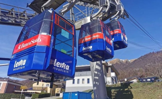
The gondola from Miglieglia takes 10 minutes to reach the summit of Monte Lema at 1624 m above sea level, covering 849 meters of elevation. At the top, there's a hostel with a restaurant and terrace, offering accommodation for up to 30 people. For hikers traveling between Monte Lema and Monte Tamaro, a bus is available at the valley station in Miglieglia to Rivera, and from Rivera, there's a bus back to Miglieglia. From Monte Lema, on a clear day, you can enjoy views of Lake Maggiore to the west and the Bernese and Walliser Alps behind it. The Matterhorn, Monte Rosa, and Mont Blanc are easily recognizable. To the south, you can see far over Lake Lugano all the way to Milan in Italy.
The gondola runs continuously from 8:45 AM to 5:15 PM every 30 minutes. In July and August, it operates until 5:45 PM. During peak guest periods, the frequency may increase, while in bad weather, it runs only once an hour.
 Monte Lema Cable Car (Photo: Ticino Tourism Agency ATT SA)
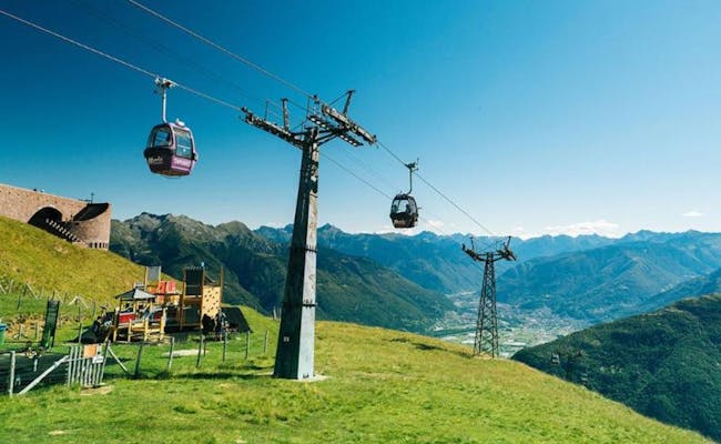 Monte Tamaro Cable Car (Photo: Ticino Tourism Agency ATT SA)
Ticino has a cogwheel railway and 6 public funiculars. They run on tracks. In addition, there are gondola lifts, aerial tramways, and chairlifts.
The Monte Brè funicular operates in two sections up to Monte Brè.
The funicular has been in operation since 1908. The total length of the route is 1,599 m. Cassarate is a district of Lugano located at about 330 m above sea level. The short section to Ruvigliana covers 107 meters in elevation over a distance of 196 m.
To reach the summit of Monte Brè (933 m above sea level), you ascend about 600 meters in less than 10 minutes.
From the Lugano station, you can take bus number 2 to Lanchetta. From the city center, bus line 1 runs every 10 minutes, taking you to the valley station at the Cassarate/Monte Brè stop. If you're driving, you can take the Lugano Nord exit and drive through the city. However, there are only a few parking spots at the valley station.
The 1st section runs every day between 7:00 and 21:00 every 15 minutes in both directions. In July and August, it operates on Fridays and Saturdays, and on August 1st, it runs until 23:00.
The 2nd section operates daily in both directions between 9:00 and 17:00 every 30 minutes. In April and May, it runs until 18:00. During Easter as well as from June to October, the funicular runs until 19:00. In July and August, you can use the funicular on Fridays and Saturdays, and on August 1st, it's also available until 23:00.
The cable car at Monte Tamaro operates in two sections:
The mountain station is not at the summit of Monte Tamaro. The hike to the summit takes about 1.5 hours.
The cable car ascends approximately one thousand meters from Rivera (529 m.a.s.l.) to Alpe Foppa (about 1530 m.a.s.l.) in twenty minutes. The intermediate station Piano di Mora leads to the ropes course.
The Monte Tamaro cabins can carry wheelchairs and strollers, which must not exceed 65 cm x 78 cm in size. The valley station in Rivera is no more than fifteen kilometers from Lugano. It is easily reachable by car via the A2 (exit Rivera) and by train at Rivera-Bironico station.
The cable car operates continuously from 8:30 AM to 5:00 PM, with the last ascent at 4:30 PM and the final descent at 5:00 PM. In July and August, it runs for an extra hour.
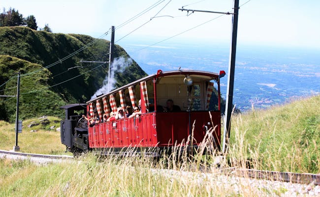
Since 1890, a cog railway has been running from Lake Lugano to Monte Generoso. The nine-kilometer train operates from May to October, with the valley station located in Capolago by Lake Lugano.
The individual stations of the train are:
The cog railway takes forty minutes to travel between the valley and mountain stations. The mountain station Generoso-Vetta sits at 1605 m.a.s.l., right at the border with Italy. This railway is the only "typically Swiss" cog railway south of the Alps.
Electrified since 1982, the railway still retains a fully restored steam locomotive for special excursions.
The cog railway departs hourly around the half hour from 9:25 AM to 4:35 PM. On days with bad weather, only trains leave Capolago at 11:35 AM and from the peak Generoso Vetta at 2:45 PM.
This is one of the steepest funiculars in all of Europe, operating since 1917. Spanning 1,369 meters, the small Ritom funicular overcomes 786 meters of altitude with a slope of 87.8 percent. You should be free of vertigo for this ride. It lasts only twelve minutes, but provides an excellent view of the valley, the surrounding mountains, and the nature of Leventina. Lake Ritóm is a reservoir in the Piora Valley, near the mountain station, with accommodation located at the dam.
The valley station Piotta is at 1,010 m.a.s.l. and the mountain station Piora is at 1,796 m.a.s.l. Bikes are allowed on the funicular. You can take the train to Piotta station, then it's a 1.5 km walk. By car, you take the A2 highway exit 42. Coming from the north, you would take Airolo, and from the south, exit Quinto. The funicular is well signposted.
 Cogwheel train Generoso with steam locomotive (Photo: Ferrovia Monte Generoso SA)
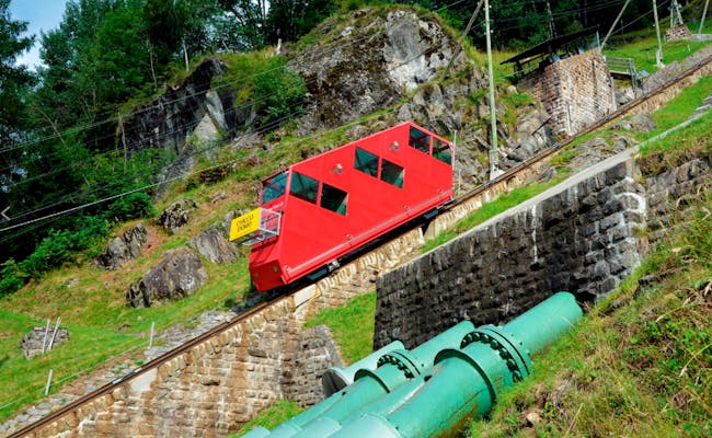 Ritom Funicular (Photo: Funicolare Ritom SA)
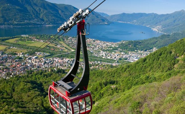
A funicular transports visitors from Locarno up to Orselina, directly reaching the pilgrimage church Madonna del Sasso on Sacro Monte. Along the way, you can enjoy the view of the stream and two remarkable bridges. The funicular (Funicolare) has a length of 825 meters and includes three intermediate stations: Grand Hotel, Belvedere, and Santurio.
The funicular operates year-round from 8:00 AM to 7:30 PM, and in the summer, it sometimes runs until midnight. However, it has regular annual maintenance breaks during which it is closed. The Funicolare runs every 15 or 30 minutes depending on visitor traffic.
From Orselina, you can continue to the local mountains of Locarno, Cimetta and Cardada. A cable car runs between Orselina and Cardada, with a stop in Brè, operating every 30 minutes.
From Cardada, you can take a chairlift further up to Cimetta. The lift operates only on weekends from late October to March.
It's just a few minutes' walk from the SBB train station or nearby parking garages to the funicular station in Locarno. If you present your parking ticket at the funicular ticket office, you receive a 50% discount on parking fees. If you park at Lido in Locarno, you can take the FART bus line from the Residenza Lido stop to the valley station.
In the Monte Carasso district of Bellinzona, the valley station of the cable car is located, which overcomes 1,100 meters in altitude in just twelve minutes, arriving at Mornera.
The cable car stations are:
The cable car runs daily but is only intermittently staffed with a cabin operator. Especially during winter months, this is only the case a few hours in the morning and afternoon. At other times, rides between 6:30 AM and 9:30 PM are possible by pressing a button in the cabin after purchasing a ticket at the machine.
Curzútt serves as the starting point for crossing the Tibetan Bridge. It is advisable to buy cable car tickets in advance as this experience is very popular.
To reach the valley station, take the A2 Bellinzona Süd exit in the direction of Giubiasco. Continue towards Sementina and at the end of Via Ticino, turn towards Monte Carasso.
 Orselina Cable Car (Photo: Ticino Tourism Agency ATT SA)
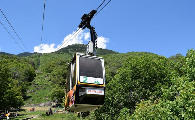 Monte Carasso - Mornera Cable Car (Photo: Ticino Tourism Agency ATT SA)
The cable car runs in two sections:
The bottom station of the cableway is only 200 meters from the highway exit of Airolo and has a large parking lot. The village is located in the district of Leventina, at the gateway to the South; because here both the railroad and the road tunnels to Bisaca open.
At the southern foot of the Gotthard Pass, Airolo is situated at 1141 meters above sea level and offers access to the Bedretto Valley. From Pesciüm one looks directly over to the St. Gotthard massif. Sasso della Boggia is located at 2,065 meters above sea level. This area is a ski resort with 30 kilometers of slopes in winter and a popular hiking and mountain biking area in summer.
The cable cars run in summer from the end of June to the beginning of October between 8:30 am and 6:00 pm every 30 min (September and October only until 5:00 pm). In winter is open daily from 8:45 am to 4:00 pm.
From the bottom station in Rodi-Fiesso (940 m above sea level) to Lago Tremorgio it takes only five minutes by cable car. Bicycles or mountain bikes cannot be transported by cable car. The top station is located at 1830 meters above sea level, so the cable car covers almost 900 meters in altitude. From the top station it is only a few meters to the Tremorgio hut. Numerous hiking trails leave from here.
The village of Rodi-Tiesso is a district of Prato Leventina and is located directly on the A2 highway. The mountain railroad operates continuously from 07:30 to 19:00 between June and the beginning of October, weather permitting.
The bottom station of the Ritzberg chairlift is located at 1500 m above sea level in Bosco Gurin. The village of Bosco Gurin is situated at 1503 meters above sea level and is one of the most beautiful mountain villages in Ticino. It was founded in the middle of the 13th century by Wallisian settlers.
The middle station Rossboda reaches 2000 m a.s.l. and the top station Sonnenberg stands at 2400 m a.s.l. In summer the chair lift operates only in the lower section. Bosco Gurin is located in the western part of Ticino and can be reached from Ascona in one hour by car in the direction of Vallemaggia. Also from the north and east, the route must be chosen via the A2 and the A13 via Ascona.
The chair lift starts at 1655 m.a.s.l. in Cari and goes up to 2000 m.a.s.l. to Brusada. It is open mainly in winter. In the months of July and August the chair lift runs on weekends. Cari is located in the district of Leventina on the southern slope of the Alps. Besides a nice toboggan run in winter, the Cari-Brusada route is popular for mountain biking in summer. A beautiful hike leads from Brusada via Predèlp to Cari.
 Tremorgio Cable Car (Photo: Ticino Tourism Agency ATT SA)
 Airolo - Pesciüm cable car (Photo: Ticino Tourism Agency ATT SA)
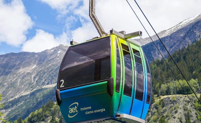
The bottom station is located in Vergeletto (906 m above sea level), in the Zott area and near the Arena forest reserve. The gondola lift is a 4-person gondola lift. It goes up to Alpe Salei (1783 m a.s.l.) in 7 min. The cable car runs from the beginning or middle of May until the end of October. Mon-Fri: 08:30 - 12:00 / 14:00 - 18:00 and Sat/Sun and holidays: 08:30 - 18:30.
Two chairlifts operate on the routes:
The chair lift to Nara is open in July/August only on weekends and holidays from 9:00 to 17:00. However, it runs daily between 9:00 and 11:00 during the first two weeks of August. In winter, several ski lifts operate here. Nara is a popular ski resort with ski slopes, snow parks and sledding trails. In winter, both chairlifts are open from mid-December to mid-March on Fridays to Sundays until 17:00 (first lift from 08:30). They run daily during the week around Christmas and in February.
Intragna is the village with the highest bell tower in the whole Ticino. Here stands the bottom station of the cable car at 366 m above sea level. Intragna is the center of a 160 km long hiking network. Intragna is the main village of the Centovalli Valley.
The area around the middle station is also interesting. In Pila it is worthwhile to take a walk. Some old houses can be found here on a kind of terrace next to modern houses. Particularly interesting to look at, however, are the winding former vineyards and the stone staircases that connect the houses to each other.
Costa is located at 637 meters above sea level. The Grottino next to the mountain station is a popular restaurant. The view from here goes over the Pedemonte plain to Lake Maggiore. The cable cars run daily from March to November (except the first Wednesday of the month) from 09:00-12:40 and 14:30-18:10. Both trains run every 20 minutes and take about five minutes to complete the journey.
Intragna can be reached by the Centovalli Railway from Locarno in about 20 minutes.
 Zott Cable Car - Alpe Salei (Photo: Ticino Tourism Agency ATT SA)
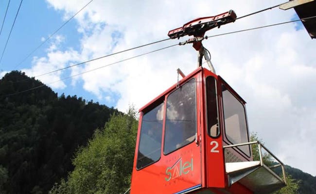
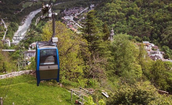 Intragna Pila Costa Cable Car (Photo: Ticino Tourism Agency ATT SA)
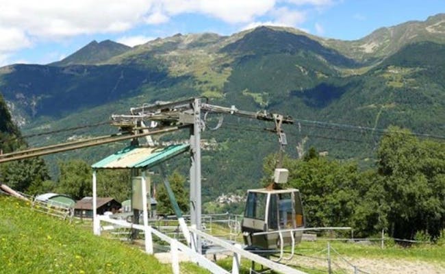
Rasa is a village in the Centovalli Valley at 898 meters above sea level that cannot be reached by road. The cable car takes a maximum of 8 people from Verdasio to Rasa in about five minutes. The bottom station below Verdasio (550 m a.s.l.) is thirteen kilometers from Locarno and is reached by the Centovalli cable car from Locarno in about thirty minutes. There is ample parking at the bottom station. A trip to Rasa is like a journey into Ticino's past.
The cable car is in operation from March to November. It runs daily (except the first Tuesday of the month) from 09:00 -13:00 and 14:20 -18:00 every 20 minutes.
The bottom station of the cable car is also located in Verdasio (550 m above sea level), thirteen kilometers from Locarno. Sufficient parking spaces are available here. The Centovalli cable car takes about thirty minutes to get here from Locarno, and the place is also easily accessible from Italy. The mountain station on Monte Comino is located at 1150 meters above sea level.
The cableway operates in the summer season from the beginning of April to the beginning of November. It runs at intervals of about thirty minutes. From June to September it runs continuously between 9:00 and 18:30. The two cabins hold 4 people each. The ride over a length of 1,100 meters takes seven minutes.
Two short walks depart from here:
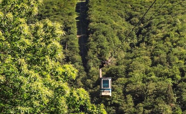 Verdasio - Monte Comino (Photo: Ticino Tourism Agency ATT SA)
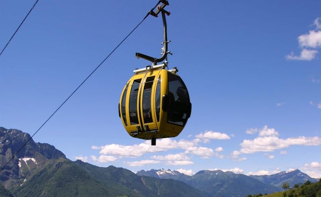 Verdasio - Rasa (Photo: Ticino Tourism Agency ATT SA)
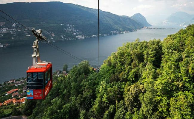
The bottom station of the aerial tramway is in Brusino Arsizio (285 meters above sea level) and the ride to Serpiano (650 meters above sea level) takes just a few minutes. The cableway is 934 meters long and climbs 367 meters in altitude. The valley station can also be reached by boat from Lugano or by bus from Capolage. Both stops are only a few meters away from the valley station.
From Serpiano there is a comfortable hiking trail to Meride with the Fossil Museum. The fossils of Mount San Giorgio are part of the World Natural Heritage. From the top of Monte San Giorgio you can see Lake Lugano.
The cableway is open from April to the end of October. It runs from Wednesday to Sunday from 9:15 to 17:45. The trips take place every 30 minutes.
The cable car has its valley station in the north of Lumino (320 m a.s.l.) and goes up to Monti di Saurù (1308 m a.s.l.) in 12 minutes. Hikes from here lead, for example, to the Brogoldone hut at 1910 meters above sea level.
The cableway runs daily from March to October and on weekends in January and February. It consists of two four-seater cabins.
 Brusino - Serpiano (Photo: Ticino Tourism Agency ATT SA)
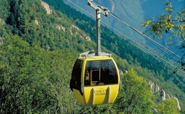 Lumino - Monti di Saurù (Photo: Ticino Tourism Agency ATT SA)
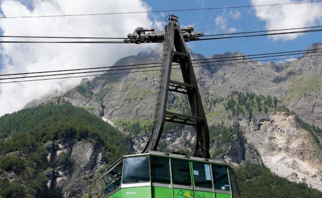
San Carlo is located in the Bavona Valley in the northwest of Ticino. It can be reached from Locarno in about an hour by car. There's also direct public transportation to the area. The large cable car takes up to 96 people at a time to Robiei, situated at an altitude of 1,900 m above sea level. The journey takes 15 minutes, covering a distance of four kilometers, passing seven tall cable car masts along the way.
The cable car operates from mid-June to mid-October, running approximately hourly from 8:00 AM to around 5:00 PM. The ascents at 9:00, 11:00, 3:35 PM, and 5:00 PM from San Carlo connect with the post bus. The same applies for the descents from Robiei at 8:30 AM, 10:30 AM, 3:15 PM, and 4:45 PM.
Malvaglia is located in the Blenio Valley in northern Ticino. From Malvaglia, the sunny terrace of Dagro (1,400 m above sea level) can be reached in eight minutes. Mountain bikes and paragliders are allowed on the cable car. There’s a panoramic playground on the terrace, and hiking can be enjoyed all year round.
The small cable car runs year-round. The Val Malvaglia is known for its old houses (cascine) built on dry stone foundations.
On a hike from the Dagro mountain station down to Madra, Dandrio, towards Malvaglia, you can see these historical houses. The houses from the 13th century in Ville can be found in Val Malvaglia. This area is listed in the inventory of landscapes of national importance in Switzerland.
 San Carlo Robiei (Photo: Ticino Tourism Agency ATT SA)
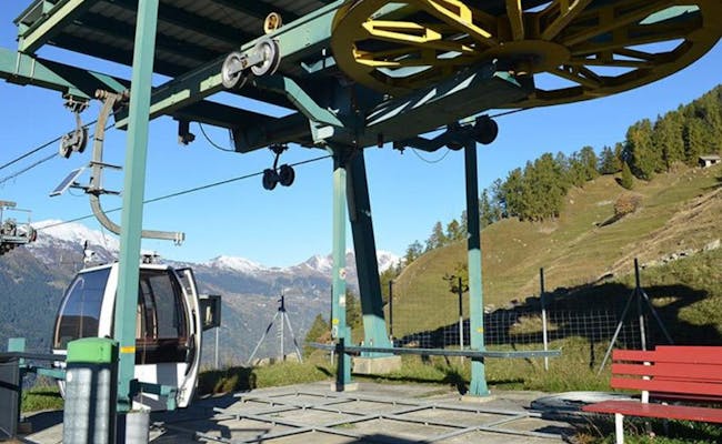 Malvaglia - Dagro (Photo: Ticino Tourism Agency ATT SA)
The small cable car built in 1970 can carry four people. The bottom station in Camorino is at 310 meters above sea level, the top station at Monti di Croveggia at 920 meters above sea level. Camorino is a district of the municipality of Bellinzona. More than 600 meters of altitude are covered in just under nine minutes. The cableway is open from April to the second half of November. It runs up to three times a day (morning, noon, evening), but usually only on Fridays, Saturdays and holidays. In high summer it is also open on Tuesdays and Thursdays. Monti di Croveggia is the starting point for hikes. Every year in June there is a big cableway festival.
The bottom station of the cable car is located at 711 meters above sea level, very close to the exit of the A2 freeway from Faido. It takes 5 minutes to reach the top station on Pianaselva (1,100 m above sea level). Pianaselva is known for its ancient woods and beautiful waterfalls. Near the mountain station there is the farm Piana Selva with a typical grotto. Horse riding lessons, children's quads and swimming pool are waiting for visitors.
The cable car operates daily in July and August between 8:00 and 20:00. From the first of May is already open on weekends and holidays.
 Faido - Pianaselva Cable Car (Photo: Ticino Tourism Agency ATT SA)
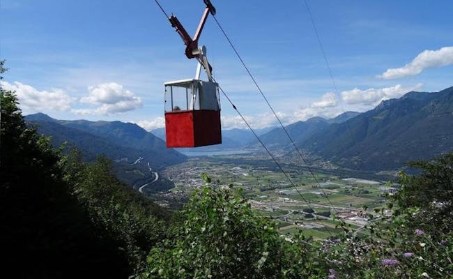 Monti di Croveggia (Photo: Ticino Tourism Agency ATT SA)
The funicular was built in 1886. It’s still the quickest way to get to the train station in Lugano. Bicycles are allowed. The ride takes just 1.5 minutes from Piazza Cioccaro to the station. It operates daily from 5:00 AM to midnight without interruption.
In San Gotthardo, an old military railway was converted into a funicular in 2012, accommodating 16 people. It runs from the base station San Gottardo (artillery fort) to the A Battery West Stollen II section at 2199 m above sea level. It’s one of the largest fortifications in Switzerland.

Ticino is a charming mixture of Mediterranean flair with palm trees in the south and the Swiss Alps in the north. Wide mountain valleys and large lake landscapes are typical for Ticino. Here you can do everything your heart desires. Whether you want to relax on a lakeside or have fun on the lake, plan a hike along one of the rivers or on a mountain peak, go wild canyoning or rafting or stroll through the charming piazza in Lugano, Locarno or Ascona, Ticino is the place to be
Find out more about Ticino region