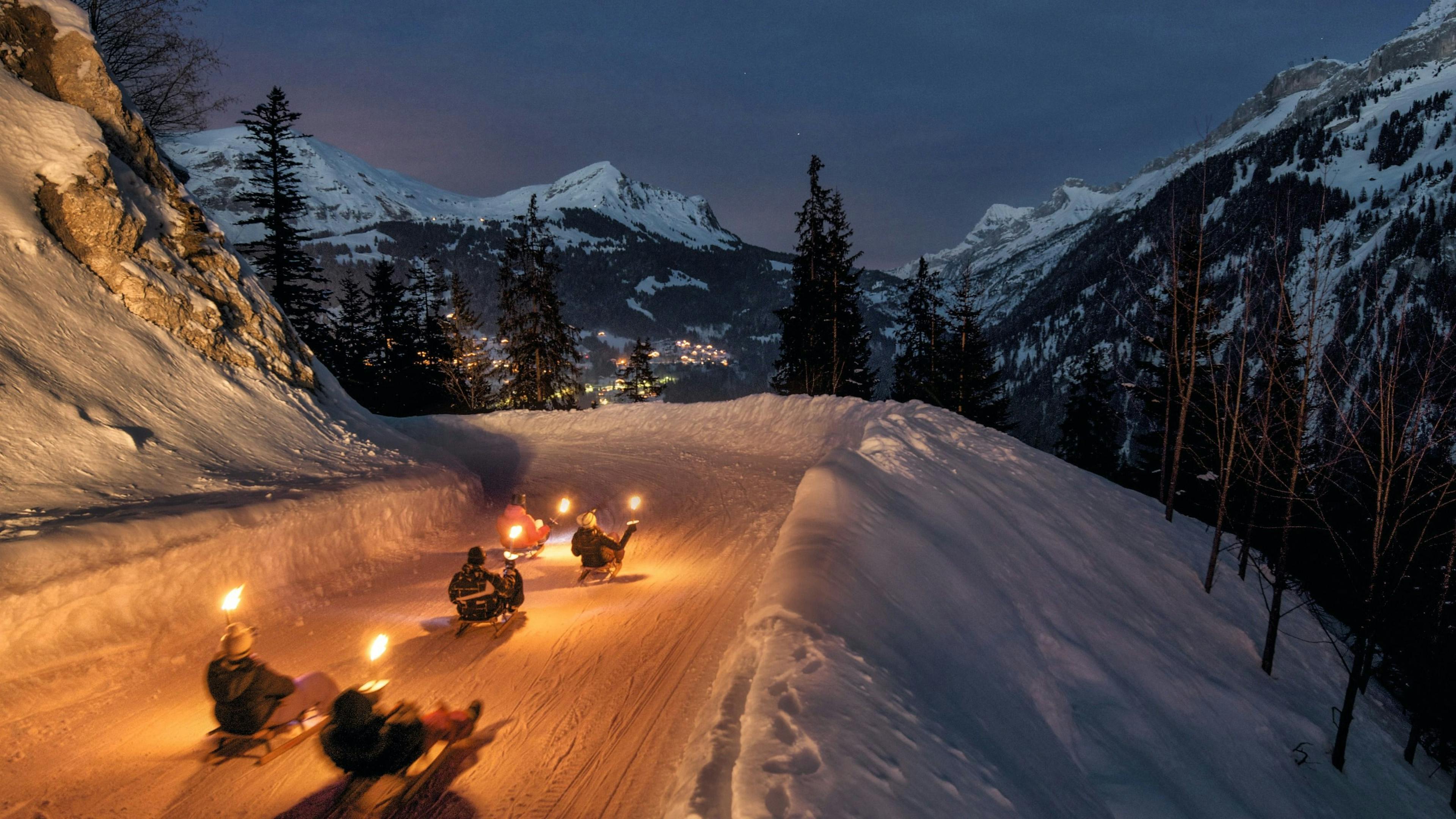
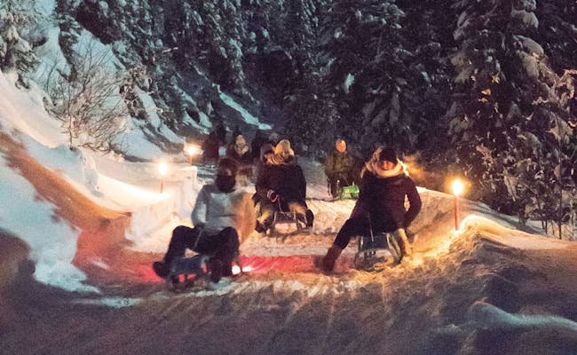
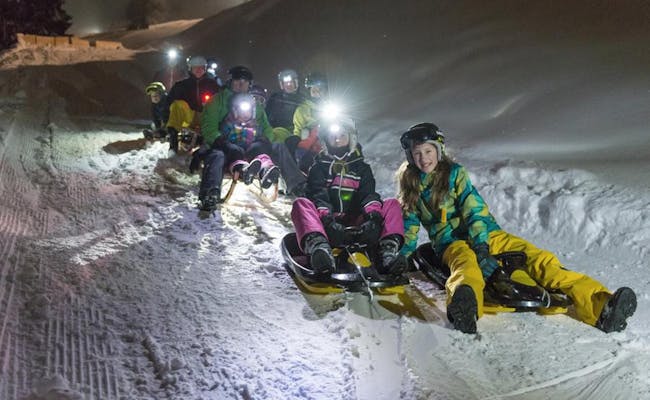
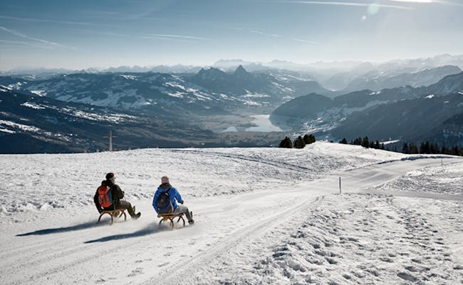
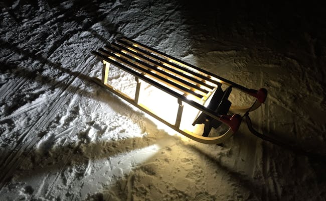
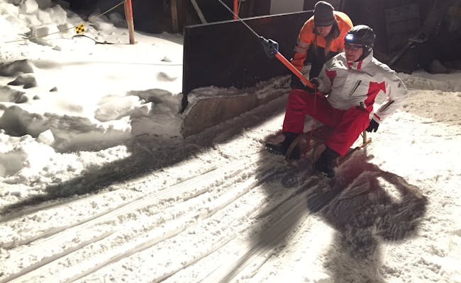
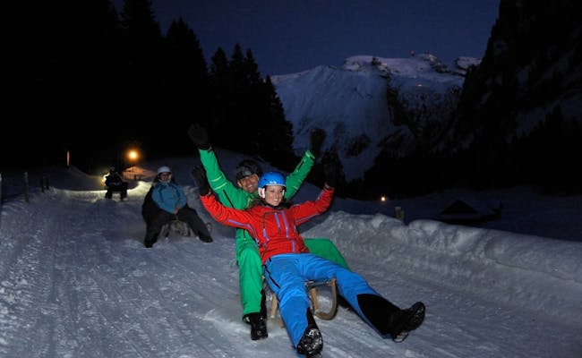
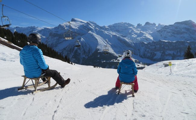
Night sledding in Switzerland is a special experience. Sometimes it's long descents like those over the big mountain passes, which are prepared as toboggan runs in winter. Sometimes it's the nearby local mountain that's the destination or you sled down below the famous Eiger north face. In our ultimate night sledding guide you will also find a route near you.
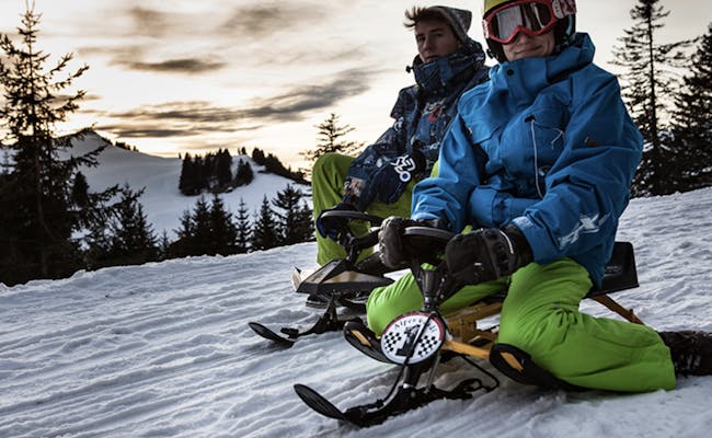
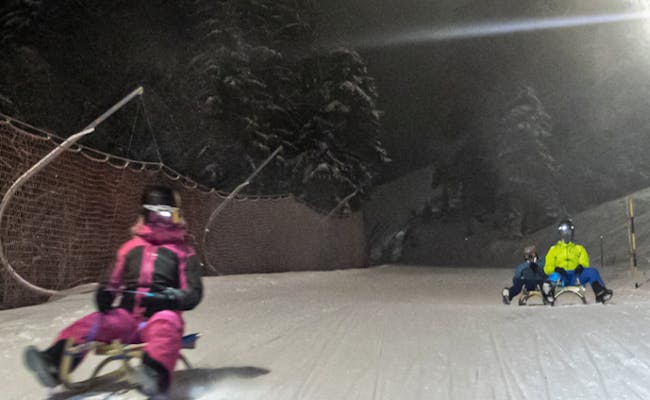
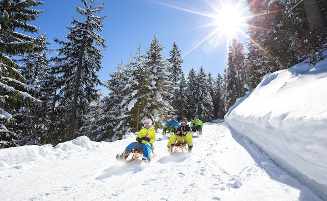
Video Night Sledding - Light Ride Lenzerheide
Practical information about night sledding in Switzerland
At the bottom of this page, the FAQ answers questions about the organization and rules of night sledding. You can also read about the difference between a toboggan and a sled. But we already answer some of the most burning questions here.
Are all toboggan runs lit at night?
In most cases, toboggan runs are sufficiently illuminated as soon as night sledding is scheduled. But unfortunately, this is not true for all sledding runs. In these cases it is advisable to put on a headlamp. Often these are rented at the toboggan runs with the necessary helmet and other equipment.
Can I rent sledding equipment for night sledding on site?
Usually you can rent sledges and toboggans directly at the toboggan run or at the stations. If you reserve or book your sledding equipment in advance, it will be ready for you on site.
Can I take my dog with me to the night sledding?
No, dogs are generally strictly forbidden on the toboggan runs. However, there is one exception: the Fideriser Heuberge sledging mountain permits dogs on the sledging runs and in the mountain huts. Good training is required. Other people must not be inconvenienced or harmed by them.
Where in Switzerland is the best place to go night sledding?
Some alpine tourism regions in Switzerland have plenty of runs for night sledding. We've summarized the number of options available by tourism region in a table for you.
We’ll describe the individual runs, including access and special features, in detail for each tourism region below.
Overview of Tourism Regions with Night Sledding Runs
| Tourism Region | Number of Night Sledding Runs |
|---|---|
| Bern | 14 |
| Lucerne-Lake Lucerne | 14 |
| Eastern Switzerland-Liechtenstein | 7 |
| Graubünden | 17 |
| Valais | 6 |
| Lake Geneva | 1 |
| Zurich | 1 |
Region Bern: Night Sledding
Night sledding in the Berner Oberland is more popular than ever. The trips are usually short, and the fun increases when experienced in a group. At night, surrounded by snow, with or without moonlight, and with or without a torch. This ensures a unique atmosphere.
Night Sledding Trails in the Berner Oberland
| Start | Destination | Length (km) | Special Features | Days of the Week |
|---|---|---|---|---|
| Eggli Mountain Station | Gstaad | 5.00 | Eggli Run with torches from 10 PM | Tuesdays from December to early March |
| Sparenmoos Mountain House | Heimchuewald | 3.60 | easy, illuminated | Saturdays in January and February |
| Heimchuewald | Zweisimmen | 2.20 | medium difficulty, unlit, occasionally closed | Saturdays in January and February |
| Alpiglen | Brandegg Mountain Station | 2.70 | Eiger Run, No. 64, fast alongside the Eiger North Wall | Thursday to Saturday, late December to early March |
| Alpiglen | Brandegg Mountain Station | 1.90 | Eiger Run, No. 64a, very fast alongside the Eiger North Wall | Thursday to Saturday, late December to early March |
| Niederhorn Mountain Station | Vorsass Mid Station | 3.10 | single lanterns along the path | Fridays and Saturdays |
| Tschentenalp | Möser (Valley Station Chairlift) | 2.20 | illuminated from 6:00 PM to 9:00 PM | Wednesdays and Saturdays in January and February |
| Tschentenalp | Adelboden | 6.00 | extension between Möser and Adelboden unlit | Wednesdays and Saturdays in January and February |
| Nüegg Mountain Station | Nüegg Valley Station | 5.60 | Diemtigtal | Fridays from late December |
| Ramslauenen Mountain Station | Kiental | 4.00 | suitable for families | Wednesdays to Fridays from late December to mid-March |
| Mägisalp | Bidmi | 3.00 | Hasliberg, illuminated, slope 14 | Wednesdays from early February to early March |
| Mägisalp | Bidmi | 3.00 | Hasliberg, unlit sledding path | Wednesdays from early February to early March |
| Sulwald Mountain Station | Isenfluh | 4.70 | unlit, past the frozen Sulsbach waterfall, old forest road | Monday to Saturday, lift runs until 7:30 PM, December to February |
| Sulwald Mountain Station | Lauterbrunnen | 8.20 | unlit, past the frozen Sulsbach waterfall, extended along the old Isenfluh road | Monday to Saturday, lift runs until 7:30 PM, December to February |
| Bussalp | Weidli | 5.40 | official route, unlit | Thursday to Saturday from mid-December to early March |
| Bussalp | Grindelwald | 8.00 | in good weather conditions, unlit | Thursday to Saturday from mid-December to early March |
Eggli Run (Gstaad): 5km Night Sledding
The Eggli Run is perfect not just for sporty sledders but also for families. The sledding trail is also used by hikers. The Tuesday night sledding with torches is a special event and very popular. A reservation is essential for groups of 10 or more.
Location: Gstaad
Gstaad is largely car-free and sits at 1,041 m above sea level. It is the tourist hub of the Saanenland region, famous for its chalet-style houses.
Night Sledding Timetable
Normally, the last ascent is scheduled for 16:30. On Tuesdays from December to early March, a Tuesday Night Fondue is offered at the mountain restaurant, combined with night sledding. On these days, the cable car operates additional times: Ascent: from 19:00 to 20:00 Descent: from 21:00 to 23:00 Sledding with torches starts at 22:00.
Getting There
You can reach Gstaad via public transport using the SBB Bern-Spiez, the BLS to Zweisimmen, and the MOB to Gstaad-Saanen. Direct trains run from Bern to Zweisimmen with the Lötschberger. By car, it takes about 1.5 hours from Bern via the A6 motorway and Route 11. Gstaad has some car-free zones, and there's limited parking at the valley station of the cable cars.
Tickets
Bookings are made through the Eggli mountain restaurant. Reservations are recommended as this event is highly sought after. Ski passes, season passes, shareholder vouchers, etc., are not valid for cable car rides on these days from 18:00 onwards.
Sled Equipment Rental
Valley Station Eggli, Gstaad
Night Sledding Process
The torch sledding starts at 22:00. Using the 10-person gondola from the Porsche Design Studio, you ride from Gstaad to Eggli (1,555 m above sea level). The sledding trail begins near the mountain restaurant. It stretches 5 km through the mountain landscape and cozy forests on a nearly straight path, descending about 500 meters in elevation. After about an hour of sledding, the trail ends in the Gstaad district of Grund. You can easily walk back to the Eggli valley station.
Catering
Eggli Mountain Restaurant
Sparenmoos Night Sledding
There’s a 3.6 km long family sledding track along with a 2.2 km moderately difficult route. The lift is open until 10 PM in good weather. After the cozy and well-lit section up to Heimchueweid, a narrow path through the forest begins, which is more challenging to follow. It is often closed for safety reasons.
Location: Zweisimmen
Zweisimmen gets its name from the two rivers that flow together here, the Kleine and the Grosse Simme.
Night Sledding Opening Hours
The lift is open until 10 PM in good weather. You can drive to Sparenmoos by private car. From Zweisimmen, it's nine kilometers. Parking costs only a few francs a day. The bus takes about 10 minutes between Zweisimmen station and Heimchuewald, and 20 minutes to Sparenmoos. It stops at Heimchuewald on every trip.
Bus Timetable
- Zweisimmen Departure: 6:35 PM, 7:35 PM, 8:35 PM, and 9:35 PM.
- Sparenmoos Departure: 7 PM, 8 PM, 9 PM, and 10 PM.
Getting There
Coming from the north, motorways conveniently lead you from Zürich and Bern to Spiez on the Lake Thun. From there, it takes about 40 minutes via the mountain road Route 11 to Zweisimmen. From the south, you exit the motorway in Aigle and take Route 11 north. You can reach Zweisimmen in just over an hour from Aigle.
If you're coming from the west of Switzerland, you go over Bulle and the Jaun Pass. Even before reaching Boltigen, you switch to Route 11 towards Saanen. The journey from Bulle to Zweisimmen takes about an hour. Parking in Zweisimmen is free.
If you're using public transport, take the BLS AG train from Spiez and the Montreux Oberland Bernois from Montreux station.
Night Sledding Procedure
You can take the postbus/bus from Zweisimmen station to the starting point of the sledding track at Berghaus Sparenmoos. Since the buses share the same road as the sledders, there’s a clear timing rule: The descent with sleds or toboggans always takes place on the hour on the Sparenmoos road. A time window of 15 minutes is open for this. Meanwhile, buses always have their 15 minutes at half past the hour in the opposite direction. Heimchueweid serves as a bus stop. From here, you can return uphill.
The area is situated at an altitude of 1640 m above sea level in a high moor region. The nearly four-kilometer sledding path runs from the high plateau Sparenmoos to Heimchueweid, covering a descent of 340 vertical meters. It starts off on a flatter section over meadows, later moves through forests. The path then becomes a bit steeper and curvier. From Heimchueweid, the bus will take you back to the start or into the village of Zweisimmen. The sledding path is illuminated up to Heimchuewald.
To prevent any misunderstandings: dogs are welcome during the day while sledding, but not at night.
The second part of the sledding path allows experienced sledders to go from Heimchueweid to Zweisimmen. This stretch is 2.5 km long and ends at the bus stop Obegg. From the bus stop, it’s just a kilometer to the Zweisimmen station.
Dining Options
- MUMA Beizli
- Site Alp Beizli
 Sparenmoos (Photo: Paragliding Interlaken)
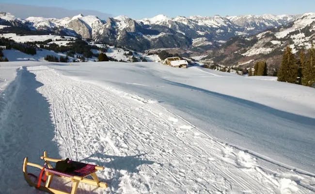
Eiger Run: Night Sledging from Alpiglen to Brandegg
The spectacular Eiger Run route (64) runs right beneath the legendary Eiger North Face, making it a particularly impressive experience in the evening. The regular route, with a 36% gradient is lit and spans 2.7 km. A direct route (64a) is shorter at 1.9 km and quite a bit faster.
Location: Grindelwald
Grindelwald is very popular among tourists and day-trippers for its diverse activities. The "Gateway to the Jungfrau Region" also attracts climbers. Grindelwald is often used as a base for ascending the Eiger North Face.
Night Sledging Opening Hours
From late December to early March, night sledging takes place on Thursdays to Saturdays in the evenings.
Getting There
You can reach Grindelwald from Bern by car via the A6 and A8 (from Spiez). At Wilderswil, take exit 25 and follow Grenchenstrasse and Grindelwaldstrasse. Grindelwald has several large parking garages.
From Bern, you can quickly take the Swiss Federal Railways to Interlaken. There, you transfer to the Berner Oberland Railway, which will take you to Grindelwald.
Sled Equipment Rental
- Wyss Sports
- Grindelwaldbus Bussalp
Night Sledging Procedure
With the Wengernalpbahn, you'll reach the starting point of the sledging track from Grindelwald in just 4.5 minutes (heading towards Kleine Scheidegg). For night sledging in the evening, special trains of the Wengernalpbahn run every half hour. With the "Eiger Run Evening Ticket," you can return from Brandegg to Alpiglen as often as you like. Then you can race back down to Brandegg. Each ride takes about 25 minutes.
Food Options
- Berghaus Alpiglen at the starting point
- Berghaus Brandegg at the destination
The faster direct sledging tour runs alongside the funicular.
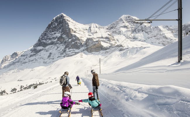 Eigernordwand Family (Photo: Jungfrau Railways)
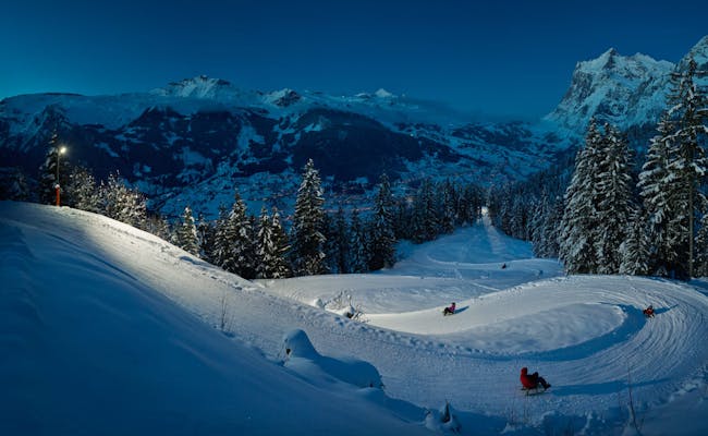 Eiger Run Grindelwald (Photo: Jungfraubahnen)
3.1 km Star Sledding from Niederhorn to Vorsass
Sledding under the stars begins at Niederhorn by the large illuminated sign.
Location: Beatenberg
Located on the northern Thunersee, Beatenberg is at an altitude of 1,155 m above sea level in the Bernese Oberland. The village sits beneath the southern slope of the Niederhorn on a plateau. The Niederhorn is the local mountain of Beatenberg.
Night Sledding Hours
- Fridays and Saturdays
- The sledding path is marked with lanterns
- The group gondola runs every 15 minutes from the mid-station Vorsass to the Niederhorn starting at 6:35 PM.
- Last ascent at 9:35 PM
Contact Information
- Niederhornbahn AG, Schmockenstrasse 253, 3803 Beatenberg,
Getting There
You can reach Beatenberg by car from Bern in about an hour via the A6 motorway. Using public transport, take the Swiss Federal Railways to Interlaken. From there, switch to the postbus on line 101. By train and bus, you're in Beatenberg from Bern in 80 minutes.
Tickets
Reservations are mandatory. If there are doubts about the conduct of night sledding (weather, insufficient reservations), you will be informed by phone on the day of the event after 3:00 PM.
Rental of Sledding Equipment
Headlamps are recommended; they are sold at the Niederhornbahn stations. The star sledding package includes a sled, which you can pick up at the mountain station Niederhorn.
Night Sledding Procedure
The Niederhornbahn operates to the Niederhorn from Beatenbucht or Beatenberg station. With the simple star sledding offer, you can sled from Niederhorn down to Vorsass during the designated time. From the mid-station Vorsass, you ride back up to Niederhorn. Under the bright moonlight, beneath a sparkling starry sky, and with a few lanterns along the path, you sled down to Vorsass. The sledding track is regularly excellently groomed. The descent takes about half an hour, covering a vertical drop of 370 meters.
Catering
- Mountain Restaurant Niederhorn (Fondue)
- Mountain Restaurant Vorsass (Mulled wine or punch)
- If you book the star sledding (PLUS) package, you start with a fondue experience at the Berghaus Niederhorn. After sledding, you’ll enjoy mulled wine or punch at the mountain restaurant Vorsass.
 Star sledding Niederhorn (Photo: Niederhornbahn)
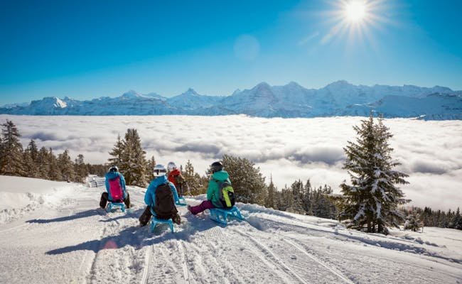 Star sledding Niederhorn (Photo: Niederhornbahn)
Tschentenalp - Möser (Chairlift) - Adelboden: 2.2 km Night Sledging
Location: Adelboden
Adelboden is an idyllic mountain village situated at 1,353 m above sea level.
Night Sledging Hours
From January to the end of February, night sledging takes place every Wednesday and Saturday evening. The sledding runs between Tschentenalp and the Möser chairlift are illuminated from 6 PM to 9 PM.
The Tschentenbahn runs uphill every 30 minutes from 6 PM. The last ascent is at 8 PM, and the last descent of the gondola loop lift is at 10 PM.
Contact Information and Details
- Tschentenbahnen AG, Bellevuegässli 4, 3715 Adelboden,
- Snow Sports Report
- TschentenAlp Night Sledging
- Adelboden Information on Night Sledging
Getting There
You can reach Tschentenalp via the Adelboden – TschentenAlp gondola lift. The valley station of the gondola is located in the center of Adelboden.
From Bern, it takes about 90 minutes to get to Adelboden using public transport: Bern – Spiez IC 6 SBB and Spiez – Frutigen BLS or directly Bern – Frutigen RE towards Domodossola. Frutigen – Adelboden Post by bus B 230.
By car, you can reach Adelboden via the A 6 in around one hour. It’s about a five-minute walk from the parking garage to the Tschentenbahn station in Adelboden.
Sled Equipment Rental
You can rent various types of sleds at Tschentenalp and can also switch between them while sledging. For detailed information, check out our page on Tschentenalp.
Night Sledging Process
The gondola takes you directly to the start of the sledding run. Once you arrive at your destination in Möser, the chairlift takes you back to the starting point in about three and a half minutes. There are two adjacent sledding runs, so you can choose whether you want a more leisurely or a sportier sledging experience. You can extend the last ride for an additional 6 kilometers down to the valley. However, it's no longer illuminated from Möser onwards. A bus runs back to the village of Adelboden from the destination. Alternatively, you can walk back in about 45 minutes.
Dining Options
In the restaurants, you can enjoy hot mulled wine or fondue. It's a good idea to reserve a table in advance, as demand is high.
- Restaurant Tschentenalp
- Der Tschentendrom is an après-ski bar right at the mountain station of the cable car.

Diemtigtal - Wiriehorn: 5.6 km night sledding
The night sledging trail is easy to ski. As long as you don't choose the rapid descent via the junction, it's totally easy to ride. However, you should have a headlamp with you or rent one along with the sled.
Location: Zwischenflüh
Zwischenflüh is located in the Diemtigtal in the Bernese Oberland.
Opening hours for night sledging
On Fridays 6pm to 10pm the chairlift runs in addition to normal operating hours. When snow conditions are good, night sledding starts around the end of December.
Arrival
Arrival by car is possible from all directions via Spiez. There you first change to route 11 and later to the Diemtigtalstrasse, which later becomes the Zwischenflühstrasse.
You can reach the station Oey-Diemtigen from Bern with the Regio-Express Lötschberger. It runs once an hour - without changing trains in Spiez - to Oey-Diemtigen. In the other case you change in Spiez to a train of the BLS AG. From the station Oey-Diemtigen you can take the post bus line 260 to Riedli to the valley station Wiriehorn.
Tickets
At the valley station you have the possibility to book the tickets including a fondue in the mountain restaurant.
Rental of sledging equipment
- Stucki Sport at the valley station rents sledges. A reservation is recommended.
Procedure of the night sledging
The Wiriehornbahn Riedli - Nüegg (6-seater chairlift) takes you up in about five minutes. The daily freshly prepared toboggan run starts at the mountain station Nüegg. It leads through the fir forest to the valley and ends again at the valley station.
The descent is 5.6 kilometers long and leads down 421 meters in altitude. It takes about 40 minutes. A headlamp is recommended for night sledding. Before the descent, you can also fortify yourself with a fondue at the Wiriehorn mountain hotel.
Catering
- Mountain hotel Wiriehorn
- Riedli at the valley station Riedli
Ramslauenen: 4 km Night Sledding in the Kandertal
Location: Kiental
The Kiental lies northeast of the Kandertal and is a side valley of the Kandertal. The small village of Kiental is situated at an altitude of 960 meters at the foot of the Blümlisalp. From there, a chairlift takes you to Ramslauenen.
Night Sledding Schedule
Night sledding typically takes place from late December to mid-March. From Wednesday to Friday, the slope opens at 7 PM. Extra trips are possible for groups of 10 or more. A prior inquiry and reservation are necessary.
Getting There
By car, first take the A6 motorway to Spiez. From there, follow the main road towards Kandersteg. Kiental is well-signposted from Reichenbach.
The RegioExpress Lötschberger brings you hourly from Bern and Brig directly to Reichenbach i. K. From Reichenbach, take the postal bus line 220 to Kiental.
From Kiental, the steepest postal bus route in Europe (28% in the Pochtenschlucht) continues to Griesalp at 1400 meters above sea level.
Tickets / Rental of Sledding Equipment
You can buy tickets directly at the valley station of the chairlift. If it's closed, be prepared for the sledding path not to be prepared.
Process of Night Sledding
With the chairlift, you ride from the village of Kiental to Ramslauenen. Here at the mountain station of the chairlift, the sledding path begins. Right at the start, it's very winding. After about 1.5 km, there’s a wide curve.
Because the ride goes through the forest and includes open woodland sections, you can enjoy views of the Niesen and Lake Thun. The sledding path is suitable for families with children and covers an elevation difference of about 500 meters.
Food and Drink
- Berghaus Ramslauenen
 Ramslauenen (Photo: Switzerland Tourism Schweizmobil)
 Ramslauenen (Photo: Switzerland Tourism Schweizmobil)
Mägisalp - Bidmi: 3 km Night Sledding on Hasliberg
On New Year's Eve and every Wednesday from February until early March, the illuminated slope, accessible via three stages of the cable cars, attracts visitors.
Location: Meiringen
Meiringen is located at 595 m above sea level in the Haslital region. The town is known for nearby attractions like Aareschlucht and the Reichenbach Falls.
Opening Hours for Night Sledding
- Every Wednesday, night sledding takes place from 18:00 to 21:00 on the illuminated slope or the unlit sledding path Mägisalp-Bidmi. The sledding operation is continuously available until 21:00.
- Last mountain ride from Reuti: 20:30
- Last mountain ride from Bidmi: 20:35
- Last descent from Mägisalp: 21:30
- The evening bus from Reuti (cable car) departs at 21:35 to Brünig (arrival at 22:02).
- The train to Meiringen departs from Brünig at 22:03.
Getting There
You can reach Hasliberg by car from Lucerne via the A8 in about 44 minutes. From Bern, it takes 66 minutes via the A6 and A8.
By public transport, you can get to Meiringen via Brünig. Get off the Zentralbahn trains in Brünig and take the post bus.
Tickets
Tickets are available at the evening ticket desk from 16:00:
Children are counted from age 6 to 16. Also valid: Annual and seasonal passes, Top4 ski pass, day and multi-day ski/hike tickets.
Rental of Sledding Equipment
You can rent sleds at the Mägisalp mountain shop and pick them up there. Returns can be made at the Bidmi station.
Process of Night Sledding
To reach the start point of the sledding path, you need to take three cable cars uphill:
- Meiringen - Reuti (80-person cabin cable car, travel time 3:20 minutes)
- Reuti - Bidmi (8-person gondola, 4:40 minutes)
- Bidmi - Mägisalp (8-person gondola, 4:20 minutes)
The illuminated slope No. 14 (Neuenhag) runs from Mägisalp to Bidmi. There is also an unlit sledding path Mägisalp-Bidmi. Headlamps must be brought along; there is no rental service. The slope begins at the Mägisalp mountain station and descends 3 km through the spruce forests to the Bidmi middle station. The last cable car ride from Mägisalp is at 21:30 with a connection to Meiringen.
Catering
- Kuhstall Bar at Mägisalp
- Mägisalp Mountain Station
- Before sledding, you can enjoy a tasty raclette or fondue at the Mägisalp mountain restaurant.
From Sulwald to Isenfluh: 4.7 km Full Moon Sledding or 8 km to Lauterbrunnen
The sledding path is particularly beautiful under a full moon and is not artificially lit. It passes by the spectacularly frozen Sulsbach waterfall in winter.
Location: Lauterbrunnen
Lauterbrunnen is located in the Lauterbrunnen Valley, nestled between the mountains of the Bernese Alps.
Opening Hours for Night Sledding
The cable car from Isenfluh to Sulwald operates (December to February) Monday to Saturday until 8 PM. Advance booking is required until 4 PM at the valley station.
Getting There
From Interlaken Ost, take the Berner Oberland Bahn to Lauterbrunnen. You can reach Isenfluh either by PostBus route 142 or by car.
Parking
In Lauterbrunnen, there is a parking garage and an open parking lot by the Schilthorn cable car in Stechelberg. The Lauterbrunnen parking garage can be reserved online. Near the Isenfluh cable car, there is a public parking lot with a parking meter. Additionally, there is a private parking option where you can simply drop the parking fee in the owner's mailbox. If both parking areas are full, you can use the parking lot on the other side of the village.
Sled Rental
Sleds can be rented:
- directly at the cable car in Isenfluh
- at Alpia Sport in Lauterbrunnen or
- at Imboden Bike in Lauterbrunnen.
The Sledding Experience
You ride the cable car from Isenfluh to Sulwald. The Sulwaldstübli is also open. Here, the sledding starts quite leisurely. The trail goes along the 4 km forest road towards Isenfluh. In good conditions, you can even sled down to Lauterbrunnen, along the old Isenfluh road (3.5 km) down to the valley. The sledding path can be extended from 4.7 km to 8 km in good snow conditions by continuing down the old Isenfluh road (3.5 km) to Lauterbrunnen.
Dining Options
- Restaurant Sulwaldstübli
- Restaurant Waldrand in Isenfluh
- You can start your sledding adventure with a fondue meal at Restaurant Sulwaldstübli or stop by Restaurant Waldrand in Isenfluh after sledding.
Bussalp City - Run 5.4 km night sledding or 8 km to Grindelwald
The route is not illuminated. Equipped with a headlamp, you will ride leisurely down the toboggan run with a view of the Eiger, Mönch and Jungfrau. If the snow is good, you can extend the run and ride down to Grindelwald.
Place: Grindelwald
Grindelwald is a popular vacation resort with a variety of activities. The "gateway to the Jungfrau region" also attracts mountaineers. Grindelwald is often used as a base for climbing the north face of the Eiger.
Opening hours for night sledging
From mid-December to the first week of March, night sledding takes place on Thursdays, Fridays and Saturdays. On these days the moonliners of the Grindelwald bus also run. Reservations for the night sledging and the fondue party are absolutely necessary. Bus departures from Grindelwald are at 15:45 and 17:50 (Thu - Sat).
Contact and information
- Grindelwald Tourism, Dorfstrasse 110, 3818 Grindelwald
- Bussalp mountain restaurant
- Overview of the toboggan runs
- Moonliner bus timetable
Arrival
By car you reach Grindelwald from Bern via the A6 and the A8 (from Spiez). At Wilderswil take exit 25 and follow Grenchenstrasse and Grindelwaldstrasse. Grindelwald has several large parking garages.
From Bern you can quickly get to Interlaken with the Swiss Federal Railways. There you change to the train of the Berner Oberlandbahnen, which brings you to Grindelwald.
Procedure of the night sledging
The Grindelwald bus (mountain line 126) runs regularly from Bärenplatz to Bussalp. It is situated at 1800 m above sea level. Here you can first enjoy a fondue with friends or family in the mountain restaurant with a panoramic view. Then it's time to hit the slopes. If you have forgotten your headlamp, you can borrow it together with the toboggan. From Bussalp to Weidli (the official end of the toboggan run), you'll descend 560 meters in altitude. Weidli is located at 1240 m above sea level. If the snow conditions are suitable, you can continue your trip to Grindelwald.
Catering
- Bussalp mountain restaurant
 Meiringen Hasliberg (Photo: Meiringen Hasliberg Cable Cars)
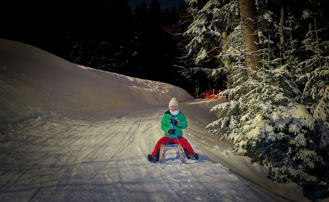 Meiringen Hasliberg (Photo: Bergbahnen Meiringen Hasliberg)
Luzern-Vierwaldstättersee: Night Sledding
In the Luzern-Vierwaldstättersee region, you’ll find at least 14 slopes for night sledding. Night sledding around the Vierwaldstättersee is an incredible experience, not just on the Rigi.
One of the longest toboggan runs in Switzerland starts high above Lake Lucerne at Klewenalp. You reach it via the longest cable car in the region. For nighttime tobogganing, many visitors only use the lower section between Stockhütte and Emmetten to avoid the lengthy walk otherwise required.
In the area around Engelberg, nighttime tobogganing is offered at both Titlis and Brunni. The route from Gerschnialp to Engelberg follows the former bobsled track of the famous bobsled pilot Fritz Feierabend.
Night Sledding on the Slopes in Lucerne/Lake Lucerne
| Start | Destination | Length (km) | Special Feature | Days of the Week |
|---|---|---|---|---|
| Klewenkapelle (Klewenalp) | Emmetten | 11.00 | unlit; short ascent to Twäregg required at the Ängi chairlift | Saturday |
| Bergstation Stockhütte | Emmetten | 5.20 | unlit | Saturday |
| Rigi Kulm | Rigi Staffel | 1.10 | lit; great view from Rigi Kulm if there is no fog | Fridays December to mid-March |
| Rigi Staffel | Rigi Klösterli | 2.00 | unlit, steep | Fridays, December to mid-March |
| Bergstation Rossweid | Sörenberg | 2.20 | lit | Fridays, January to mid-March |
| Skilift Handgruobi | Skilift Handgruobi | 0.50 | unlit; wide slope suitable for group descents | Saturdays (January and February), Fridays (February) |
| Skilift Sternegg bei Stoos | Skilift Sternegg | 0.40 | lit; sledding slope 83 | Saturdays, Christmas to mid-March |
| Bogenfang (Alpthal) | Fryfang (Alpthal) | 2.50 | unlit; accessible on foot or by shuttle from Fryfang | Wednesday and Saturday from December to March |
| Skilift Brunni (Alpthal) | Skilift Brunni (Alpthal) | 0.50 | unlit; wide slope suitable for group descents | Saturdays (January and February), Fridays (February) |
| St Karl | Illgau | 2.30 | unlit | Saturdays in January and February |
| Mostelberg Bergstation | Sattel | 3.50 | lit, partly steep | Saturdays |
| Gerschnialp | Engelberg | 3.50 | fast descent | Friday and Saturday (Christmas to early March |
| Brunni | Ristis | 2.50 | offered as an organized tour | agreed days |
| Mörlialp | Giswil | 1.90 | lit | Friday and Saturday (Christmas to mid-March |
| Melchsee-Frutt | Stöckalp | 8.00 | lit only from Cheselen | Friday and Saturday (January to early March |
| Cheselen | Stöckalp | 3.50 | lit | Friday and Saturday (January to early March |
Klewenalp - Stockhütte - Emmetten: 11 km Night Sledding
Emmetten is located on a terrace above the southern Lake Lucerne at 753 m. From Emmetten, a 6-person gondola takes you up to Stockhütte at an altitude of 1262 meters.
Beckenried is situated at 435 meters directly on the shores of Lake Lucerne. From here, a 69-cabin cable car travels over three kilometers to Klewenalp, which is at an altitude of 1602 meters.
Getting There
From Lucerne, you can drive via the A2 (exit 34-Buochs) to Beckenried. The drive takes about half an hour. If you prefer the shorter sledding run and want to go to Emmetten, continue along the Emmetterstrasse, which later becomes Dorfstrasse. Turn right onto Hinterhostattstrasse.
Using public transport, you can take a train or the S4 of the Zentralbahn from Lucerne to Stans, then catch bus 311 of the PostAuto to Beckenried and Emmetten.
Parking
In Beckenried, there are plenty of parking spaces available on Kirchweg 27 next to the valley station. The same is true for the valley station in Emmetten.
Tickets
Sledding tickets can be purchased through the mountain railways.
Sled Rental
You can rent sleds for 10 CHF at the mountain stations Klewenalp and Stockhütte. Returns can be made there or at the valley station in Emmetten.
Night Sledding Hours
In good snow conditions, the gondola lifts Beckenried - Klewenalp and Emmetten - Stockhütte run continuously until 10 PM every Saturday. Night skiing also takes place in parallel, with all facilities open at the same time.
Night Sledding Procedure from Klewenalp
You go up with the 69-cabin cable car from Beckenried to Klewenalp. From the mountain station, it's a short walk towards Klewenkapelle to reach the starting point of the sledding track. The sledding run starts at Röthenport at an altitude of 1600 meters and loops around Klewenstock, first heading towards Ängital. Here, you'll need to make a short ascent on foot to the Twäregg at the Ängi chairlift. The sledding path then winds through the conifer forest down to Stockhütte and continues down to Emmetten. The lower part of the sledding path is about 5 km long.
- 1 hour from Klewenalp to Twäregg to Stockhütte
- 1/2 hour from Stockhütte to Emmetten
- total of 900 meters in elevation From Emmetten, the PostAuto will take you back to Beckenried.
Dining Options
- Mountain inn Panorama Klewenalp
- Restaurant Mountain Inn Röthenport
- Mountain Inn Stockhütte
Night Sledding Procedure from Stockhütte
Ride the 6-person gondola from Emmetten to Stockhütte, which is at 1284 meters above sea level. The sledding run starts right next to the mountain station. The descent to Emmetten primarily takes you through the forest. This easy sledding tour is 5.2 km long and takes about half an hour, covering approximately 520 meters of descent.
Dining Options
- Mountain Inn Stockhütte
 Night sledding Klewenalp Emmetten (Photo: Stiftung Schweizmobil)
 Night sledding Klewenalp Emmetten (Photo: Swiss Mobility Foundation)
Rigi-Kulm to Rigi-Staffel: Night Sledding on 1.1 to 3 km
The best view of the valley with its lights around Lake Lucerne can be enjoyed from Rigi Kulm. It has a majestic feel. It's no wonder that Rigi is called the Queen of the Mountains. You can top off the experience with a fun sledding session at the mountain restaurant.
Location: Rigi Kulm, Rigi Staffel and Rigi Klösterli
Rigi Kulm is at an altitude of 1,797 m, Rigi Staffel at 1,603 m, and the pilgrimage site Klösterli at 1,316 m. You can find Rigi Kulm and Rigi Staffel directly on the route of the Vitznau cogwheel train. In Klösterli, you can access the line of the other cogwheel train, the Arth-Rigi Bahn. There are multiple accommodation options available in Klösterli.
Contact Information
- Rigi Bahnen AG, Bahnhofstrasse 7, 6354 Vitznau
Getting There
You can get to Rigi Kulm, for example, by taking the Vitznau cogwheel train. This train also stops at Rigi Staffel, making it easy to return down to Vitznau later.
Opening Hours
- Friday
- 7:00 PM to 10:00 PM
- From around December to mid-March
Sled Equipment Rental
The rental center at Rigi Kulm is only open when the sports shuttle train (sled shuttle) is in operation. They rent out sleds with child seats and padded sleds. You can return the rented sleds at Rigi Staffel.
Night Sledding Procedure
The sledding path is prepared and lit up before each night sledding event. It runs down the mountain like a glowing snake. Over the 1.1 kilometers to Rigi Staffel, there’s a light layer of snow, and icy spots are removed. The sledding path follows along the Rigibahn tracks up to Rigi Staffel, covering about 190 meters of elevation. You can sled multiple times since the shuttle train will bring you back up to Kulm each time.
The steep sled ride only begins afterward and is not included in the night sledding. It is also not illuminated. If you continue down to Klösterli, you’ll reach the cogwheel train to Arth-Goldau. You should check in advance if a shuttle train will take you back from Klösterli to Kulm and whether the cogwheel train will even be operating on night sledding days. Alternatively, you can stay overnight in Klösterli. The descent to Klösterli covers about 460 meters of elevation over a distance of three kilometers.
Food and Accommodation
- Mountain Restaurant Rigi Kulm
- Restaurant Bahnhöfli Rigi Staffel
- Restaurant Zum goldenen Hirschen Rigi Klösterli including single, double, and family rooms
- Alp Lodge Heirihütte with mattress dormitory and double rooms
- Holiday village in Klösterli with accommodations
Rossweid - Sörenberg: Night Sledding on 2.2 km
The romantic night sledding at the Lake Brienz has a unique atmosphere surrounded by high mountains.
Location: Sörenberg
Sörenberg is located at 1,159 m above sea level in the northeast of Lake Brienz. The village is surrounded by mountains that are about 1,000 meters higher. To the south of the village stands the Brienzer Rothorn (2,350 m). Rossweid is at 1,465 m above sea level and can be reached by a cable car from Sörenberg.
Night Sledding Hours
Starting from early January until mid-March, the Rossweid run is illuminated for sledders on Fridays from 7:00 PM to 10:00 PM.
Contact Information
- Luzern Tourismus AG, Tourist Information, Zentralstrasse 5, 6002 Lucerne,
- Bergbahnen Sörenberg AG, Hinterschöniseistrasse 4, 6174 Sörenberg,
Getting There
If you’re driving from Bern, it takes about 90 minutes via Route 10 and Flühlistrasse to get to Sörenberg.
For public transport, take the BLS train to Schlüpfheim, then switch to the PostBus line 241. You’ll reach Rossweid with the 6-person gondola Sörenberg-Rossweid in about 5 minutes and 20 seconds.
Sled Rental
- Intersport Felder next to the Rossweid valley station, also open on Fridays from 7:00 PM to 10:00 PM
Night Sledding Experience
Take the gondola up to Rossweid, where you can enjoy a fun spaghetti meal with friends if you like. The gondola also carries the sleds. The descent to the valley station is quite thrilling. A more relaxed route goes via the Alphotel & Skihütte Schwand. In either case, you’ll cover about 300 meters in altitude. The valley station is a 15-minute walk away.
NOTE: On both sledding runs, airboards and homemade sleds are strictly prohibited. Allowed are: Davos sleds, plastic sleds, toboggans, and bobs.
Dining Options
- Bergrestaurant Rossweid
- During night sledding, the Rossweid restaurant offers a spaghetti meal.
Handgruobi: 1.3 km Night Sledding
Handgruobi is a winter sports area, not a town. Here you'll find a mountain restaurant, a small lodge, and a ski lift. All of this is part of the town of Rickenbach, located five kilometers away.
Night Sledding Hours
During the winter season from late December to early March, night sledding takes place every Friday and Saturday evening. Sledding runs from 6:30 PM to 9 PM, and fondue is available from 7:30 PM.
Contact Information and Links
- Mythenregion AG, Rickenbachstrasse 163, PO Box 541, 6431 Schwyz, Information
- Sledding Bus: Betschart Transport: Reservation is required. The bus departs from Schwyz Post.
Getting There
You can reach Handgruobi from Schwyz by car via the access road through Rickenbach in about fifteen minutes. From Einsiedeln via Oberiberg-Ibergeregg, it takes around 40 minutes by car. There's a large parking lot right next to the ski lift. Alternatively, you can take the sledding bus from Schwyz Post to Handgruobi, provided you've made a reservation in advance. With public transport, you can get from Schwyz to Rickenbach.
Sled Equipment Rentals
included with ticket purchase
Night Sledding Process
It's essential to reserve a spot for the sledding bus. You'll be transported from Schwyz Post to the T-bar lift, which takes you up the mountain. The descent via the ski slope is suitable for beginners and families. At the valley station in Rickenbach, you can enjoy a cheese fondue at the Berggasthaus Hand. Cabin coffee is served at the Erlebnis Hütte Musärä.
Dining Options
- Berggasthaus Hand
- Erlebnis Hütte Musärä
At Sternegg in Stoos: 400 m Night Sledding
The journey up to Stoos via the funicular railway is quite steep. Once you arrive, you'll stroll over to the Sternegg ski lift, which is lit up and reserved for night sledding every Saturday evening.
Location: Stoos
Stoos is a car-free village situated at 1,305 m above sea level on a high plateau. It offers accommodations with a total of over 2,000 guest beds. You can reach Stoos by taking the Stoos funicular from Schlattli in the Muotathal.
Opening Hours for Night Sledding
Between Christmas and mid-March, the Sternegg ski lift operates every Saturday from 7:30 PM to 10 PM, and the slope is lit up. The sledding slope 83 is open for night sledding.
Contact Options and Information Links
- Stoos-Muotatal Tourism GmbH
- Stoosbahnen AG, Stoosplatz 1, 6433 Stoos
Getting There
From Lucerne, you can reach Stoos by car via Küssnacht and Schwyz using the A14 and A4 in about 40 minutes. The drive via the A2 through Stansstad and the A4 via Flüelen takes just a little longer. With the Swiss South East Railway (SOB), you can travel from Lucerne to Schwyz. From there, take line 501 of Auto AG Schwyz to get to the Stoosbahn. The total journey takes about 81 minutes.
Sled Equipment Rentals
Near the Sternegg ski lift, you can rent sleds from Suter Sport. There are also other sports shops in the area that offer sled rentals.
Night Sledding Experience
For this sledding outing, you'll first take the funicular from Schlattli in Muotathal up a steep incline to the car-free mountain village of Stoos. Alternatively, you can start from your hotel room in Stoos. A short walk from the top station of the funicular leads you to the Sternegg ski lift, which is exclusively open for night sledders on Saturday evenings. It takes you about 400 meters to the starting point of the slope. The sledding path is lit.
Food Options
- Fondue fun at Restaurant Sternegg
 Stoos (Photo: Roger Betschart Muotatal Tourism)
 Stoos (Photo: Muotatal Tourism)
Bogenfang - Night Sledding (Alpthal): 2.5 km Night Sledding
In Fryfang, there's a cozy sledding spot located in a forest clearing. From here, you’ll walk up with your sled to Bogenfang.
Night Sledding Hours
- December 1 to the end of March
- Wednesdays to Saturdays, by reservation only
Contact Information
- Sledding Spot
- Mythenregion Info
Getting There
Take the train to Einsiedeln and then continue by post bus towards Alpthal until you reach the stop Stei, Alpthal.
If you’re driving: Take the A3 motorway from Chur and exit at No. 39 (Schindellegi), or from Zurich, take exit No. 37 (Richterswil) until you reach Biberbrugg. From Biberbrugg, continue towards Alpthal.
From Alpthal or Brunni (Alpthal), you can reach Fryfang by turning off Brunnistrasse onto Fryfangerstrasse at Stei. There’s also the post bus stop at the fork in the road. From there, it’s about a 1 km walk to the sledding spot.
- For GPS: Stei, Alpthal Coordinates: 47°03'15.9"N 8°42'31.4"E or 47.054420, 8.708721
- Only use designated parking spots. They are located about a kilometer below the sledding spot on the road.
Tickets
Cash payment only on-site (CHF or EUR)
Equipment Rental
- at the sledding spot: sleds or bockers
Night Sledding Process
The meeting point is the sledding spot. You’ll walk or take a minibus together to Bogenfang, where the sledding run begins at an elevation of 1317 m. If you like, you can enjoy a little appetizer (bread rolls and mulled wine) in the tipi at Bogenfang. The sledding run drops about 275 meters in elevation. In the hut, homemade fondue is served. After that, you can continue sledding (if you have your own sled) to the parking area (1 km) or walk back down.
Food and Drink
- Sledding Spot
Brunni (Alpthal): 500 m night sledging
Brunni lies at 1100 m above sea level. It is a hamlet of the municipality of Alpthal at the foot of the Mythengruppe. As the region is considered to be snow-sure, many excursionists from Zurich come here in winter.
Opening hours for night sledding
From the beginning of January until the end of February, night sledding takes place at the Brunni ski lift every Saturday from 6 p.m. to 9 p.m. (in February additionally on Fridays).
Contact
- Skilift Brunni Tourismus GmbH Brunnistrasse 21, 8849 Alpthal
Arrival
From Zurich you drive by car for about three quarters of an hour to the ski lift in Brunni. You take route 3 to exit 37-Richterswil. Then you continue on Bergstrasse, Einsiedlerstrasse and Brunnistrasse. There is a parking lot at the Brunni ski lift.
By public transport you take the train of the Swiss Federal Railways (SBB) from Zurich. In Wädenswil you take the train of the Schweizerische Südostbahnen (SOB) to Einsiedeln. From there you take the post bus line 554 to the valley station in Brunni. Only a few meters back you reach the ski lift.
Rental of sledging equipment
You can rent tobogganing equipment and headlamps at the Brunni valley station. A colored lightstick is included. The special rental toboggans have a hanging device. Rented are: Ski lift sled with eyelet, Davos sled, toboggan and bob (ideal for children).
Night sledding procedure
The night sledging takes place on the wide ski slope Brunni. You will be pulled up by the bow lift - sitting on the toboggan. The drag lift pulls you up in four minutes over 482 meters and 100 vertical meters.
Since the slope is not illuminated, headlamps are urgently needed. The ride back down to the valley is via the ski slope. The ski slope in Brunni is very wide. Therefore, the descent is also possible in a group. The slope is easy to ski. With the evening ticket you can always be pulled up and sled down. Also the ride over the magic carpet is possible.
Catering
- Restaurant Skilift Brunni: offered is a raclette on the fire
St. Karl to Illgau: 2.3 km Night Sledding
You can reach Illgau via the small cable car Illgau-Ried. Outside of the official operating hours, you can operate the Illgau-Ried cable car on your own. It then runs on a token system.
Location: Illgau
Illgau is situated at 807 m above sea level on a picturesque sun terrace and can only be reached by a mini cable car using public transport. This cable car covers a height difference of 227 meters in just 2 minutes. The length of the cable car is only 374 meters.
Opening Hours for Night Sledding
From January to mid-February, night sledding takes place in Illgau on Saturdays from 6:30 PM to 9:00 PM. If at least four people sign up, it can also happen on other evenings.
Contact Information
- Stoos-Muotatal Tourism GmbH, Grundstrasse 232, 6430 Schwyz
- Illgau-Vorderoberberg AG Cable Car, Dorfstrasse, 6434 Illgau
Getting There
By public transport, get off the SOB train at the Schwyz station and transfer to bus line No. 501 headed towards Muotathal. Get off at the Illgau cable car stop and take the cable car to Illgau, operating independently if necessary in token mode.
If you’re driving, head towards Muotathal and turn left towards Illgau after Schlattli. Free parking is available in the village of Illgau.
Sled Rental
You can rent a sled or a ski bob at the valley station of the Illgau-St. Karl cable car. Both sledding devices are allowed on the slope.
Night Sledding Procedure
You will reach the mountain station at 1178 m above sea level in 7 minutes via the cable car. This is where the sledding path begins. The slope in Illgau is not lit, so don’t forget to bring headlamps. The sledding path starts at the mountain station of the cable car and is groomed daily under good snow conditions. After 2.3 km, where you descend 360 meters, you’ll arrive at the village.
Catering
Special offer: 2 sled rides followed by a delicious fondue at the Sigristenhaus restaurant
Mostelberg - Sattel: 3.5 km Night Sledding
The forested landscape shows clear traces of the Ice Ages. You can see floodplains, moraines, and rock ridges here.
Location: Sattel
Sattel is located at just under 800 m above sea level at the foot of Hochstückli in the valley of the Steiner Aa. On the opposite side, the Chaiserstock and Morgartenberg rise steeply.
Night Sledding Hours
- Night sledding on Saturdays
- Illuminated from 19:00 to 22:00
- Last gondola descent at 23:15
Contact
- Sattel-Hochstuckli AG, 6417 Sattel
Getting There
The family mountain Sattel-Hochstuckli is situated between Lake Lucerne and Lake Zurich right in the heart of Central Switzerland. You can reach Sattel from Lucerne in 35 minutes by car via Route 2. From Zurich, it takes about 40 minutes via the A3 and Route 8. If you're coming by the Südostbahn from Zurich, it takes 1.5 hours. From Lucerne, you travel via Schwyz and switch to the PostBus line 507. You'll reach Sattel in about 70 minutes.
- Rental of sledding equipment available at the gondola station (limited quantity).
Night Sledding Process
Taking the Stuckli Rondo 8-person gondola, you'll ascend from Sattel to the Mostelberg mountain station in 6.2 minutes. From here, you have a 360-degree view of Lake Lauerzersee, Lake Aegerisee, and the village of Sattel.
The sledding track winds through forests and fields to the valley station in Sattel. It's varied and easy to navigate, although there are some steep sections. Just before the end of the 3.5-kilometer run, there's a long gliding section.
Afterward, you can take the gondola back up until night sledding ends. During your descent, you'll cover an elevation difference of 400 meters.
Food and Drink
- Mountain guesthouse Mostelberg
- Lutz Hut (coffee)
- Mostler’s Q-Hof with live music
Gerschnialp - Engelberg: 3.5 km Night Sledding
Engelberg is a mountain town located in the Engelberg Valley south of Lake Lucerne. It's nestled between the towering peak of Titlis, which stands at 3,238 m to the south, and a mountain range to the north, where you can find the sunny hiking area of Brunni on its southern slopes.
Getting There
You can take the Zentralbahn from Lucerne to Engelberg in about three quarters of an hour. If you’re driving, take the A2 to Stans and then switch to the cantonal road and Engelsbergerstrasse. There are plenty of parking spaces available at the valley station of the Titlis cable car at a reasonable price.
Night Sledding Schedule
From Christmas until early March, night sledding takes place on Fridays and Saturdays from 7:30 PM to 9:30 PM.
No prior reservation is required.
Night Sledding Experience
The cogwheel train climbs from Engelberg to Gerschnialp in just four minutes. Initially, the path winds through the snow-covered Gerschni forest. The next stretch is quite flat, so it's best to pick up some speed beforehand. After the flat section, there's a twisty stretch where good technique is essential, leading into a long straightaway. The final highlight of this thrilling descent is the target curve-S that brings you back to the valley station. In total, you'll conquer 260 meters of elevation.
Food & Drink
- Gerschnialp inn offers fondue fun in the chalet starting at 8 PM
 Gerschnialp Engelberg (Photo: Engelberg Titlis Tourism)
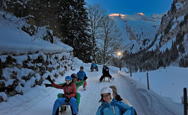 Gerschnialp Engelberg (Photo: Engelberg Titlis Tourism)
Brunnihütte - Ristis: 2.5 km Night Sledding
There are two sledding slopes that lead down to Ristis via different paths:
- Rinderbüel is a gentler descent through Hüttismatt, making it well-suited for families.
- Zigerboden offers a thrilling ride but has some very steep sections, so it's not suitable for kids. It's only opened when there's enough snow.
Night Sledding Opening Times
Night sledding usually takes place between 6 PM and 9 PM. You can arrange the exact days and procedures directly.
Getting There
Taking the Zentralbahn, you can reach Engelberg from Lucerne in about 45 minutes. From Engelberg train station, take the free local bus to Brunni Talstation. If you're driving, take the A2 to Stans, then follow the cantonal road and Engelsbergerstrasse.
Tickets
Night sledding is offered as an organized total tour with sledding fun, as the Brunnibahnen are generally only open until 5 PM.
Equipment Rental
- At Yetipark (Ristis)
Night Sledding Process with Sledding Fun
In the afternoon, you’ll ride the cable car up to Ristis from Engelberg. There, you can rent your sled at Yetipark. Airboards and skigebels are also permitted in the Brunni area. Then, take the chairlift from Ristis up to Brunnihütte.
This is where the groomed sledding slope down to Ristis starts (Hüttismatt). It’s 2.5 km long and descends about 260 meters.
At Hüttismatt, you’ll enjoy an appetizer. Afterward, a 3-course meal featuring cheese fondue will be served at Berglodge-Restaurant Ristis. You can take the cable car back to Engelberg through the night, or stay overnight at the mountain lodge.
What's included in the price:
- Cable car Engelberg - Ristis return
- Chairlift Ristis - Brunnihütte one way
- Sledding fun with mulled wine appetizer, Engelberger sausage, cheese, and bread
- 3-course meal with cheese fondue at Berglodge Restaurant Ristis (drinks not included)
Catering
Catering
- Berglodge Restaurant Ristis
- Yetipark
- Brunnihütte
Mörlialp Run: 1.9 km night sledging
This short route is a well-lit toboggan run. You sled here along the Glaubenbielen panorama road, which in summer runs from Giswil to Entlebuch. In winter the pass road from Mörlialp is closed.
Place: Giswil
The skiing area Mörlialp is situated on the Giswilerstock at 1353 m above sea level. From Giswil you can get to the top by post bus line 362. Giswil is located at the Sarnersee in the valley at an altitude of about 500 m.
Opening hours for night sledging
- Mid-December to mid-March
- fridays and Saturdays 7 - 9 p.m
- the toboggan run and the ski run are illuminated
The facilities can be rented at favorable conditions also on other evenings.
Contact
- Giswil-Mörlialp Tourism, Bahnhofplatz 1, 6074 Giswil
- Ski lifts Mörlialp AG, P.O. Box 267, 6074 Giswil
Arrival
With the Swiss Central Railways you first reach Interlaken from Bern. Here you change to the Zentralbahn, which takes you from Interlaken Ost to Giswil. From Giswil you can take the post bus line 362 to Mörlialp. The journey takes 2.5 to 3.5 hours, depending on the connection.
If you travel by car, you will reach the Mörlialp via the A6 and A8 in about 1.5 hours. Thereby you use the routes south of Lake Thun and Lake Brienz. The stretch from Giswil to Mörlialp is 11.5 km long and can be driven.
Rental of sledging equipment
- Valley station of the Mörlialp chairlift
- various tobogganing equipment from the Davoser to the racing toboggan for experts
Procedure of the night sledging
From the Mörlialp valley station (1355 m above sea level) you take the chairlift to Mörlialp-Stössi (1545 m above sea level) at the Bully Bar on Alpoglen.
The toboggan run leads over almost two kilometers to the valley station. In addition to leisurely stretches, there are also plenty of curves. They lead through the beautiful winter forest. In the process, the toboggan run overcomes about 200 meters in altitude. Since the descent is not steep, it is very suitable for families.
Catering
- Giswilerstock Inn
- Bully Bar
- Mountain restaurant Mörlialp
Hotels, vacation apartments and group accommodation can be booked at Mörlialp.
Melchsee-Frutt - Stöckalp: 8 km night sledding
From Melchsee-Frutt, there are two night sledding runs. The longer run is the nearly eight-kilometer route from the high plateau of Melchsee-Frutt to Stöckalp, which is located at about 1070 m above sea level in the Melchtal.
About 850 meters higher up, you'll find Melchsee on the high plateau of Melchsee-Frutt, which sits at an altitude of 1920 meters. This high plateau features not only Melchsee but also Tannensee and is almost entirely surrounded by mountain ranges. A cable car operates for approximately three kilometers from Stöckalp to Melchsee-Frutt.
You can reach Cheselen from Stöckalp via a chairlift.
The roughly eight-kilometer sledding run from Melchsee-Frutt down to Stöckalp is the longest in Central Switzerland. It descends almost 900 meters in altitude and is quite fast and winding in places.
Getting there
With the Zentralbahn, you can travel to Sarnen. From Sarnen, the PostBus Line 343 goes to Stöckalp in 31 to 34 minutes.
For night sledding, the PostBus operates extra services in addition to the regular schedule:
- Thursdays at 21:29 from Sarnen; 22:40 from Stöckalp
- Fridays and Saturdays at 18:44 and 21:29 from Sarnen and 22:40 from Stöckalp
By car, you can take the A8 motorway to the Sarnen/Kerns exit. Then continue along the cantonal road through Kerns into the Melchtal and to Stöckalp. For GPS directions to the base station at Stöckalp, use Fruttstrasse 53, 6067 Melchtal.
Parks
At the Stöckalp base station, there's a parking garage and open parking spaces. The parking garage is only available for use during the day (max until 1 AM).
You'll find an electric car charging station at the entrance to the parking garage on Level A.
Sled rental
- Stöckli Rental and Service Center, Stöckalp, at the base station of the Stöckalp-Melchsee-Frutt gondola
- Frutt-Rental, Old Mountain Station Melchsee-Frutt,
- Hans Durrer Sports, Kerns,
You can purchase a headlamp at the Stöckalp base station. Helmets are rented out with the sled.
Dining
- Bärgbeizli Cheselen
Night sledding hours
From the first week of January until the first week of March, the Stöckalp – Melchsee-Frutt gondola operates every Thursday, Friday, and Saturday from 18:30 to 19:30. For night sledding, it's open longer, so you should check the operating times of the lift before your arrival. The sledding run is open on these days from 18:45 to 22:00, with the last allowed descent at 22:00. After that, the sledding path will be closed.
Night sledding process
Take the 15-person gondola from Stöckalp to Melchsee-Frutt in under ten minutes. The sledding run starts right at the top station. On the former packhorse paths, you’ll descend almost 900 meters. The winding route can be quite fast, and it's groomed every day, with snowmaking using exclusively hydroelectric power. The sledding run crosses a road that is open to cars in the summer, so it's nice and wide.
Note: The sledding path is unlit from the mountain station to Cheselen. The section from Cheselen to Stöckalp is lit on Fridays and Saturdays. Dogs are expressly not allowed!
From Cheselen to Stöckalp: 3.5 km night sledding
The shorter sledding run is part of the sledding path from Melchsee-Frutt to Stöckalp. It starts only in Cheselen. This illuminated night sledding run is approximately 3.5 km long and covers about 320 meters of altitude.
Night sledding hours
From the first week of January until the first week of March, the chairlift Stöckalp – Cheselen operates on Fridays and Saturdays from 19:00 to 21:30. The sledding path will be open and lit on these days from 18:45 to 22:00. Later, the sledding path will be closed and groomed by snowcats.
Night sledding process
You can reach Cheselen in just about 6 minutes via the chairlift from Stöckalp, covering nearly 1.3 km. The sledding path begins right at the top station of the chairlift and is 3.5 km long. The entire stretch is illuminated during operating hours. Dogs are expressly not allowed!
 Melchsee Frutt (Photo: Sportbahnen Melchsee-Frutt)
 Melchsee Frutt (Photo: Urs-Stettler Sportbahnen Melchsee-Frutt)
Eastern Switzerland-Liechtenstein: Night Sledding
The Eastern Switzerland-Liechtenstein region encompasses the alpine Glarnerland and the holiday region of Heidiland. The Weissenberge, Ämpächli, and Grotzenbüel are part of Glarus Süd, while Kerenzerberg is situated in Glarus Nord. If you're quick, you can tackle at least three runs in a single evening in the Glarner Land. Flumserberg and Pizol are located in Heidiland amid well-developed tourist ski areas. Night sledding is also available in the Saminatal (Principality of Liechtenstein).
Night Sledding Trails in the Eastern Switzerland/Liechtenstein Tourism Region
| Start | Destination | Length (km) | Special Features | Days of the Week |
|---|---|---|---|---|
| Furt Mountain Station | Maienberg | 3.50 | exciting trail at Pizol | Fridays from late December to early March; additionally Thursdays (February) |
| Prodalp Mountain Station | Tannenheim | 2.00 | lit; steep curves at Flumserberg | Thursdays and Saturdays from January to March |
| Malbun | Steg | 1.00 | lit; starting platform with ramp | daily from early December to early April |
| Weissenberge | Matt | 3.00 | lit with lanterns; "outrageous" sledding track | Fridays, Saturdays |
| Ämpächli | Elm | 4.00 | lit | Wednesdays, Fridays, Saturdays from late December to March |
| Grotzenbüel | Hüttenberg | 3.00 | lit | Fridays from January to March, also on Wednesdays in February |
| Kerenzerberg | Filzbach | 7.00 | lit; groups of 10 or more possible daily | Saturdays from late December to March |
Pizol - Maienberg: 3.5 km thrilling night sledding in Sarganserland
The exciting sledding track at Pizol runs from Furt to the Maienberg middle station over 3.5 km. It's lit up for night sledding every Friday night and on some Thursday evenings.
Location: Wangs
Wangs is situated on the western slope of the Rhine Valley below the Churfirsten mountains. It's not far from the Sarganserland highway junction. Pizol is a mountain peak at an elevation of 2844 m above sea level and was formerly known as Piz Sol.
Opening Hours for Night Sledding
From late December to early March, night sledding takes place every Friday. From late January to late February, the track is also lit on Thursdays from 18:00 to 22:30.
Getting There
If you're coming from the south, drive from Chur via the A13, take the A3 at the Sarganserland highway junction, and exit at junction 50 (Mels). Follow the Neue Wangserstrasse, Bahnhofstrasse, and Dorfstrasse to reach Pizolstrasse in Vilters-Wangs. There's a large parking lot at the valley station in Wangs.
From the north, you can also reach Vilters-Wangs via the A13/A3 with exit 50 (Mels). The Wangs valley station is reachable from both Zurich and St. Gallen in 60 minutes. By public transport, you can get to the Wangs station of the Pizolbahn or take bus lines 429 or 430 from the Sargans train station. On weekdays, four buses run per hour.
Tickets
Night sledding is included in seasonal and annual passes, allowing for unlimited night sledding. You can buy combined tickets with fondue experiences at the ticket office at the Wangs valley station.
Rental of Sledding Equipment
- Sportshop Wachter at the Furt mountain station
- Other rental stations on the mountain and in the valley primarily specialize in skis and snowboards but also rent helmets and other equipment.
Night Sledding Process
You take the gondola Wangs-Maienberg-Furt for about five minutes to the Furt mountain station, which is at 1520 m above sea level. The sledding track is groomed daily and suitable for children and families. The route takes you down 480 meters over a distance of 3.5 km.
The descent begins with a few curves near the ski slope. Then, you'll go through Mattwald and a large loop back to the slope. Under the gondola, you'll pass by several scattered chalets before reaching the Maienberg middle station. From here, you'll have a stunning view of the valley lit up in the evening.
The extension Maienberg-Wangs (also 3.5 km) is challenging in good snow conditions and is recommended only for experienced sledders aged 18 and older. It's better to skip this route for night sledding. From the middle station, you can keep riding back up and enjoy night sledding multiple times.
Food Options
- Berghotel Alpina
- The Berghotel Furt located at the start of the sledding slope
- Berghotel Schönbühl
Prodalp - Tannenheim: 2 km Night Sledding on the Flumserberg
The Prodalp-Tannenheim route is only 2 km long but has some thrilling sections. This popular sledding track gets groomed for snow when needed.
Location: Tannenheim
Tannenheim is one of the villages that make up the Flumserberg ski area. It’s situated at around 1,220 m above sea level. Flumserberg is located in the south of the canton of St. Gallen.
Night Sledding Hours
- January to March
- Thursdays and Saturdays
- 7:00 PM to 9:00 PM, regardless of the weather
Contact Information
- Heidiland Tourismus AG, Flumserbergstrasse 196, 8898 Flumserberg,
- Flumserberg Cable Cars, Moseralpstrasse 9, 8898 Flumserberg,
Getting There
From the south, you can drive from Chur via the A13, take the A3 at the Sarganserland interchange, and exit at junction 49 (Flums).
If you're using public transport, take the Swiss Federal Railways from Chur to Walenstadt. From there, you'll switch to the Swiss Southeastern Railway, which takes you to Flums. Bus line 441 will finally take you to Tannenheim.
Sled Equipment Rental
- Flumserberg Mountain Station
- Intersport Flumserberg in Tannenheim
- Other sports shops at Flumserberg
The Night Sledding Experience
Take the Prodalp Express gondola from Tannenheim, which takes you up to the mountain station at 1,580 m above sea level in five and a half minutes. The slope starts right next to the mountain station. At first, you can admire the Chur princes while the sled path begins gently.
The Prodalp, lined with fir trees, has a slight incline. However, it doesn't take long before it becomes quite steep, and you'll need to steer properly.
Many sledders end up in the snow at the sharp curves. Since the slope is lit, you might be watched by those in the gondola overhead as they glide to the mountain station. The sledding path is specially groomed for night sledding. The elevation difference is about 360 meters.
Dining Options
- Mountain Restaurant FahrBar at the Mountain Station
- Pizzeria Tannenheim
 Pizol (Photo: Pizolbahnen)
 Pizol (Photo: Pizolbahnen)
Weissenberge - Matt: 3 km adrenaline kick with night sledding
The small village of Matt lies in the Sernftal valley on the Sernf river at 847 meters above sea level. The Sernf is the right tributary of the Linth. Matt is the middle of the three villages in the valley. Matt belongs to the vacation region Elm.
Here in the Glarus region you have the opportunity to try a particularly tricky sledding run through the wild Chrauchbach gorge. Even the locals call it "outrageous".
Opening hours for night sledging
- with lantern light
- fridays and Saturdays from dusk until 10 p.m. in good snow conditions
- The toboggan run is lit and supervised after 5 p.m. only when night sledding is announced.
- Rented sledges may be used until 8 p.m. on request - if no night sledging is announced - but the cable car runs only according to the timetable without group registration. In these cases, sledging is exclusively at your own risk. After 8 p.m. the sledges have to be put back. For this purpose the platform of the cable car valley station is provided.
Contact details and links to information
- Matt - Weissenberge aerial cableway, Alte Strasse 7, 8766 Matt
Arrival
By car you come from Zürich or Chur via the highway A3 to exit 44-Niederurnen. Here you change to route 17 and the Sernftalstrasse to Matt. By public transport you take the train of the SBB to Schwanden and change there to the Sernftal bus line 541 to Matt. Take the cable car Matt-Weissenberge to the top. The Weissenberge is rarely called the sun terrace of the region. Parking spaces are available in sufficient numbers.
Rental of sledging equipment
- sledges at the valley station, there you can also buy headlamps (not for rent)
Procedure of the night sledging
From the top station (1,266 meters above sea level) you have to pull the toboggan for a few minutes on foot to the Weissenberg inn. The toboggan run through the wild Chrauchbach gorge down to the village of Matt is very winding.
It is referred to here as the "outrageous toboggan run". 440 meters of altitude are overcome over a length of three kilometers. It also goes over bridges and past spectacular icefalls as well as rock faces. Some hairpin bends make the ride dangerous. After a good quarter of an hour, you reach the village of Matt.
Catering
- Edelwyss mountain inn at the valley station
- Wirtschaft zum Weissenberg at the top station
Ämpächli - Elm: 4 km Night Sledding
Location: Elm
Elm is a village located in the back Sernftal valley. It belongs to the municipality of Glarus South. Elm is surrounded by the mountains Vorab, Piz Sardona, Hausstock, and Kärpf.
Night Sledding Hours
- Wednesday, Friday, Saturday
- 19:00 to 21:30; the slope is freshly prepared beforehand between 17:00 and 19:00
- End of December to March, depending on snow conditions
Contact Information
- Sportbahnen Elm, Obmoos, 8767 Elm,
Getting There
By car, you can reach Elm from Zurich or Chur via the A3 motorway to exit 44-Niederurnen. From there, switch to Route 17 and then the Sernftalstrasse to Elm. Using public transport, take the SBB train to Schwanden and transfer to the Sernftal bus on line 541 to Elm.
Sledding Equipment Rental
- Diverse sleds can be rented at the Ämpächli mountain station.
Night Sledding Procedure
You take the Elm-Ämpächli gondola to go up. The 6-person gondola takes about four minutes to ascend the 466 meters from the valley station (1060 m) to an elevation of 1480 m above sea level. You then sled down the 4-kilometer track for about 20 minutes. The slope is suitable for both families and athletes. The sledding track is freshly prepared daily and is illuminated.
Food and Beverages
- Restaurant Ämpächli
- Älpli
- Karussell, a glass bar where hot drinks are served on Wednesdays.
- Fondue and raclette specials are available on Fridays and Saturdays at the Ämpächli mountain restaurant. Registered groups can also enjoy this on Wednesdays.
Grotzenbüel - Hüttenberg: 3 km night sledging
Place: Braunwald
Braunwald belongs to the municipality of Glarus South. The village lies at 1256 m above sea level and is known as a car-free spa and tourist resort.
Opening hours for night sledding
- fridays in the middle of January until the beginning of March and in February additionally on Wednesdays
- 19:00 - 22:00, illuminated toboggan run
- the sports lifts open: Niederschlacht ⇒ Hüttenberg 19:00 to 20:15 hrs
- Hüttenberg ⇒ Grotzenbüel 19:00 to 22:00 h
Contact options
- Sportbahnen Braunwald AG, Dorf, 8784 Braunwald,
- Braunwald guest information, Dorfstrasse 2, 8784 Braunwald
- Glarnerland Information,
- Group circulation gondola Braunwald
Arrival
By car you need about 75 minutes from Zurich. Take the A3 freeway to exit 44 Niederurnen. Then take route 17 Glarus Süd.
By public transport you take the SBB train to Linthal and from there you reach Braunwald by funicular.
Rental of sledging equipment
Grotzenbüel mountain station (Sportbahnen Braunwald): 1-person aluminum sled; children's sled seats for the very young are available in small numbers.
Procedure of the night sledging
Take the 15-seater group gondola from Hüttenberg to Grotzenbüel. Hüttenberg is situated at 1,308 meters above sea level, Grotzenbüel at 1,560 meters. The 3 km long toboggan run starts in Grotzenbüel at the Chämistube and leads via Gross-Syten to the station Hüttenberg. The run is reserved exclusively for tobogganers, it can be ridden in a swinging manner. A total of 259 meters of altitude are overcome on the easy to ski route.
Catering
- Mountain restaurant Chämistube at the mountain station Grotzenbüel (starting point)
- Hotel Cristal at the Hüttenberg station (finish)
Kerenzerberg - Filzbach: 7 km Night Sledding
Location: Filzbach
Filzbach is a village in the municipality of Glarus Nord. The scattered settlement is situated above the Lake Walensee on the high plateau of Kerenzerberg.
Night Sledding Hours
- Saturday from 6:00 PM to 9:00 PM, the sledding and mountain lift are operational
- depending on snow conditions, usually from Christmas to March
- Special trips for groups upon request (from 10 people) available daily
Contact Information
- Sportbahnen Kerenzerberg GmbH, Talalpstrasse 15, 8757 Filzbach
Getting There
By car, you can drive from Zurich via the A3 motorway and Kerenzerbergstrasse (past Mühlehorn) in just under an hour. There is a large free parking area directly at the valley station on Talalpstrasse 15.
By SBB train, you travel to Ziegelbrücke. From there, take the Swiss Federal Railways to Mühlehorn and then the Postbus line 511 to Filzbach. The bus stop closest to the valley station is at the "Sportzentrum Filzbach".
Rental of Sledding Equipment
- at the valley station in Filzbach
- at the mountain station, various models can be rented
- The new wooden sleds at the mountain station are easy to steer. You can rent single or double seats. Child seats are available for toddlers that fit almost any sled.
For several years now, there has also been E-Bobsleigh, a kind of go-kart with an electric caterpillar drive. They can reach speeds of up to 30 km/h. They're easy to drive and very popular due to their low seating position.
Procedure for Night Sledding
With the 2-seater chairlift, you go from Filzbach (746 m) to Kerenzerberg (1283 m above sea level). The sledding track starts at the Habergschwänd restaurant and stretches down seven kilometers to the valley station. The route is partly quite casual to navigate but has some thrilling sections as well. The sledding track is also suitable for children, as it isn't too steep. Overall, 537 meters of elevation are covered along the route.
Food and Beverages
- The mountain inn Habergschwänd serves a delicious alpine herb fondue or raclette on request before the last sledding trip (until midnight).
Malbun to Steg: 1 km Sücka - Night Sledging Track
The sledging track starts at the mountain inn Sücka and leads down to the hamlet of Steg. The track is close to nature and is lit up at night.
Location: Steg
Steg is situated above Triesenberg in the Principality of Liechtenstein at about 1300 m above sea level. It belongs to the Saminatal and was once a summer pasture for the farmers of Triesenberg. Triesenberg was a Walser settlement. The name Steg comes from the bridge that spans the Samina river here.
Night Sledging Hours
Early December to early April, depending on snow conditions. The track is illuminated daily starting at dusk, in line with the inn's opening hours.
Contact Information
- Liechtenstein Marketing, Städtle 39, 9490 Vaduz
Getting There
It's a 20-30 minute walk from the parking lot to Sücka.
Tickets
Use of the track is free.
Rental of Sledging Equipment
You can rent sleds at an affordable price from the Sücka inn.
Night Sledging Procedure
You will reach the Sücka inn after a short walk that's separate from the main path. Here, there is a permanent starting setup, complete with a ramp. The course is suitable for training runs, and timing can be done on request.
The course features only a few manageable curves that are well secured. The long final stretch into the valley has a chicane to slow down the speed a bit. The finish line is close to the parking lots. Over a length of just under a kilometer, you will descend 142 meters in elevation.
Catering
- Sücka Inn
- Mountain Stüble Steg
- Alpenhotel Steg, Triesenberg
Graubünden: Night Sledding
Whether it's at the SkiArena Andermatt - Sedrun - Disentis, in the Viamala, at the Abula Pass, or in Bergün, night sledding in Graubünden is really popular. Often, cable cars, chairlifts, or the postbus will take you to the start. Sometimes, though, you have to struggle uphill with your sled to enjoy the descent even more.
Sledding at Night in the Graubünden Tourism Region
| Start | Destination | Length (km) | Special Features | Days of the Week |
|---|---|---|---|---|
| Milez Mountain Station | Dieni | 4.00 | lit and secured | Thursday, from Dec. 3rd until Easter |
| Stagias | Mompe Medel | 3.00 | unlit | daily with good snow |
| Foppa, Mountain Restaurant | Flims | 3.00 | unlit, regularly groomed and checked | Tuesday, Saturday, from late January to late March |
| Curnius | Falera | 3.50 | unlit, regularly groomed and checked | Friday, from mid-February to mid-March |
| Dros | Lohn or Mathon | 2.60 | lit, uphill on foot | when the sledding bar is open (check dates) |
| Dultschinas Mountain Station (Sarn) | Lescha Valley Station (Sarn) | 3.80 | unlit | daily with good snow from mid-December to mid-March (check dates) |
| Brambrüesch Mountain Station | Känzeli Valley Station (Chur) | 4.10 | unlit | Saturday, from early January to early March |
| Prätschli | Obersee (Arosa) | 1.00 | lit | daily |
| Tschuggen | Inner Arosa | 1.00 | unlit | Thursdays in February |
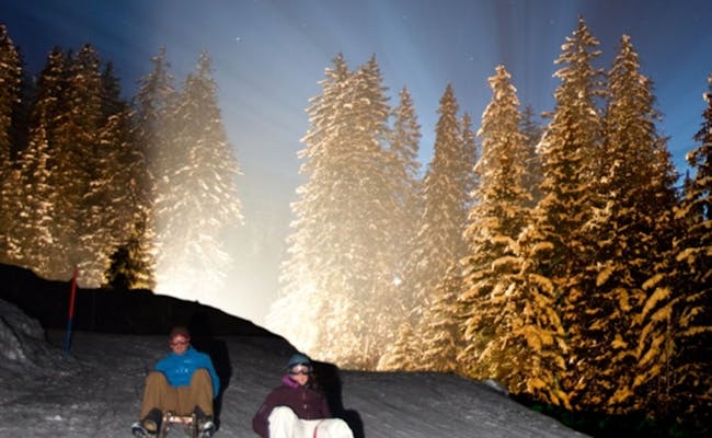
| Lenzerheide Scharmoin Mountain Station | Canols | 3.80 | lit, multisensory light effects | Wednesday, Saturday from mid-January to mid-April, plus Monday in February |
| Heuberge Mountain Restaurant or Arflina Mountain Restaurant | Fideris | 12.00 | access by buses that drive along the sledding path | daily from December to March, with a minimum of 6 people by prior arrangement |
| Schatzalp | Davos | 2.80 | lit | daily with good snow from mid-December to the end of March |
| Rinerhorn | Davos | 3.50 | lit, 33 curves and steep turns | Wednesday and Friday from mid-December to mid-March |
| Preda | Bergün | 6.50 | lit, suitable for families | Tuesday to Sunday from mid-December to mid-March |
| Darlüx | Bergün | 4.00 | unlit, very fast | Tuesday to Sunday from mid-December to mid-March |
| Alp Proliebas | La Punt Chamues-ch | 2.35 | lit with torches | Wednesday in February (by prior arrangement) |
| Lü | Tschierv (Val Müstair) | 3.00 | partially lit, suitable for families | Tuesday and Thursday from mid-December to mid-April (by prior arrangement) |
Milez - Dieni: 4 km Snow Night
This toboggan run is located in the SkiArena Andermatt - Sedrun - Disentis and is also used by hikers in the upper section.
Location: Dieni
Dieni is known for the ski resort Andermatt - Sedrun - Disentis. The small village by the Vorder Rhine is a tourist destination and has several hotels.
Opening Hours for Night Sledding
every Thursday:- First lift at 6:30 PM
- Last ascent and descent with the chairlift at 10:00 PM
- Last slope check at 10:30 PM
during the winter season, usually from the third week of December until a week after Easter (during the Snow Night Sedrun)
Contact Information and Maps
- Skiarena Andermatt Sedrun, Dieni, 7189 Rueras
Getting Here
By car, you can drive from Zurich via the A3 and Route 19 in about 2.5 hours. From Lucerne, take the A2. However, the Oberalp Pass is closed in winter. From Andermatt, you can take the train over the Oberalp Pass to the Dieni station.
From Lucerne, you can take the SBB train to Erstfeld, then the SOB to Göschenen, and finally the Matterhorn-Gotthard-Bahn over the Oberalp Pass to Dieni. Alternatively, you can travel from Zurich via Chur to the Dieni station.
A free Snow Night bus operates on Thursday evenings between Disentis/Sedrun and Dieni. Transportation between Dieni and Disentis is guaranteed until 10:00 PM.
Toboggan Equipment Rental
- at the sports shop at the valley station in Dieni
Night Sledding Process
Right next to the parking lot in Dieni is the valley station of the Milez-Flyer chairlift. It takes you about 7.5 minutes from 1,452 m to 1,881 m above sea level. The entrance to the toboggan run is just a few meters away from the mountain station. The whole length of the toboggan run is secured and illuminated.
Although the upper section is specifically designed as a toboggan run, it also serves as a hiking path. It runs alongside a fairly steep ski slope, so be careful not to go too fast. From the groomed roadway in Mulinatsch, the gradient becomes gentler. After passing under the railway line, the toboggan run veers to the right. From there, it's only a few meters to the valley station of the chairlift. You will descend a total of 448 vertical meters.
Catering Options
- Restaurant Milez
- Pistenrestaurant Sudada
- Alphütte Las Palas
Mompé Medel: 3 km night sledding
You can reach the toboggan run exclusively on foot.
Place: Mompé Medel (Mumpé Medel)
Mompé Medel is a small village in the Surselva region. It is located near the village Disentis, also through a tunnel.
If you come by car from Lucerne or Zurich, you have to go via Chur to Disentis. From Disentis you drive to Mompé Medel in direction Lukmanierpass. After about 2.5 km you have to turn right (tunnel) to the end of the village. Mompé Medel is only accessible by car, parking is above the village. Free parking is available at the end of the toboggan run, at the bar La Scursalada.
- Ticket sale and rental of sledges and headlamp at the bar La Scursalada
Procedure of the night sledging
The sledding starts with an ascent of about 30 minutes. While you walk uphill, you have the sun in your face. Part of the way goes along a winter hiking trail, for the other part you walk along the edge of the sledding trail.
Shortly below Stagias, at 1550 m above sea level, the toboggan run begins. There are fast and slow passages. The path is clear and well secured. A total of 284 meters of altitude are descended.
Catering
- Bar La Scursalada
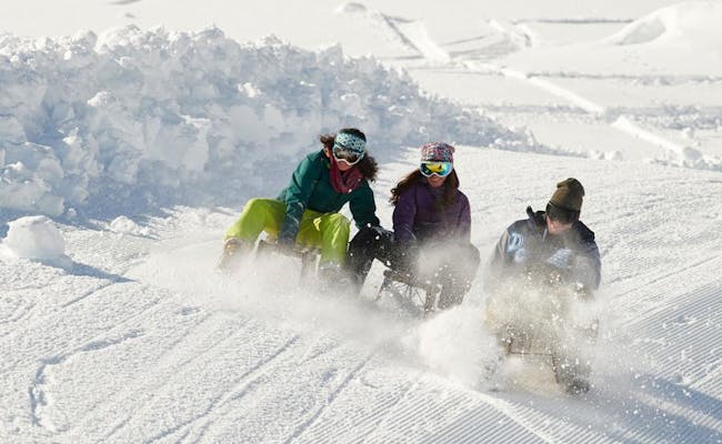 Mompé Medel (Photo: Switzerland Tourism Schweizmobil)
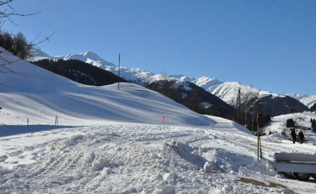 Mompé Medel (Photo: Switzerland Tourism Schweizmobil)
Foppa - Flims in the ski area Flims, Laax, Falera: 3 km night sledging
The toboggan run is regularly groomed and checked. The ski area extends over the municipal areas of Flims, Laax, Falera, Ladir and Ruschein.
Location: Flims
Flims is located in the Imboden region. It is divided into Flims-Dorf and Flims-Waldhaus.
Opening hours for night sledging
- From the end of January to the end of March
- tuesdays and Saturdays from 6 p.m., last ascent is at 8:30 p.m.
- last piste check 21:00
Tickets can be bought at the ticket office Flims between 17:45 and 20:30.
contact details
- Via Nova 62, 7017 Flims
- Flims valley station 7017 Flims
Arrival
The villages of Flims, Laax and Falera can be reached by car from Chur via route 19 in only 30 minutes. From Zurich you need about 1 hour and 45 minutes. By public transport you take the post bus line 81 from Chur.
Rental of sledging equipment
- Bundi Sport, Flims village
- Meini Sport & Mode, Via Murschetg 41, 7032 Laax
- Menzli Sport
- Sport Beat, Via Nova 49, 7017 Flims
Procedure of the night sledging
The chair lift takes you in eight minutes from the valley station in 1098 to 1424 m above sea level. The toboggan run starts below the restaurant of Berghaus Foppa.
The run is specially prepared for night sledding. The trail leads you through the forest to the valley station in Flims. 367 meters of altitude are descended.
Catering
- Foppa mountain lodge
- Legna Bar at the valley station in Flims
Curnius - Falera: 3.5 km night sledging
The toboggan run is regularly groomed and checked. The ski area extends over the municipal areas of Flims, Laax, Falera, Ladir and Ruschein.
Location: Falera
Falera belongs to the Surselva region. The village is situated in the Vorderrheintal on a terrace. It may only be entered with a permit. Cars must be parked at the entrance of the village on a large parking lot.
Opening hours for night sledging
- Mid-February to mid-March
- fridays from 17:45 to 20:30 o'clock
- Last piste check 22.00
You can buy tickets at the cash desk Falera between 17:45 and 20:30.
Contact details
- Via Principala 45c, 7153 Falera
- Falera valley station, 7153 Falera
Arrival
The villages of Flims, Laax and Falera can be reached by car from Chur via route 19 in only 30 minutes. From Zurich you need about 1 hour and 45 minutes. By public transport you take the post bus line 81 from Chur.
Rental of sledging equipment
- Bundi Sport, Flims village
- Meini Sport & Mode, Via Murschetg 41, 7032 Laax
- Menzli Sport
- Sport Beat, Via Nova 49, 7017 Flims
Procedure of the night sledging
Take the chairlift Falera-Curnius to the top. From Curnius you sled down the 3.5 km long toboggan run. It leads past rustic alpine pastures and the Mirasteilas observatory. The end point of the toboggan run is the valley station of the chairlift in Falera. You will descend 387 meters in altitude. The chairlift takes you back to the starting point in about seven minutes.
Catering
- Mountain restaurant Tegia Curnius
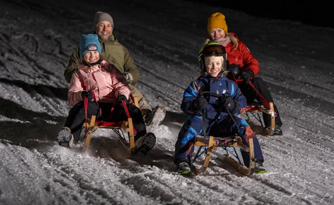 Flims Laax (Photo: Weisse Arena Gruppe)
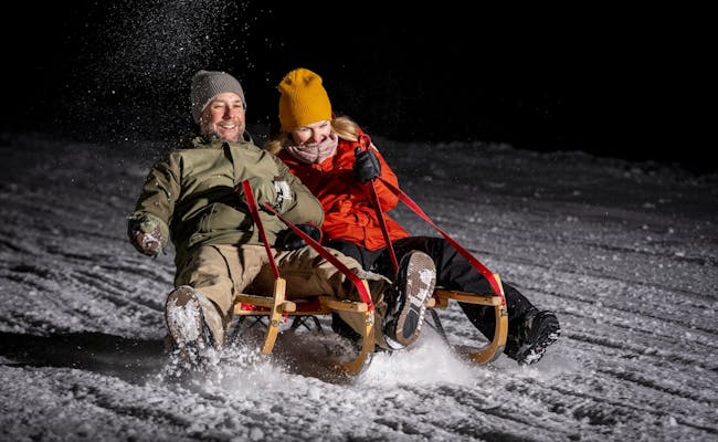 Flims Laax (Photo: Weisse Arena Gruppe)
Dros - Lohn (or Mathon): 2.6 km Night Sledding in the Viamala
The view from Dros is worth it. You can see Piz Curvér, Surettahorn, Piz la Tschera, and several other peaks. However, you’ll need to pull your sled or toboggan up on foot. It’s 2.6 km and a climb of 300 meters to get up, so you can slide back down afterwards.
A visit during the day is also worthwhile to check out the closely packed houses and barns. The church features towers from different eras. You can even tour the church. In the village, Romansh (Sutsilvan) is still primarily spoken.
The sledding path is lit up in the evenings whenever the sledding bar is open.
Instead of sledding to Lohn, you can also turn off towards the sledding bar and head to Mathon; the route is about the same length and is also lit up.
Location: Lohn
The little village of Lohn is situated at 1585 m a.s.l. in the Viamala region.
The Viamala refers to a roughly eight-kilometer stretch of path that was notorious for its deep gorge in the past. It runs along the Hinterrhein between Thusis and Zillis-Reischen. During the Roman era, the path was used as a mule track from the south via the Splügen. Today, Viamala is the name of the region.
Night Sledding Hours
The sledding track is lit up whenever the sledding bar is open in the evening.
Getting There
You can reach Lohn using public transport via the post bus line Zillis–Lohn–Wergenstein. So you’ll change from the Rhaetian Railway in Thusis to the post bus.
If you’re driving, take the A13 motorway - Chur - Thusis - San Bernardino, and exit at Viamala. Follow the main road 13 past the Viamala visitor center to the next motorway entrance.
Tickets
not needed
Sled Rental
- Pizzeria Orta in Lohn (closed Mondays and Tuesdays)
- Restaurant Muntsulej in Mathon
- Hotel Restaurant Capricorns in Wergenstein
- Sleds/toboggans must be ordered in advance.
Night Sledding Process
The Schamserberg can be reached from the post bus stop in Lohn. The ascent to the alpine settlement of Dros takes about 45 minutes. You can only go up on foot. On the way down, the climb is quickly forgotten. You’ll first travel over open terrain, then the sledding path enters the woods.
While it’s well-lit, the trees become denser as you descend. The path is smoothly sloping and easy to navigate. The curves are also quite gentle. About halfway down, the sledding bar beckons with grilled food. At the end of the second part of the descent, there’s a tighter S-curve, where you’ll need to turn off towards Lohn.
Food and Drinks
The sledding bar offers grilled specialties and drinks. It’s located right next to the sledding track and is illuminated on night sledding days.
Dultschinas - Sarn (Heinzenberg): 3.8 km night sledding in Viamala
The sledging trail leads 400 meters downhill and gets really racy at the end. The run is prepared with artificial snow, but is not illuminated. A headlamp is recommended.
Place: Sarn
Sarn is a cluster village in the middle of the Heinzenberg region. In the west of the small village there is a mountain range between Tguma (2163 m a.s.l.) and Präzer Höhe (2120 m a.s.l.). Sarn is situated at 1178 m above sea level.
The Viamala denotes a section of path about eight km long, which used to be very notorious because of its deep gorge. It leads along the Hinterrhein between Thusis and Zillis-Reischen. At the time of the Romans, the path was used as a mule track from the south over the Splügen. Viamala is the name of the region today.
Opening hours for night sledging
In good weather conditions, night sledding takes place from 18:00 to 20:00. The exact dates have to be asked for. The winter season runs from about mid-December to mid-March.
Contact:
- Heinzenberg Skilifte und Sesselbahn AG, valley station, 7423 Sarn
- Viamala Tourism, Bodenplatz 4, 7435 Splügen
Arrival
By public transport you reach Sarn from Chur with the Rhaetian Railway to Thusis. There you take the post bus line 532.
The valley station of the chair lift in Lescha is easily accessible by post bus. By car you drive from Chur via the A13 and take the exit 21- Thusis-Nord in Thusis. Afterwards the road leads over the Äussere Heinzenbergstrasse and the Heinzenbergstrasse. A large open air parking lot with 500 free parking spaces is available at the valley station of the chairlift in Lescha.
Tickets
There are separate tickets for night sledging. However, night sledging is included in the season ticket. Weekly and daily tickets are not valid for night sledging. An evening ticket is valid from 18:00 - 20:00.
Rental of sledging equipment
- Ernie's Point Rent à Sport: Swiss snow sports school Heinzenberg-Sarn,
- Mountain restaurant Dultschinas Sarn, only sledge rental
- INTERSPORT BANZER Thusis,
- Strimer Sport Thusis,
- viamala sportwerkstatt Thusis,
Procedure of the night sledging
From the valley station Lescha above Sarns you take the chair lift to the mountain station Dultschinas. Only a few meters above, the toboggan run begins, which leads over a length of 3.8 km about 400 m downhill. The descent is quite leisurely at first, but gets faster in the lower part. It goes past small houses and through the forest.
Just before the end of the toboggan run, two sharp curves are mastered. On the way, the view goes to the mountain peak Piz Beverin (2998 m above sea level). The toboggan run is not illuminated, a headlamp is recommended.
Catering
- Mountain restaurant Dultschinas
- Restaurant Lescha
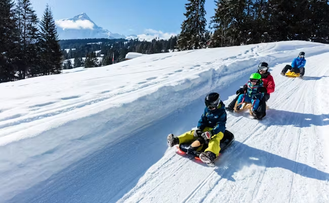 Sarn Heinzenberg (Photo: Viamala Tourism)
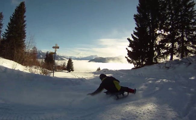 Sarn Heinzenberg (Photo: Viamala Tourism)
Brambrüesch - Känzeli: 4.1 km night sledding above Chur
From Chur's local mountain Brambrüesch, the toboggan run leads to Känzeli. The ride goes through forests as well as over open alps. Here you can enjoy a magnificent view to Schanfigg-Arosa with its evening lights.
Place: Chur
Chur is the capital of the canton of Grisons and lies at 593 m above sea level. The local mountain is the Brambuesch, whose cable car has its valley station on the outskirts of Chur.
Opening hours for night sledging
- Night sledding takes place on the Brambüesch from the beginning of January to the beginning of March.
- saturdays 17 to 22 o'clock
- The Chur-Känzeli aerial tramway and the Känzeli-Brambrüesch 4-seater gondola lift are open during this period
contact possibilities and links to information
- Brambrüeschbahn, Kasernenstrasse 15, 7007 Chur
Arrival
It is only one kilometer from Chur train station to the valley station of the modern Brambrüeschbahn.
Parking
Guests of Chur Bergbahnen can park free of charge in the Stadthallen parking lot as long as the cable cars are in operation.
Rental of sledging equipment
You can rent sledges at the Chur valley station. Either ID or credit card must be deposited as a deposit. The equipment is then handed out at the top station of the 4-seater gondola lift. If you rent the sled directly at the top station, the deposit is 50 CHF.
Procedure of the night sledging
The toboggan run is not illuminated, so you should use a headlamp. From the outskirts of the city, you first take the Chur-Känzeli aerial tramway to the Känzeli middle station. From there, take the 4-seater gondola up to Chur's local mountain. On Brambrüesch, the toboggan run starts at the top station at 1,590 meters above sea level.
It has stretches with sweeping curves and rapid descents. There are also leisurely stretches. The Schanfigg valley with its Walser villages lies at your feet and the Aros Weisshorn towers behind. The toboggan run is well suited for families and children, as it mostly has an even gradient. 436 meters of altitude are overcome on the trail.
Catering
- Mountain restaurant
- Battaglia hut
- Malixerhof
- Bergbaiz
- Edelweiss hut
A reservation is required for the fondue fun in the mentioned restaurants. For the tobogganing itself you do not need a reservation.
- Additionally there is the Älplibar near the Malixerhof.
Prätschli - Obersee: 1 km Night Sledding Arosa
The sledding path from Prätschli to Obersee offers a beautiful panoramic view. You can admire the entire mountain backdrop of Arosa, Davos, and Lenzerheide.
Location: Arosa
Arosa is located in the alpine valley of Schanfigg. The area is known for its lakes (Obersee, Untersee, Iselsee), hiking trails, and ski slopes. Arosa is a popular holiday destination.
Night Sledding Hours
The sledding path is open every day and is illuminated in the evening.
Contact Information
- Arosa Tourism, Arosastrasse 27, 7050 Arosa
Getting Here
You can take the Rhaetian Railway from Chur to Arosa, which runs every hour. From the train station, it’s just a few steps to the bus stop for the Weisshornbahn/ski school. The free local bus takes you to Prätschli in no time.
If you’re driving from Chur, it takes about three quarters of an hour along Arosastrasse to reach Arosa.
Parking
There are only a limited number of parking spots at Hotel Prätschli. It’s best to park your car in the Ochsenbühl parking garage, which you’ll find on the right after the sports and congress center. It’s open 24 hours.
Tickets
not required
Sled Rental
- Sled King
- Schmid Sport Arosa
How Night Sledding Works
The sledding path from Hotel Prätschli to Obersee is about one kilometer long and goes up 165 vertical meters. Prätschli is situated at the edge of the forest and provides a fantastic panoramic view right from the start.
The initially relatively flat sledding path becomes a bit faster later on. Once you enter the forest, it gets steeper and follows some sharp curves. Be cautious when crossing the ski slope. After a bend, you’ll reach the train station and after about a kilometer of riding, you’ll arrive at the end of the sledding path. Right next to it is Obersee.
Catering
- Prätschli-Stall
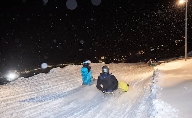 Arosa (Photo: Arosa Mountain Railways)
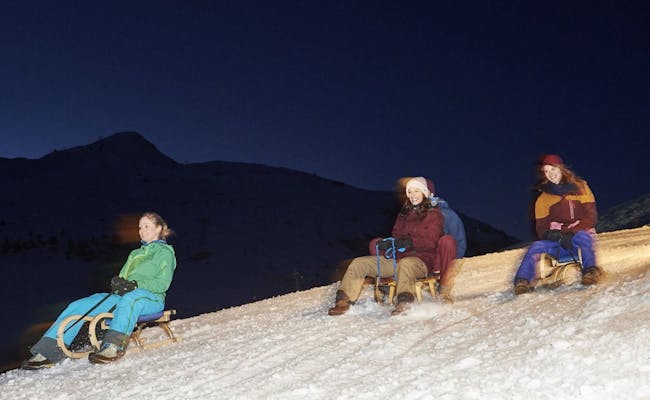 Arosa (Photo: Arosa Bergbahnen)
Tschuggen - Innerarosa: 1km Night Sledding
Location: Tschuggen/Arosa
The Tschuggen is part of the Plessur Alps and is a rounded mountain peak. It is located southeast of the Weisshorn in the municipality of Arosa. Arosa lies in the Alpine valley of Schanfigg and is known for its lakes (Obersee, Untersee, Iselsee), hiking trails, and ski slopes. Arosa is a popular holiday destination.
Night Sledding Hours
Thursdays from 6 PM to 9 PM in February, possibly also in March (check ahead)
Contact Options
- Arosa Tourism, Arosastrasse 27, 7050 Arosa
Getting There
You can take the Rhätische Bahn from Chur to Arosa every hour. From the train station, you can take bus 061 of the Arosa transport services to Innerarosa.
If you're driving, it takes about 45 minutes from Chur on the Arosastrasse to Arosa. There are no parking spaces at the valley station of the 4-person gondola Kulm. However, you can park your car in the Brüggli/Innerarosa parking garage, which is just a few meters away.
The Kulm gondola and the Arosa-Weisshorn cable car Section 1 carry sleds for free, and night sledding is also free of charge.
Sled Equipment Rentals
- Sled King Innerarosa
- Sprecher Sport Innerarosa
- Schmid Sport Innerarosa
Night Sledding Procedure
Take the Kulm gondola to the Tschuggen. You can also choose the Arosa-Weisshorn cable car Section 1. The short sledding run takes you from Tschuggen to Innerarosa.
The viewpoint at Tschuggen offers a view of the Arosa mountains, including the Erzhorn, the Arosa Rothorn, and the Schafrügg. The sledding run starts southeast and passes by the astrophysical observatory.
You will also find the legendary Tschuggen hut and the historic mountain chapel along the way. Between the Tschuggen hut and the chapel, there is a fork where you can decide whether to continue to Innerarosa or to take the gondola again to start the sledding run once more. The descent from Tschuggen to Innerarosa covers a drop of 200 meters in altitude.
Food & Drinks
- Tschuggen Hut
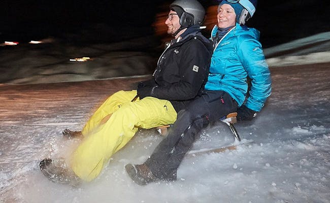 Night sledding at Tschuggen Innerarosa (Photo: Arosa Lenzerheide Tourism)
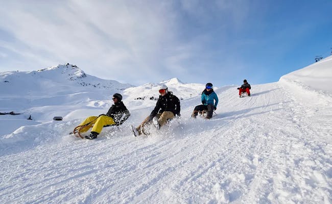 Night sledding Tschuggen Innerarosa (Photo: Arosa Lenzerheide Tourism)
Lenzerheide Scharmoin - Canols: 3.8 km "Light Rider"
Sledding down the Light Ride in Lenzerheide offers a completely new nighttime sledding experience. Multisensory light installations have been set up here, combined with a sledding challenge. This creates a blend of sledding, light art, and play.
Location: Lenzerheide
Lenzerheide is situated at an altitude of about 1450–1600 m above sea level. It became well-known as a popular venue for the World Cup finals.
Night Sledding Opening Hours
- Mid-January until the first week of April, depending on snow conditions
- Wednesdays and Saturdays, plus Mondays in February
- Rothornbahn 1 and lighting from 18:00 to 22:00
- Rothornbahn ticket office 18:00 to 22:15
Contact Information and Links
- Holiday Region Lenzerheide, Voa Principala 37, 7078 Lenzerheide
- Lenzerheide Mountain Railways Canols, P.O. Box 160, 7078 Lenzerheide
Getting There
The valley station of Rothornbahn 1 (Lenzerheide/Lai LHB) is located on the eastern shore of Heidsee at the end of Voa Principala. Next to it is the large Rothorn parking lot. You can reach the valley station in Lenzerheide from Zurich by car via the A3 motorway in less than two hours.
Before Chur, the A3 changes to the A13 (Exit 17-Chur-Süd). From Chur, you drive along Route 3 to Dieschen sot in Lenzerheide.
If you’re using public transport, you’ll get there in about two hours. Take the SBB train from Zurich to Chur. From there, switch to the postal bus line 182, which will take you to the valley station of Rothornbahn.
The ticket (4-hour sledding) is valid for the Rothorn 1 gondola and the Tgantieni chairlift.
Renting the transponder is included with the sledding ticket. The transponder collects data from the sledding challenge and analyzes it.
For annual pass holders, the transponder can be rented separately at the mountain railway ticket office. A deposit is required for the transponder (a photo ID or a driver's license).
- The number of tickets is limited per evening.
Rental of Sledding Equipment
- Pesko Rothornbahn at the valley station
- The number of rental sleds is limited each evening.
- Sleds and sports sleds "Swiss Racer" are available for rent.
Night Sledding Process
Sledding takes place on the lower part of the Scharmoin-Canols sledding slope. You reach the slope via the Rothorn 1 gondola. It takes you from 1495 m above sea level to 1906 m above sea level at the mountain station in just four minutes. The sledding slope is 3.8 km long and has an elevation difference of 411 meters.
On the upper part of the course, night sledding remains traditional with lighter and darker sections. In the lower part, multisensory light installations gradually appear, providing both entertainment and a challenge.
To be crowned the "Light Rider," you need to achieve the best possible score in the least amount of time. You can collect time credits at various stations along the way. Only wooden sleds are allowed; plastic bobsleds are not suitable. During the time from 18:00 to 22:00, at least three runs are possible.
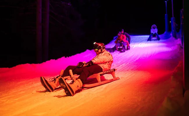 Lightrider Lenzerheide (Photo: Arosa Lenzerheide Tourism)
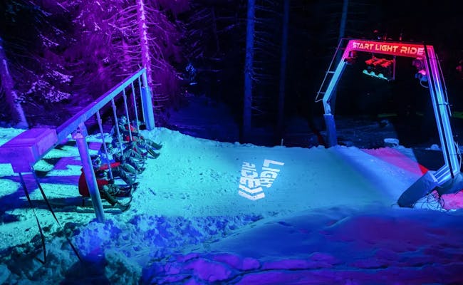 Lightrider Lenzerheide (Photo: Arosa Lenzerheide Tourism)
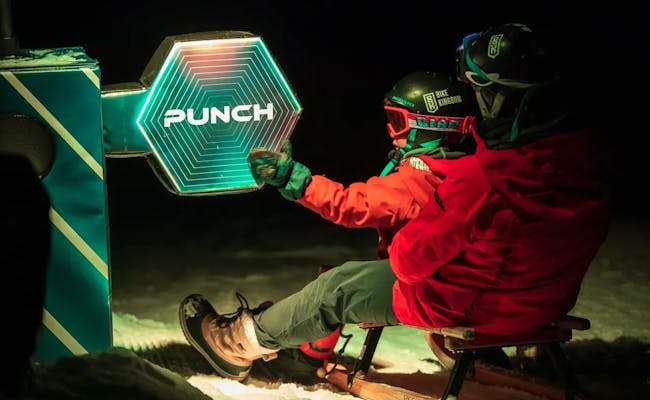 Lightrider Lenzerheide (Photo: Arosa Lenzerheide Tourism)
Fideriser Heuberge: 12 km Full Moon Sledding
12 km of full moon sledding at the Fideriser Heuberge is a unique experience. During the days around the full moon, the moonlight is usually bright enough, although headlamps are recommended for safety.
Fideris in the Prättigau
Fideris is a village in the middle of the Prättigau. It features several impressive houses that were spared from destruction by the Austrians in 1622. Fideris is situated at nearly 900 m above sea level.
Hours for Night Sledding
From December to March, night sledding is possible every evening as long as at least six people register. No registration means you can't participate. The days around the full moon are particularly popular.
Mountain rides are available during the following times:
- Weekdays 16:15 - 19:15
- Weekends 16:15 - 22:30
Getting There
By public transport, take the Rhaetian Railway from Landquart to Schiers. From Schiers, the post bus operates to Fideris village. The total travel time is at least 35 minutes.
By car, the bus station can be reached in about half an hour via Route 28. From Vaduz, take the A13 and Route 28. A large parking lot is located just below the bus station at the sawmill in Fideris.
Tickets
Mountain rides and sledding day passes can be purchased at the ticket office at the base station of the minibuses (Sägerei Fideris).
Sled Equipment Rental
- Modern and comfortable sleds can be rented at Berghaus Arflina, with payment made directly in the ski room. Alternatively, you can also do this with the staff at Berghaus Heuberge. Returns are made at the ticket office by the sawmill in Fideris.
- Rätikon Sport in Küblis (4 km away)
Process of Night Sledding
Sledders are exclusively transported to 2000 meters altitude using the minibuses from the ski area, where the sledding path begins. You can start either at Berghaus Arflina or Berghaus Heuberge. The sledding path runs along a road that is specially closed for sledders. However, be prepared for (well-lit) buses coming in the opposite direction.
The distance of the route is 12 km, with an elevation difference of 1100 meters. The base station of the buses is located at the area of the sawmill in Fideris, which is also the endpoint for the sledding experience. Mountain rides and sledding day passes can be purchased at the ticket office here. The return of sleds is next to the ticket booth.
Catering
On Fridays and Saturdays, there is an opportunity to combine night sledding with a fondue night or dinner. Bus rides depart from Fideris sawmill.
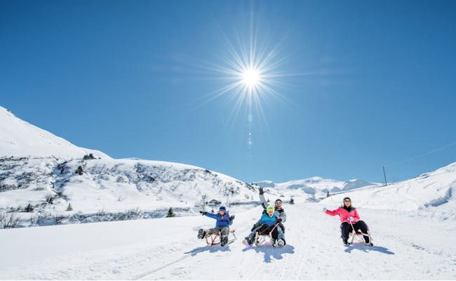 Fideriser Heuberge (Photo: Switzerland Tourism MySwitzerland)
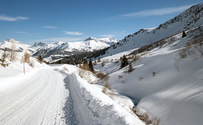 Fideriser Heuberge (Photo: Switzerland Tourism MySwitzerland)
Schatzalp - Davos: 2.8 km Night Sledding
Thomas Mann called the Schatzalp "magic mountain" in his novel of the same name. And at night, the mountain with its illuminated sledding track truly has a special charm.
Location: Davos
Davos is a popular ski and winter sports resort. It's located at 1,560 m above sea level. Davos is also famous for the panoramic Glacier Express train, which runs from Davos to the Matterhorn. Davos-Glaris is situated below Rinerhorn at 1,457 m above sea level, next to the Landwasser river. Davos-Platz, along with Davos-Dorf, lies in the almost flat upper section of the valley.
Hours for Night Sledding
- The curves of the sledding track are illuminated until 11 PM
- Open daily from mid-December to the end of March, weather permitting
Contact Information
- Schatzalp, 7270 Davos Platz
- Schatzalpbahn, Schatzalp, 7270 Davos Platz
Getting There
You can drive from Chur to Davos-Platz via Route 28 in about an hour. With SBB, you can reach Davos Platz from Chur in about 90 minutes, though you may need to change to the Rhaetian Railway in Filisur. A bus runs from Davos-Platz to the valley station of the Schatzalpbahn. Walking takes about eleven minutes.
Tickets are available at the valley station of the Schatzalpbahn.
Sled Rental
- Rent, pick up, and return sleds at the valley station of the Schatzalpbahn
Night Sledding Procedure
The Schatzalpbahn takes you from the center of Davos-Platz (1,560 m above sea level) to the magic mountain (1,865 m above sea level) in just four minutes. The Schatzalp is a sun terrace high above Davos. The sledding path winds down in 18 curves through the magic forest back to Davos-Platz.
The sledding path is pleasantly wide and well-prepared. It's free to use the 2.8 km track where you'll descend 300 meters in altitude. The sledding track is also suitable for beginners and children. Of course, you'll be using a Davos sled—what else?
The Schatzalpbahn operates every 30 minutes from 7 PM to 11 PM, and every 15 minutes before that.
Catering
- Panoramic restaurant next to the mountain station of the Schatzalpbahn
- Piano Bar in Hotel Schatzalp with live music daily
Rinerhorn - Davos: 3.5 km night sledding
The downhill run from the Rinerhorn has it all with 33 curves and unique steep bends. It is something for experienced sledders.
Place: Davos
Davos is a popular ski and winter sports resort. It is located at 1560 m above sea level.Davos is also known for the panoramic Glacier Express railroad that runs from Davos to the Matterhorn. Davos-Glaris is located below the Rinerhorn at 1457 m above sea level on the Landwasser. Davos-Platz lies with Davos-Dorf in the almost flat upper part of the valley.
Opening hours for night sledging
- wednesdays and Fridays from 19:00 to 23:00 hrs
- December till March
Contact
- Davos Klosters Bergbahnen AG, Brämabüelstrasse 11, 7270 Davos Platz
- Bergbahnen Rinerhorn AG, Landwasserstrasse 49, 7277 Davos Glaris
Arrival
By car you can reach Davos Glaris from Chur via route 3 in about one hour. The toboggan run starts with the arrival via the 6-seater gondola Rinerhornbahn from Davos Glaris. Parking is available at the valley station of the Rinerhorn cable car.
With the post bus you can reach Davos-Glaris from Chur in 1,5 hours. You take the post bus line 182 to Lenzerheide and change there to line 183.
- Rental of sledging equipment in the sports store at the valley station
Procedure of the night sledging
The Rinerhorn cable car takes you from the village of Glaris (1459 m above sea level) to the summit of the Rinerhorn (2050 m above sea level) in about ten minutes. You can see the Schatzalp from here in good weather. The toboggan run is something for experienced sledders.
The 3.5 km long Rinerhorn toboggan run has it all. It is considered one of the most challenging toboggan runs far and wide. A lot of steering and braking skills are required because the curves are steep. Right at the beginning there is a very steep section with a tunnel passage.
Both the entrance and the exit are dangerous. Afterwards it becomes a bit more even, the path winds through a fir forest. Further down the route, there are once again steep sections with spectacular steep-wall curves to negotiate.
They now continue to the end of the track. The local bus brings the sledders safely home, even at a late hour. In total, almost 600 meters of altitude down are mastered.
Catering
- Jatzmeder mountain restaurant, right next to the mountain station (self-service): spaghetti dinner by candlelight on Wednesdays and raclette or fondue on Fridays
- Restaurant Blockhuus
- Restaurant Spina
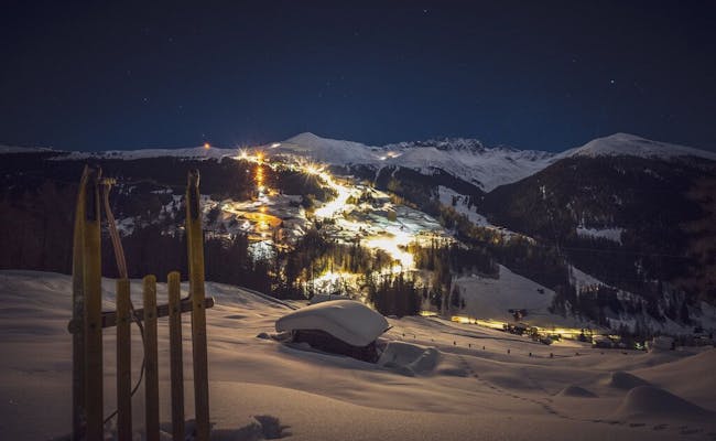
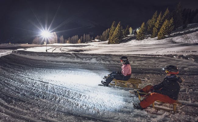
Preda - Bergün: 6.5 km Night Sledging on the Albulapass with the Family
The Albulapass becomes a sledding paradise in winter. The pass roads are closed to cars, which benefits the sledders. These runs offer truly unique experiences.
The sledding route between Preda and Bergün is one of the most beautiful sledding tracks. The 6.5 km long stretch winds through the viaducts of the Rhaetian Railway and is world-famous.
Location: Bergün
Preda and Bergün/Bravuogn are small villages in the municipality of Bergün Filisur in the Swiss canton of Graubünden. Bergün is located in the Albula Alps at an altitude of 1,367 m above sea level.
Night Sledging Hours
The sledding route between Preda and Bergün is open daily from Tuesday to Sunday until 11:00 PM. Generally, the winter season lasts from mid-December to mid-March.
Contact Information
- Bergün Filisur Tourism
- Sledding Bergün
Getting There
You can reach Chur with the SBB. From there, transfer to the Rhaetian Railway. The Rhaetian Railway runs on the Albula line towards St. Moritz. If you're coming from the south, you can take the RhB via Samedan to Preda and Bergün.
Parking
If you're driving, there's a large all-day parking lot right at the beginning of the village of Bergün. A parking space costs just a few francs per day.
Tickets
- All-in-one day passes for the RhB, sledding routes, and lift are available. If you're arriving by public transport, you should buy a Rail Away ticket for the Sledding World Preda Darlux Bergün directly from your home station. This way, you can get to Darlux, where the sledding track starts, with just one ticket.
- Individual sledding tickets can't yet be purchased online. They are available at the sled rental or at the valley station of the Darlüx lift.
Equipment Rental for Sledding
- Mark Sport: Pickup at Preda Station, return: Bergün Village, left of the ice bar
- Club 99: Pickup in Preda and Bergün, return at Bergün Station
Only wooden sleds and toboggans are allowed on this sledding track. Plastic bobsleds or steering sleds are not suitable and not permitted.
Helmets and back protectors can also be rented. You can borrow headlamps at the mountain restaurant La Diala in exchange for a deposit.
Night Sledging Procedure
From Bergün, you can take the Rhaetian Railway to Preda. The ride up to the sledding track is already an experience in itself.
The sledding track runs along the pass road between Bergün and Preda. It is specially closed in winter for sledders. The track goes under the railway line and is well-groomed, ensuring a safe descent. In the evenings, sledding becomes an unforgettable adventure thanks to the excellent lighting along the route.
Food, Toilets, and ATMs
For nighttime refreshments, there are restaurants available in Preda and Bergün. You can find toilets at Bergün Station and Preda Station. There's an ATM in Bergün located at the entrance of the Mark Sport shop, to the left of the ice bar.
Darlüx to Bergün: 4 km of fast-paced nighttime sledding
The Darlüx - Bergün toboggan run is a sporty toboggan run that leads over 4 km downhill. The toboggan run offers a fast-paced downhill experience and is suitable for sporty tobogganers.
Place:
Preda are small villages in the municipality of Bergün Filisur in the Swiss canton of Graubünden. The villages are located in the Albula Alps. Bergün is situated at 1367 meters above sea level. Preda is situated on the road above the Albula Pass. The village is located at 1789 meters above sea level. Here is the north portal of the Albula tunnel of the Rhaetian Railway. To get to the start in Darlux, you take the chairlift to the middle station of Darlux. There you will also find a mountain restaurant.
Opening hours for night sledging
Night sledding takes place on Fridays from 6 pm between the end of January and the beginning of March. In addition there is a Raclette-Plausch in the mountain restaurant La Diala. The facility is not illuminated.
Contact
- Bergün Filisur Tourism
- Tobogganing Bergün
Arrival
Take the SBB to Chur. Here you change to the Rhaetian Railway. The Rhaetian Railway runs on the Albula line in the direction of St. Moritz. From the south you can take the RhB via Samedan to Preda and Bergün.
Parking
If you arrive by car, you will find a large day parking lot right at the beginning of the village of Bergün. A parking lot costs only a few francs per day.
Tickets
- All-in-one day tickets for RhB, toboggan runs and lift are available. If you travel by public transport, you should buy a Rail Away Ticket Schlittelwelt Preda Darlux Bergün directly from your home station. This way you get with one ticket directly to Darlux to the start of the toboggan run.
- Unfortunately you can't buy single tickets online yet. They are available at the toboggan rental or at the valley station of the Darlux cable car.
Sledging equipment rental
- Mark Sport: pick-up at Preda train station, return: Bergün village, left of the ice bar
- Club 99: pick-up in Preda and Bergün, return: Bergün train station
Only wooden sledges and toboggans are allowed on this toboggan run. Bobsleds or steerable sleds made of plastic are not suitable and not permitted.
Helmets and back protectors can also be rented. Headlamps can be rented at the mountain restaurant La Diala.
Procedure of the night sledging
576 meters of altitude are covered in about four kilometers of rapid descent. Only good and experienced sledders should come here for night sledding. Also because the run is not illuminated at night and leads steeply downhill. The toboggan run starts at the top station of the Darlux chairlift. The chairlift Bergün - Pros da Darlux (section 1) takes you about a quarter of an hour up to the Darlux ski area.
Because of its rapid descent, the run is also called the "Lauberhorn of toboggan runs". The run runs parallel to the ski slope and through the forest. It ends next to the bottom station of the chairlift, at the village entrance of Bergün. On the way, you pass the mountain station and can take a rest in the mountain restaurant La Diala. In the moonlight, the descent is a unique experience.
Both descents could be combined directly if necessary. The end of the toboggan run from Preda is the start for the ride up to the start in Darlux. From Darlux, the adrenaline kick is sought at the appropriate speed.
Catering, toilets and cash machines
For the nightly catering there is a restaurant in La Diala at the middle station Darlux. Toilets can be found in the middle station La Diala.
Alp Proliebas - La Punt Chamues-ch: 2.35 km Night Sledding
Not far from Bergün, the eastern section of the Albulapas is unreachable in winter. It's also closed off to allow sledding. The night sledding on the torch-lit route is very popular.
Location: La Punt-Chamues-ch
La Punt-Chamues-ch is part of the Maloja region.
Night Sledding Opening Hours
Every Wednesday evening in February, registration must be completed by 5 PM.
Getting There
You can reach La Punt Chamues-ch from St. Moritz on the Engadinbus line 6 in about 30 minutes. The bus runs every half hour. From Pontresina, you can take the train to La Punt-Chamues-ch in about twenty minutes. You board trains heading towards Scuol-Tarasp on the Rhaetian Railway. The Albula and Bernina lines of the Rhaetian Railway are listed as UNESCO World Heritage sites.
The train travels through the Albulatunnel via Chur or from Tirano (Italy) over the Bernina Pass. From Landquart, the train comes via the Vereinatunnel.
If you're driving, the journey via Ofen, Julier, and Maloja Pass (open in summer and winter) is an experience, though snow chains may be required. If you take the Vereina car transport, you'll be taken with your car from Prättigau (Selfranga) to the Engadin (Sagliains). The ride through the Vereinatunnel takes 18 minutes. During peak times, the car train runs every 30 minutes.
Tickets
Free bus shuttle; registration by 5 PM via the tourist information.
Sled Equipment Rentals
- Colani Sport
Night Sledding Procedure
A free shuttle bus will take you to the upper barrier. The sledding path starts at the upper barrier Alp Proliebas, illuminated by torches. It stretches 2.35 km down to the lower barrier (reservoir). The sledding path features thrilling descents with many curves.
Food and Beverages
Not available
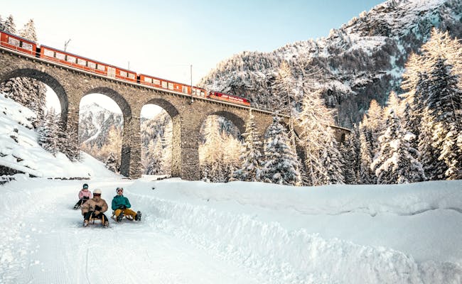 Preda to Bergün (Photo: Switzerland Tourism MySwitzerland)
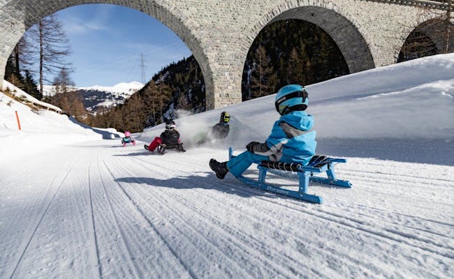 Bergün (Photo: Bergün Filisur Tourism)
Lü - Tschierv: 3 km Night Sledding in the Münstertal, at the Darkest Spot in Switzerland
Lü is known as the darkest place in Switzerland and is a hidden gem for star enthusiasts. Located high above the Val Müstair on a sun terrace, it offers a particularly good view of the stars.
Location: Val Müstair
Lü sits at 1920 meters above sea level and is part of the Val Müstair. The local dialect spoken here is "Jauer," a variety of Romansh. Tschierv (deer) is the highest valley village in the Münstertal and is located east of the Ofen Pass at 1660 meters above sea level.
Opening Hours for Night Sledding
- On Tuesdays and Thursdays, the “Sledding Express” runs for nighttime sledding fun from Tschierv to Lü and back.
- Mid-December to mid-April
Contact Information and Links to Important Information
- Visitor Information Val Müstair, Plaun Grond 24J, 7532 Tschierv
Getting There
You can reach the Münstertal by car from Chur in about two hours. First, take the A13 and then Route 28 to Klosters-Serneus. Take the train (car transport) at the Vereina Tunnel, and then follow Route 28 to the Münstertal Val Müstair. Lü is located above Fuldera and can be reached in about 10 minutes by a side road.
By train, you'll need about three hours from Chur. Take the SBB to Landquart, then the Rhaetian Railway to Zernez. Here, switch to the PostBus line 811, which will take you to the PostAuto stop Fuldera, cumün. From there, take the PostBus from Fuldera, cumün to the Lü, cumün stop.
Parking
There are free parking spots in Tschierv and free parking at the village entrance in Lü.
For groups of at least 8 people, book by 5 PM on the day of sledding at the Val Müstair guest information. The meeting point is 8 PM in Tschierv at the Center da Biosfera in the old schoolhouse (easily reachable by skibus).
Rental of Sledding Equipment
You can rent sleds in Lü, Müstair, and Tschierv.
- Alprestaurant La Posa, Alp Champatsch 7534 Lü
- Gasthaus Hirschen, Via Maistra 30, 7534 Lü
- Muglin Sport, 7532 Tschierv
- Aventüras Berg + Talsport, Via Maistra 74, 7537 Müstair
Process of Night Sledding
The sledding trail from Lü to Tschierv is partially illuminated and suitable for the whole family. You should wear a headlamp anyway.
The 3 km long sledding path starts right at the PostAuto stop Lü, cumün (2088 m above sea level), which the Sledding Express takes you to. It winds its way down through snowy forests until you reach Tschierv. Once you leave the forest, you can see the opposite valley side and the massive Ortler massif in the background. You descend a total of 240 meters in elevation. The endpoint is the PostAuto stop Tschierv, Biosfera.
After every snowfall, the path is groomed. The Sledding Express runs on Tuesdays and Thursdays between the PostAuto stops Tschierv, Biosfera and Lü, Cumün.
Catering
- Mountain Restaurant Alp da Munt in Tschierv
- Alp Champatsch: Raclette or fondue on reservation during full moon. The Alp can be reached on foot from Lü.
From Alp Champatsch, the sledding path nearly doubles in length, but you'll need to walk uphill from Lü. This tour starts in Lü at the PostBus stop.
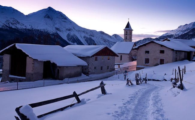 Lue Tschierv (Photo: Andrea Badrutt Switzerland Tourism Schweizmobil)
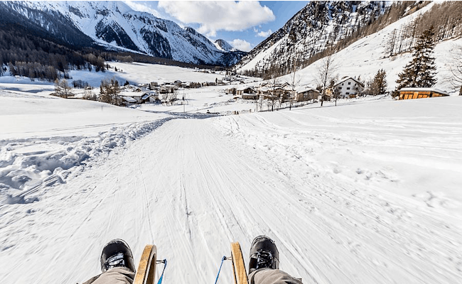 Lue Tschierv (Photo: Switzerland Tourism Schweizmobil)
Wallis: Night Sledding
In Wallis, you can choose from several slopes for night sledding, all located in the Saastal. The Saastal consists of four villages, three of which offer night sledding. In addition, two small night sledding areas are provided directly in the villages. You'll also find attractive night sledding slopes at the Simplon Pass and in the UNESCO World Heritage region of Jungfrau-Aletsch-Bietschhorn.
Night Sledding on the Slopes in the Valais Tourism Region
| Start | End | Length (km) | Special Feature | Days of the Week |
|---|---|---|---|---|
| Kreuzboden Mountain Station | Trift Middle Station | 3.00 | lit up | Wednesday during the winter season |
| Kreuzboden Mountain Station | Saas Grund | 11.00 | from Trift Middle Station unlit | Wednesday during the winter season |
| Hannig Mountain Station | Saas-Fee | 6.00 | unlit, fast-paced | Tuesday during the winter season, Thursday as an alternative |
| Furggstalden Mountain Station | Saas-Almagell | 3.00 | unlit, easy family slope | Wednesday from late December to mid-February |
| Rosswald Mountain Station | Ried-Brig | 8.00 | unlit, partly fast-paced | Friday and Saturday |
| Bellwald Fieschen | Bellwald-Richenen | 3.40 | unlit | Mid-December to late March |
Additional small slopes:
- Saas-Grund in the hamlet "Unter dem Berg" has a small night ski and sledding area at the Ziebel baby lift
- The village lifts in Saas-Balen extend their operating hours once a week
Saastal: Overview Night Sledding
- Saas-Grund is located at 1559 m above sea level and is the main village of the Saastal. Here you'll find an approximately 11 km long sledding path from Kreuzboden via Trift to Saas-Grund, which opens on Wednesdays.
- Saas-Fee is the largest village in the Saastal by population. This village, which is also at the highest elevation (1800 m), is car-free. Right at the entrance to the village, you'll find a large parking garage. A 6 km long sledding path from Hannig to Saas-Fee is open on Tuesdays.
- Saas-Almagell is the furthest of the four villages in Saastal. With fewer than 400 residents, this village, situated at 1670 meters, is the smallest of the four towns in the Saastal. A 3 km long night sledding path winds its way from Furggstalden to Saas-Almagell on Wednesdays.
- Saas-Balen is the first village you reach geographcially in the Saastal. It sits at 1480 m and is known for its typical Valais wooden houses, which are sun-darkened.
In addition to the three longer sledding tracks, there are two additional night sledding tracks available on selected dates or upon prior booking for groups. Scheduled dates will be announced on the village square's website.
- In Saas-Grund, there's a small night skiing and sledding area in the hamlet "Unter dem Berg". It's located right by the Ziebel baby lift and will be lit up from 19:30 to 22:00 when needed.
- The village lifts in Saas-Balen extend their operating hours once a week from 20:00 to 22:00.
Getting There
If you're using public transport, take bus 511 by PostAuto, which takes about 50 minutes from Brig. From the north, you can reach the Saastal by car via Bern through the Lötschberg car transporter. The tourism offices in Saastal offer discounted tickets for the Lötschberg car transporter.
From the east, the pass road over the Furka Pass is closed in winter, so you will need to use the Furka car transporter instead.
From the south, you can get to Saastal via the Simplon Pass or the Simplon car transporter, and from the west, you can come via Lausanne. Drive along the Rhône Valley to Visp and from there to Saas-Grund.
Parking
There are plenty of parking spaces at the valley stations of the mountain railways. You’ll find 500 parking spaces at the valley station in Saas-Grund alone. At the entrance of the car-free village of Saas-Fee, there's a large parking garage.
Kreuzboden - Saas-Grund: 11 km Night Sledding
The illuminated sledding path takes you from Kreuzboden down to the intermediate station (Triftpiste). The rest of the route is unlit and requires a headlamp. It leads down into the Saastal and offers a beautiful view of the Mischabel group along the way.
Night Sledding Hours
During the winter season, night sledding occurs every Wednesday. The cable car operates on these days from 6:30 PM to 9:45 PM. The last sledding descent is at 9:30 PM.
Night Sledding Procedure
Night sledding from Kreuzboden descends nearly 1000 meters. First, you take the cable car from Saas-Grund to Kreuzboden. At an altitude of 2400 meters, night sledding begins. The path starts over a ski slope. It then continues on an overall rather easy route that passes by alpine huts and small villages. After eleven kilometers, you'll arrive back in Saas-Grund. The sledding can also be interrupted or started in Trift after 3 km.
Refreshments
Hohsaas mountain restaurant with overnight accommodations
 Saas Fee (Photo: Saastal Mountain Railways)
 Saas Fee (Photo: Saastal Mountain Railways)
Hannig - Saas-Fee: 6 km night sledging
The unlit stretch between Hannig and Saas-Fee is illuminated with headlamps that can be rented. This is particularly important as the descent is very rapid in places. It is located away from the ski slopes.
Opening hours for night sledging
From the end of December to mid-April, night sledding takes place every Tuesday from 18:00 to 21:00. In case of bad weather or little snow, it is postponed to Thursday.
Procedure of the night sledging
In Saas-Fee you start with the cable car Hannig and go up to the Hannigalp. The mountain station is located at an altitude of 2340 meters above sea level. The Hannigalp is a terrain terrace that can be found southeast of the 2700 meter high mountain Mällig. the toboggan run is 6 kilometers long and starts at the top station of the Hannig cable car. It leads over the so-called Sonnenberg to the glacier village of Saas-Fee. 520 meters of altitude are covered in just under 6 kilometers.
Catering
Hannig mountain restaurant
Furggstalden - Saas-Almagell: 3 km night sledging
A pleasant and easy sledging trail for the whole family leads from Furggstalden to Saas-Almagell through forest and past hamlets.
Opening hours for night sledging
From the end of December to mid-February, night sledding usually takes place on Wednesdays from 19:00 to 22:00. The dates are announced on the Saas Almagell website. Since they do not apply to every Wednesday in this period, you should inform yourself in advance.
Procedure of the night sledging
In Saas-Almagell you take the chairlift to Furggstalden, a sunny high plateau at 1900 m above sea level. Furggstalden is an old Valais hamlet. The toboggan run starts directly at the Berghaus Furggstalden and leads in a curve over the mountain and the middle forest down to the village of Saas-Almagell. The toboggan run runs in large parts directly along the winter hiking trail and the Mittelwald ski slope. 222 meters in altitude are overcome over a length of 3 km.
Catering
- Mountain restaurant Furggstalden with large sun terrace
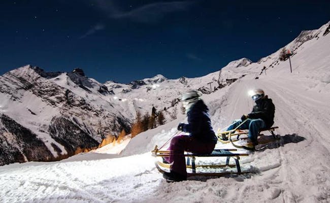 Saas Fee (Photo: Saastal Mountain Railways)
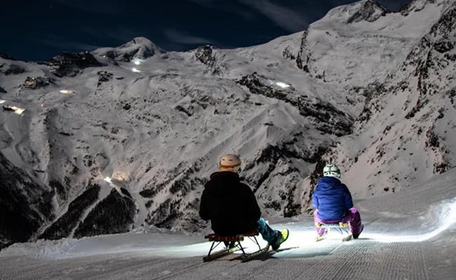 Saas Fee (Photo: Saastal Cable Cars)
Rosswald - Ried-Brig: 8 km Night Sledding
Just near the Simplon Pass, you can try one of the longest night sledding tracks in Switzerland. It runs a full eight kilometers from Rosswald down to the popular holiday town of Brig.
Location: Ried-Brig
At the foot of the Simplon Pass, the town of Ried-Brig is situated at an altitude of 1,049 meters. This place is part of the Brig district. Here, important transport routes converge. The town of Brig serves as the starting point for hiking areas and excursions to the Simplon, the Aletsch region, and the Lötschberg.
Night Sledding Hours
Night sledding is offered on Fridays and Saturdays until the end of March. On these days, the lifts operate until 21:30.
Contact Information
- Rosswald Bahnen AG, Bergstation 3913 Rosswald
Getting There
By car, you drive from Bern via the A6 and A9, taking the exit towards Ried-Brig/Termen and then turning left onto the Simplon Road. It takes just over two hours. There are 400 parking spaces available at the valley station in Ried-Brig. Using the Swiss Federal Railways (SBB), you can reach Brig directly from Bern in 70 minutes. From Brig train station, the post bus line 631 runs regularly to the valley station of the cable car and takes about 10 minutes.
Sled Rental
The following sports shops in Rosswald offer sled rentals:
- Sportshop Schirli
- Sport Mode Central
Night Sledding Procedure
With the 6-person gondola of the Rosswald Bahnen, you ride in 6.5 minutes from Brig up to the Rosswald mountain station, which is at an altitude of 1,830 m above sea level. The 8 km long sledding track is well-prepared every day. It leads from Rosswald down to Ried-Brig. From Rosswald, you have a particularly wide view over the upper Rhône Valley. The sledding path descends a total of 783 meters in elevation. Along the way, there are both quiet passages and lively curves. Right from the start, there are some areas where you can pick up speed. The gentlest section is further down, where the path also becomes wider. The endpoint of the descent is the valley station in Ried-Brig.
Food and Restrooms
- Restaurant Fleschboden with cheese fondue and modern group accommodation
- Parking restaurant with cheese fondue
- Restaurant Rosswald
Bellwald Fleschen - Bellwald Richenen: 3.4 km Night Sledding
Bellwald (1560 m a.s.l.) is a holiday resort in the UNESCO World Heritage region of Jungfrau-Aletsch-Bietschhorn. It's a typical chalet village featuring a lovely Baroque church. The village of Bellwald stretches uphill towards the northeast. Here you'll also find the valley station of the chairlift that takes you to Alp Richene or Richenen. Bellwald is accessed via the village of Fürgangen (1202 m a.s.l.).
Night Sledding Opening Times
- Mid-December to the end of March
Contact Information
- Bellwald Tourism, Bellwalderstr. 446, 3997 Bellwald
Getting There
If you're coming by car from Bern, head towards Kandersteg and take exit 19 Spiez/Faulensee. The Kandersteg car transport is clearly marked. After leaving the car transport, drive towards Gampel/Steg and turn right towards Visp/Brig/Naters. You'll pass through Naters, Mörel, Unterdeisch, Lax, and Fiesch before turning left towards Fürgangen after about 6 km. After Fürgangen, you will arrive at Bellwald.
From Zurich, it's best to take the motorway towards Gotthard and exit for the Furka Pass. In Realp, take the car train and you'll arrive in Oberwald. After that, continue on, cross the Mühlebach Gallery, and turn right towards Fürgangen. The road beyond Fürgangen leads you to Bellwald.
With the SBB, you can reach Brig directly from Bern in about 70 minutes. In Brig, switch to the Matterhorn Gotthard Bahn. It will take you to the Fürgangen-Bellwald stop. Here, you’ll transfer to the Fürgangen cable car, which takes you straight into the village center.
Sled Rental
- Directly at the Sportbahnen at the Richenen valley station
Night Sledding Process
With the chairlift, you'll reach Fleschen at 2081 meters above sea level in about six minutes. The sledding path winds along the forest. From here, you have a particularly good view of the Alps and the Simplon. Later, you'll reach Bellwald Richenen via long traverses, covering an elevation gain of 460 meters.
Food and Drink
- Mountain Restaurant Fleschen
- SSC Club Hut at Hotel Bellwald
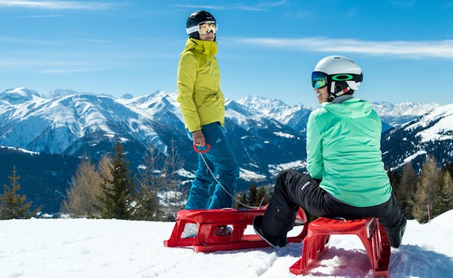 Bellwald (Photo: Fabrizio Bellwald Tourism)
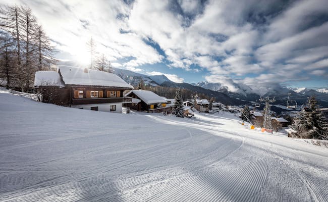 Bellwald (Photo: Bellwald Tourism)
Lake Geneva: Night Sledding
In the Lake Geneva region, you can sled down 7.2 km from the highest peak in western Switzerland.
Night Sledding Track in the Lake Geneva Tourist Region
| Start | Destination | Length (km) | Special Feature | Days of the Week |
|---|---|---|---|---|
| Les Diablerets Mountain Station | Les Diablerets Valley Station | 7.20 | unlit | Wednesday, Friday, Saturday from Christmas until mid-March |
Les Diablerets: 7.2 km Night Sledding
At 7.2 km in length, this slope ranks among the longest night sledding trails. It isn't illuminated, so each sledder carries their own light on a headlamp. The route is easy to navigate, allowing children from 6 years old to participate. You'll descend more than 500 vertical meters. Right at the start, you'll be treated to a stunning view of the Diablerets massif.
Location: Les Diablerets
The village Les Diablerets is situated at 1200 m above sea level on the north side of the Diablerets massif in the Swiss Alps. The peak of Les Diablerets, standing at 3210 m above sea level, is the highest peak in Western Switzerland.
Night Sledding Hours
Between Christmas and mid-March, the trail is open on Wednesdays, Fridays, and Saturdays from 6:30 PM to 8:00 PM. The last gondola ride is at 8 PM.
Getting There
If you’re driving, take the A9 until the Aigle exit. Following that, Les Diablerets is well-signposted. From Geneva, you can expect a 1.5-hour drive; from Bern, it’s also about 1.5 hours (A12, then A9 at La Veyte). If you’re coming from Zermatt, the route via the A9 takes around 2 hours.
By train, take the SBB trains to Aigle station, where you transfer to the ASD train heading to Les Diablerets.
Parking
Parking is available in limited numbers at the valley station.
Sled Rental
- Centre ParAdventure, Rue de la Gare 50, 1865 Les Diablerets
- Mountain Evasion Sàrl, Chemin des Grandes Isles 21, 1865 Les Diablerets
Night Sledding Process
Take the 10-person Diablerets Express gondola and reach Restaurant Les Mazots in just 6 minutes. This puts you in the middle of the Les Diablerets-Villars-Gryon ski area and at the start of the sledding trail. The mountain station is at an elevation of 1710 meters.
Over 7.2 km, you’ll glide down comfortably, descending 540 vertical meters. With the mulled wine included in the night package, you’ll feel even more buoyant as you navigate the wide curves and weave through the forest. The path winds a bit more in a zigzag until you reach the village.
The sledding route crosses the road leading to Col de la Croix, which is closed in winter and reserved for sledding. It is specially prepared for this activity.
Food
*Restaurant Les Mazots: Fondue is served at Restaurant Les Mazots (upon arrival of the cable car).
 Les Diablerets (Photo: Tourist Association Porte des Alpes - Villars)
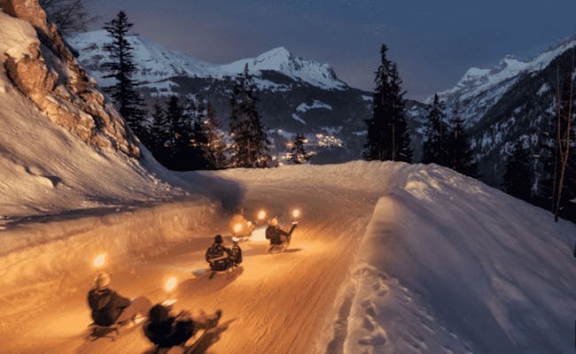 Les Diablerets (Photo: Switzerland Tourism MySwitzerland)
Region Zurich: Night Sledding
In the Region Zurich, you can go sledding on Zugerberg every day until midnight if you'd like.
Night Sledding Route in the Zurich Tourism Region
| Start | End | Length (km) | Special Feature | Days of the Week |
|---|---|---|---|---|
| Zugerberg Mountain Station | Schönegg | 2.80 | not illuminated, guidance system with safety mats and nets | daily in good snow conditions |
Zugerberg - Schönegg: 2.80 km Night Sledding
As soon as there's enough snow, the thrilling ride starts from the top station of the Zugerberg cable car down to the bottom station at Schönegg.
Location: Zug
Zug is located at Lake Zug, at the foot of the Zugerberg. The Zugerberg cable car takes about 8 minutes to reach the top. Zugerberg is the local mountain of Zug.
Night Sledding Opening Hours
Sledding is allowed here from 10 AM to 12 AM when the snow conditions are good. The Zugerberg cable car runs on weekdays from 6:26 AM every half hour until 11:56 PM. On weekends, the first ride starts at 6:56 AM.
Contact Information
Zugerbergbahn AG, An der Aa 6, 6300 Zug
Getting There
From Zurich, Zug is reachable by car via the A4 in just 40 minutes. There are parking spaces at the bottom station of the Zugerberg cable car.
By public transport, you can reach Zug-Schönegg in about 45 minutes. With SBB, you can get to Zug Metalli/Station. Zugerland Transport Services can take you to the bottom station Schönegg in just eleven minutes.
Sled Equipment Rental
You can rent sleds at the bottom station of the Zugerberg cable car from Monday to Saturday until 11 PM.
Night Sledding Procedure
You take the funicular from Zug-Schönegg to the top. The spectacular sledding trail starts just below the Zugerberg restaurant. The track winds past a farm and directly into the forest over three big curves. The speed increases until you reach the bottom station at Schönegg. A guiding system with safety mats and nets ensures you reach your destination safely. On the 2.8 km long sledding route, you descend about 350 meters in altitude. The Zugerberg cable car takes you back up for your next sledding run. The track is regularly groomed.
Caution:
After 6 PM, the cable car operates according to the schedule only if you press the button at the bottom/top station. This is done to avoid unnecessary empty trips in the evening. The button is well marked. After pressing, the door to the platform opens, and the cable car departs according to the schedule.
Dining
- Zugerberg Restaurant at the top station
 Zugerberg (Photo: Zugerbergbahn)
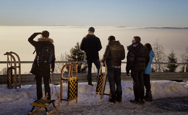 Zugerberg (Photo: Zugerbergbahn)